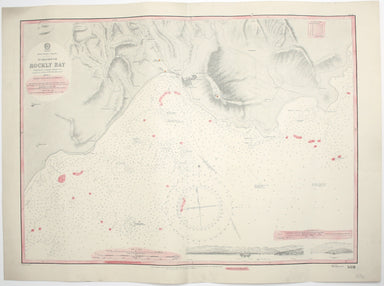
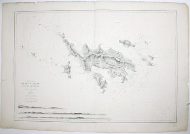
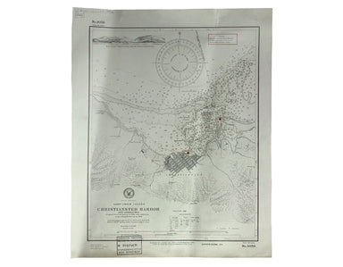
Admiralty Chart of Rockly Bay, Tobago
West Indies – Tobago – Scarborough – Rockly Bay This chart of Rockly Bay shows soundings etc, with interior detail of relief, roads and settlements...
View full details
West Indies – Tobago – Scarborough – Rockly Bay This chart of Rockly Bay shows soundings etc, with interior detail of relief, roads and settlements...
View full details
This chart of Jamaica shows soundings etc, with interior detail of relief, roads and settlements, and an inset of Morant Cays. First published in 1...
View full details
Antilles – Ile de la Grenade This detailed chart of Grenada was derived from British Admiralty surveys. Condition & Materials French naval char...
View full details
Antilles – Ile de Culebra ou du Passage This detailed chart of Isla Culebra (now an island-municipality of Puerto Rico) was derived from British Ad...
View full details
South America – British Guiana – Georgetown and mouths of Demerara and Essequibo Rivers This British chart of Georgetown shows soundings etc, with ...
View full details
South America – Magellan Strait – Western part from Punta Arenas to Cape Pillar This US naval chart of the Magellan Strait shows soundings, anchora...
View full details
West Indien – Haïti bis Martinique This Imperial German Naval Office chart shows sands, soundings and interior detail of relief. Condition & Ma...
View full details
Océan Pacifique – Ile Juan Fernandez – Mouillage de San Juan Bautista This French naval chart shows the anchorage at San Juan Bautista located on C...
View full details
West Indies – St Croix Island – Christiansted Harbour This is a US naval chart of Christiansted, the largest town on St Croix in the United States ...
View full details
Preliminary Chart – West Indies – Barbados This chart of Barbados shows sands and soundings etc, with interior detail of relief, roads and settleme...
View full details