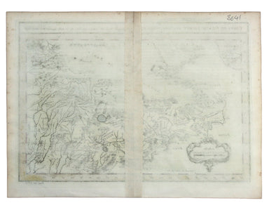
Bertius' Miniature map of Gujarat and Northern India
This miniature map of Gujarat and northern India was published in one of the earlier editions of Bertius’ Tabularum Geographicarum Contractum issue...
View full details
This miniature map of Gujarat and northern India was published in one of the earlier editions of Bertius’ Tabularum Geographicarum Contractum issue...
View full details
Plan du Port et de la Ville de Nangasaki This is a plan of the port city of Nagaski, one of Japan’s chief points of contact with the outside world ...
View full details
Carte de Isles du Japont et la presqu' Isle de Coree avec les costes de la Chine depuis Pekin jusqua Canton . . . Bellin compiled maps like this on...
View full details
L’Empire du Chine pour servir a l’Histoire Universelle, d’une Societe de Gens de Lettres Our example of Bellin’s map of China, with text in French ...
View full details
This map of the Mughal Empire is dedicated by the Blaeu brothers to Joan Huydecoper van Maarsseveen (1599–1661), a prosperous dealer in pelts and a...
View full details
A chart of part of the coast of Cochin-China including Turon Harbour and the island Callao from an actual survey in June 1793. By HW Parish of the ...
View full details
Carte du Grand Thibet. Pour Servir à l’Histoire Generale des Voyages. Tirée des Auteurs Anglois… Bellin notes that his map of Tibet was compiled fr...
View full details