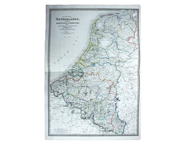
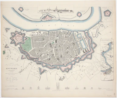
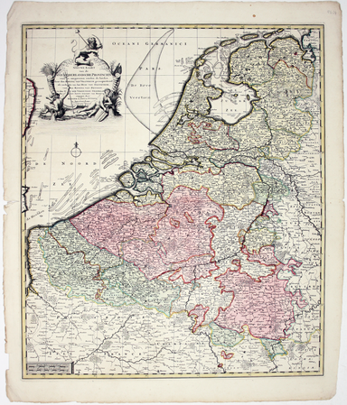
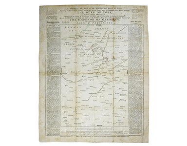
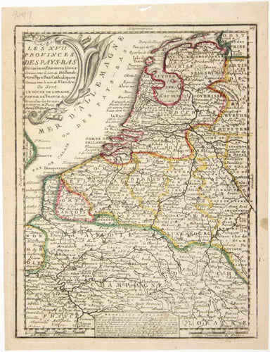
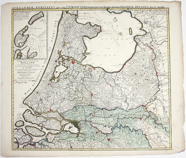
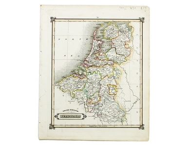
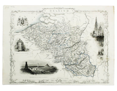
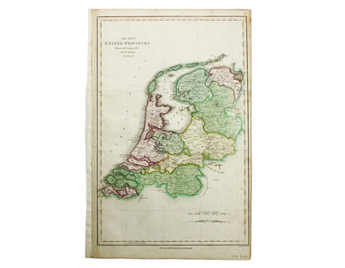
Aleph's Caricature Map of Holland & Belgium
Thus anthropomorphic map of Holland and Belgium was published in “Geographical Fun: Being Humorous Outlines of Various Countries.”. Though credited...
View full detailsThus anthropomorphic map of Holland and Belgium was published in “Geographical Fun: Being Humorous Outlines of Various Countries.”. Though credited...
View full detailsMap of the Netherlands including the Grand Duchy of Luxembourg. With the post roads and stations and the limites of Holland and Belgium This map of...
View full detailsThis map of Antwerp, engraved by Benjamin Rees Davies after William Barnard Clarke, includes elevations of principal buildings and a view of the ci...
View full detailsNieuwe Kaarte van der XVII Nederlandsche Provincien: waar in aangewezen worden de landen door den Koning van Vrankryk geconquesteerd als mede die v...
View full detailsThis map of Mons in Belgium is from the Civitates Orbis Terrarum, one of the most significant cartographic works of the late sixteenth-century, pri...
View full detailsThis plan of Namur in Belgium is from the Civitates Orbis Terrarum, one of the most significant cartographic works of the late sixteenth-century, p...
View full detailsThis map of Limbourg or Limburg is from the Civitates Orbis Terrarum, one of the most significant cartographic works of the late sixteenth-century,...
View full detailsThis is the general title page for Blaeu’s town books of the Netherlands. The first volume features plans and views of the towns of the Northern p...
View full detailsA correct sketch of the northern seat of war, exhibiting the whole of the country, wherein the British troops under the command of His Royal Highne...
View full detailsLe XVII Provinces des Pays Bas divisées en Provinces Unies connues sous le nom de Hollande, et en Pays Bas Catholiques connues sous le nom de Fland...
View full detailsHollandiae Comitatus una cum Ultrajectino Dominio nec non maximis partibus Geldriae Ducatus, per C. Specht This example of Caspar Specht’s map has ...
View full detailsThis map of Mons in Belgium is shown with Arras in northern France. It is from the Civitates Orbis Terrarum, one of the most significant cartograph...
View full detailsThis map of the United Kingdom of the Netherlands is from 'A Modern and Ancient General Atlas, comprehending all the Empires, Kingdoms, States in t...
View full detailsThis map of Belgium was engraved by John Rapkin for the Illustrated Atlas. Vignettes including Antwerp cathedral and monuments on the plains of Wat...
View full detailsThe Seven United Provinces This map of the Netherlands was prepared for Playfair’s New General Atlas. Condition & Materials Copper engraving, ...
View full detailsThis plan of Tienen in Flanders is from the Civitates Orbis Terrarum, one of the most significant cartographic works of the late sixteenth-century,...
View full details