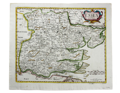
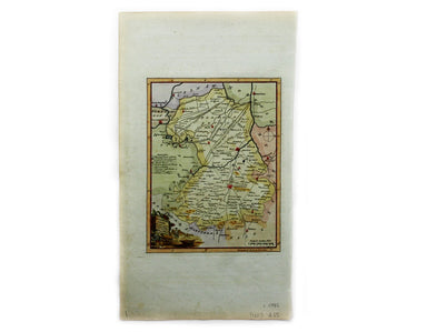
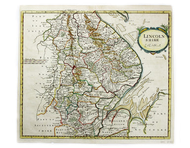
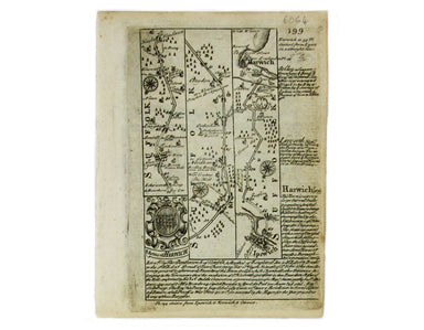
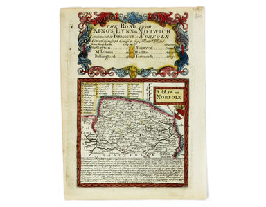
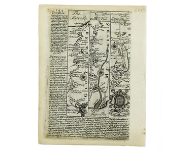
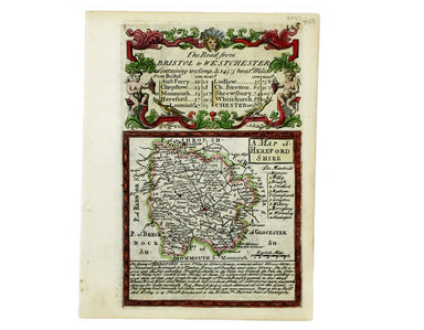
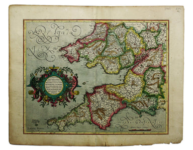
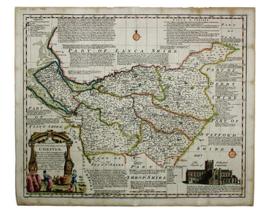
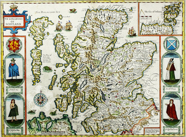
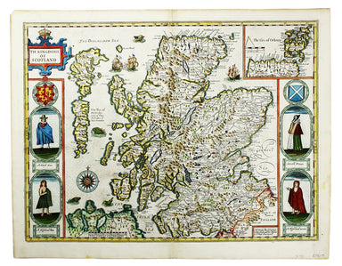
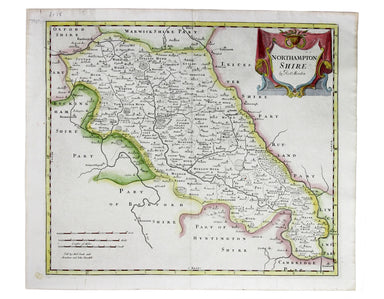
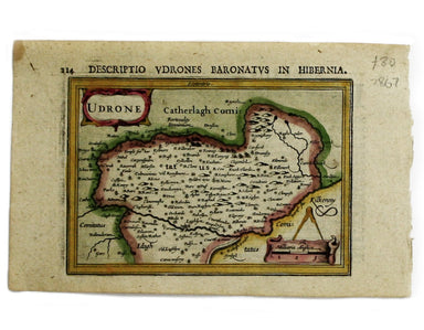
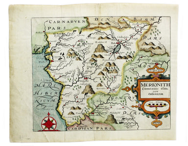
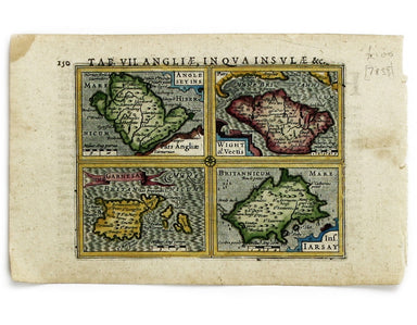
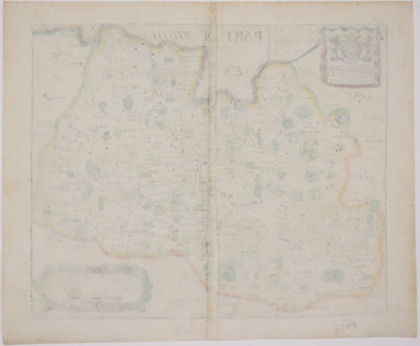
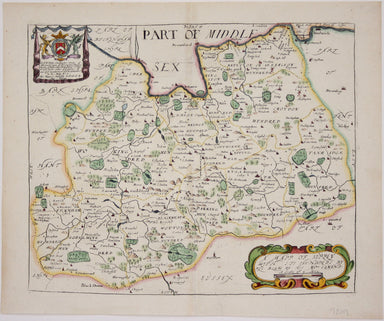
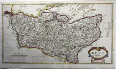
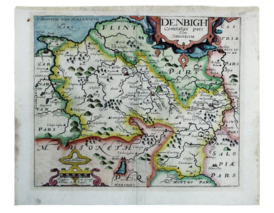
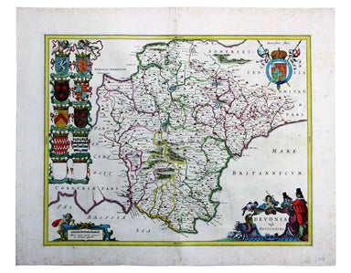
Bowen & Owen’s Berkshire
This map of Berskhire was engraved by Emanuel Bowen for John Owen’s Britannia Depicta, a pocket road book derived from Ogilby’s innovative atlas of...
View full detailsThis map of Berskhire was engraved by Emanuel Bowen for John Owen’s Britannia Depicta, a pocket road book derived from Ogilby’s innovative atlas of...
View full detailsThis map of County Durham was engraved by Kip after Saxton. It is from the second edition of Philemon Holland’s translation of Camden’s Britannia i...
View full detailsThis map of Buckinghamshire is from the so-called miniature Speed. This miniature atlas used maps by van den Keere to illustrate a pocket edition o...
View full detailsThis map of Shropshire was engraved to accompany Gibson’s edition of Camden’s Britannia, first published in 1695. Condition & Materials Copper ...
View full detailsThis map of Lincolnshire was engraved to accompany Gibson’s edition of Camden’s Britannia, first published in 1695. Condition & Materials Coppe...
View full detailsThis map of Northamptonshire was engraved by Emanuel Bowen for John Owen’s Britannia Depicta, a pocket road book derived from Ogilby’s innovative a...
View full detailsThis map of Norfolk was engraved by Emanuel Bowen for John Owen’s Britannia Depicta, a pocket road book derived from Ogilby’s innovative atlas of ...
View full detailsThis map of Herefordshire was engraved by Emanuel Bowen for John Owen’s Britannia Depicta, a pocket road book derived from Ogilby’s innovative atla...
View full detailsThis map of Northern Scotland is from the first edition of Tabularum geographicarum contractarum libri, a geographical work which is normally catal...
View full detailsThis map of Radnorshire was engraved by Emanuel Bowen for John Owen’s “Britannia Depicta”, a pocket road book derived from Ogilby’s innovative atla...
View full detailsThis is the southwestern sheet of Mercator’s five regional maps of England and Wales; Janssonius revised the decorative elements in the 1630s, but ...
View full detailsAn Accurate Map of the County Palatine of Chester […] Condition & Materials Copper engraving, 41.5 x 50.5 cm, map of Cheshire with original han...
View full detailsThis map of Merionethshire includes an inset town-plan of Harlech. John Speed (1552-1629) is unquestionably the most significant English map-maker ...
View full detailsCumbria & Westmoria. Vulgo Cumberland & Westmorland Joannes Janssonius II (1588-1664) married into the Hondius family and, with Henricus Ho...
View full detailsLincolnia Comitatus Anglis Lyncolneshire Joannes Janssonius II (1588-1664) married into the Hondius family and, with Henricus Hondius, worked on a ...
View full detailsCestria Comitatus Palatinatus. The Countye Palatine of Chester Joannes Janssonius II (1588-1664) married into the Hondius family and, with Henricus...
View full detailsThe Countie of Westmorland and Kendale the cheif towne described John Speed (1552-1629) is unquestionably the most significant English map-maker of...
View full detailsCartographically Speed follows Mercator, but his is one of the most distinctive and decorative early maps of Scotland. The portraits in the borders...
View full detailsRobert Morden's map of Sussex was engraved to illustrate Gibson's edition of William Camden's Britannia, first published in 1695 and reprinted in 1...
View full detailsRobert Morden's map of Northumberland was engraved to illustrate Gibson's edition of William Camden's Britannia, first published in 1695 and reprin...
View full detailsThis map of Bedforshire was engraved by Emanuel Bowen for John Owen’s Britannia Depicta, a pocket road book derived from Ogilby’s innovative atlas ...
View full detailsThis map of Udrone from is the first edition of Tabularum geographicarum contractarum libri, a geographical work which is normally catalogued under...
View full detailsThis map of Merionethshire is from the second edition of Philemon Holland’s English translation of Camden’s Britannia, the third printing from the ...
View full detailsAnglesey Insula; Wight olim Vectis; Insula Garnsey; Insula Iarsay This map of Anglesey, the Isle of Wight, Guernsey and Jersey is from the first ed...
View full detailsThis miniature map of Scotland is from the first edition of Tabularum geographicarum contractarum libri, a geographical work which is normally cata...
View full detailsA Plan of the Town and Citadel of Plymouth in the County of Devon This map of Plymouth was published in the London Magazine and incorporates Smeat...
View full detailsCondition & Materials Steel engraving, 25 x 33 cm, recent hand colour, blank verso; map of Bradford
Condition & Materials Copper engraving, 22.5 x 17 cm, recent hand-colour, blank verso.
This map of Monmouthshire was engraved to accompany Gibson’s edition of Camden’s Britannia, first published in 1695. Condition & Materials Copp...
View full detailsBlome published the first new series of county maps in the sixty years since the appearance of John Speed’s ‘Theatre’. In the straightened financia...
View full detailsRobert Morden's maps were engraved to illustrate Gibson's edition of William Camden's Britannia, first published in 1695 and reprinted in various 1...
View full detailsWilliam Camden was an Elizabethan historian who wrote a county by county description of England. He continued to revise and expand his work, which ...
View full detailsRobert Morden's maps were engraved to illustrate Gibson's edition of William Camden's Britannia, first published in 1695 and reprinted in various 1...
View full detailsThese maps of Staffordshire and Shropshire are presented on one sheet. Unlike Kip and Hole, Speed and Blaeu – who all devoted an entire map-sheet t...
View full detailsThis map of Denbighshire was published in the second edition of Philemon Holland’s translation of Camden’s Britannia into English, the third printi...
View full detailsThis map of Cardiganshire was published in the second edition of Philemon Holland’s translation of Camden’s Britannia into English, the third print...
View full detailsBlaeu and the rival Golden Age Dutch cartographic publishing house of Janssonius raced to bring out atlases of the British Isles in the 1630s and e...
View full detailsRobert Morden's maps were engraved to illustrate Gibson's edition of William Camden's Britannia, first published in 1695 and reprinted in various e...
View full details