

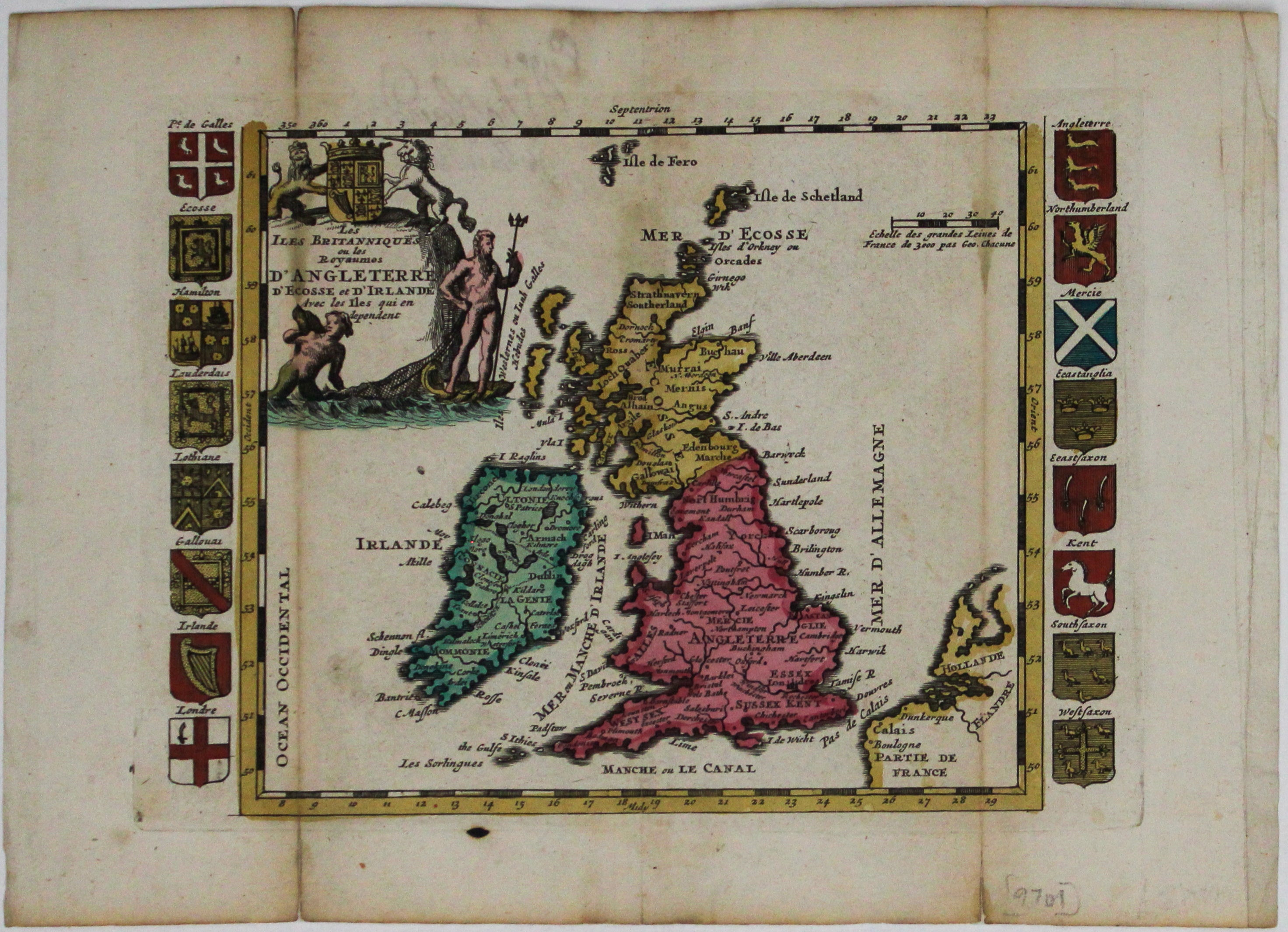
La Feuille's Map of the British Isles
SKU: 9701
Title:
La Feuille's Map of the British Isles
Date of publication:
Place of publication:
Colour:
Mapmaker:
The cartouche on this map of the British isles is surmounted by the old Stuart coat of arms and the borders are made up of sixteen regional armorial shields, such as Wales, Lothian and London, concluding with the seven kingdoms of the Anglo-Saxon Heptarchy.
De la Feuille’s map was published in his popular ‘Atlas portatif’, a pocket atlas first published in 1706 which covered the major theatres of the War of the Spanish Succession (1701-1714; the Dutch title was ‘Oorlogs tabletten’, ‘war maps’). Many of the maps are bordered with coats of arms, town plans and fortifications, and some have views of towns under bombardment. Read more
Condition & Materials
Copper engraving, printed area 16 x 21.5 cm, original hand colour, a couple of short splits to folds repaired on verso, blank verso.
References
Shirley, Printed Maps of the British Isles, La Feuille 1 Read less