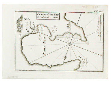
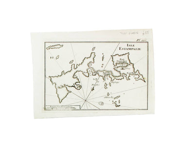
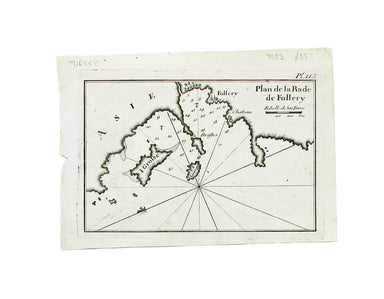
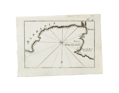

Roux’s Chart of Ios
Plan du Port Nio sur l’Isle de ce nom Copper engraving, 14 x 20 cm, black and white as issued, blank verso. Chart of Ios, a port in the Cyclades. T...
View full detailsPlan du Port Nio sur l’Isle de ce nom Copper engraving, 14 x 20 cm, black and white as issued, blank verso. Chart of Ios, a port in the Cyclades. T...
View full detailsIsle Estampalie Copper engraving, 14.5 x 20 cm, black and white as issued, blank verso. Map of Astypalaia in the Dodecanese, Greece. The practical ...
View full detailsCette Copper engraving, 14 x 20 cm, black and white as issued, blank verso. A chart of Sète in southern France.
Plan de Rade de la Rade Follery Copper engraving, 14 x 20 cm, black and white as issued, blank verso. A chart of Foça, Turkey; near Smyrna. The p...
View full detailsCanal de Constantinople Copper engraving, 14.5 x 20 cm, black and white as issued, blank verso. A chart showing the environs of Marmara Island on t...
View full detailsPlan de la Rade de Sour Copper engraving, 14.5 x 20 cm, black and white as issued, blank verso. A chart of Tyre. The practical pocket sea atlas by ...
View full detailsBône Copper engraving, 14.5 x 20 cm, black and white as issued, blank verso. The practical pocket sea atlas by Marseilles hydrographer Joseph Roux,...
View full detailsBengasi Copper engraving, 14.5 x 20 cm, black and white as issued, light staining bottom right, blank verso. The practical pocket sea atlas by Ma...
View full detailsRade de Mogodor Copper engraving, 14.5 x 19.5 cm, black and white as issued, blank verso. Essaouira, then Morocco’s principal port. The practical ...
View full details