

Leigh’s Map of London
SKU: 9128
Title:
Leigh’s Map of London
Date of publication:
Printed Measurement:
Colour:
Mapmaker:
Engraver:
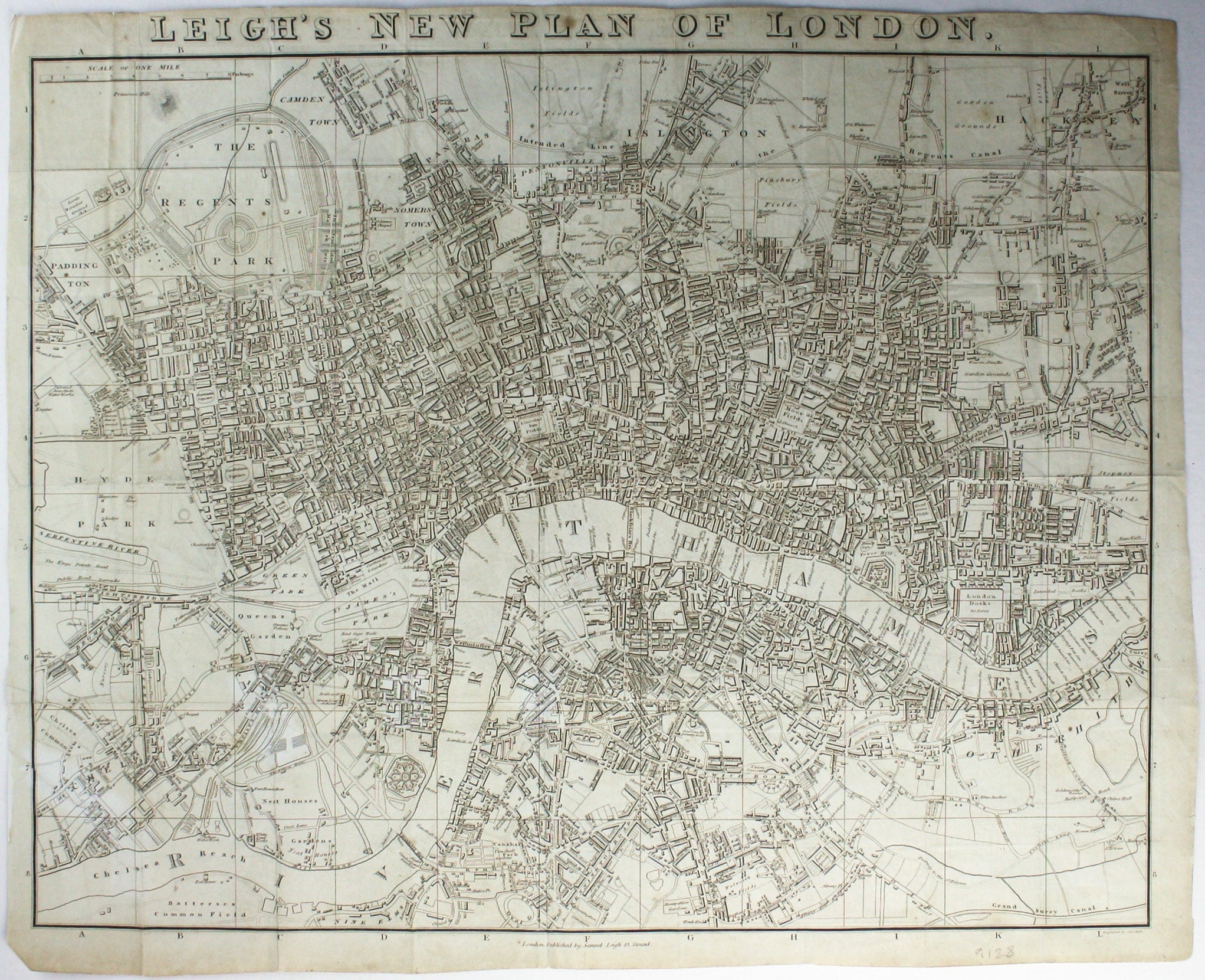
Map of London with John Rennie’s Waterloo and Southwark Bridges (opened 1817 and 1819) shown
First published in 1818, the scale, top left on our example, was added for the 1819 edition. Leigh was known for his travel guides.
Read more
Condition & Materials
Copper engraving, 46.5 x 57.5 cm, map of London engraved by Sidney Hall, black and white, old folds, closed tear and one or two repairs to folds, blank verso. John Rennie’s Waterloo and Southwark Bridges (opened 1817 and 1819) are both shown, as is an ‘intended north road’ across Finsbury Fields.
References
Howgego, Printed maps of London, 274 (2). Read less