£375.00


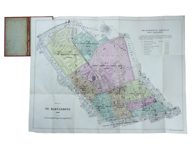
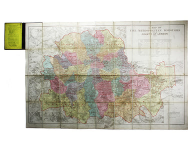
Bacon’s Plan of Marylebone
Plan of St Marylebone 1900 Folding map, sheet size 54 x 72 cm, original hand colour, laid on linen, marginal nick top left, folding into red cloth ...
View full detailsPlan of St Marylebone 1900 Folding map, sheet size 54 x 72 cm, original hand colour, laid on linen, marginal nick top left, folding into red cloth ...
View full detailsGuide du chemin de fer Trans-Sibérien Sir William McAlpine (1936-2018) was a railway enthusiast, sometime owner of the Flying Scotsman and patron o...
View full detailsA Map of the Metropolitan Boroughs within the County of London, Lithographed map, 67.5 x 103 cm, colour printed, dissected into 36 sheets and laid ...
View full detailsThis map of South Africa was published by The Times during the Second Anglo-Boer War, for the benefit of members of the British public following th...
View full details