

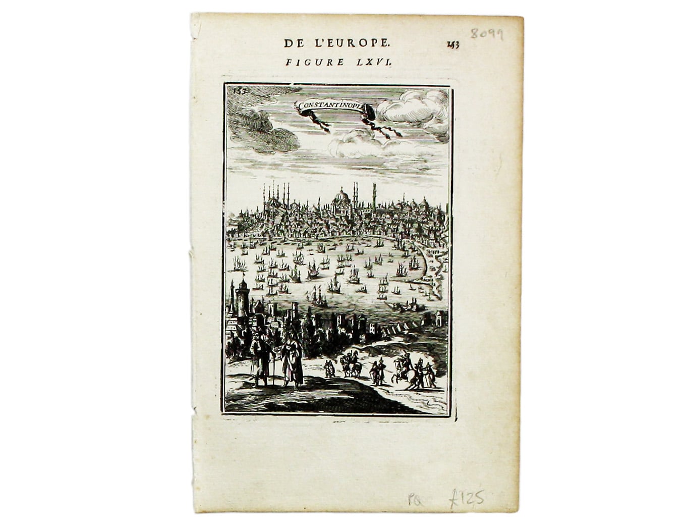
Mallet’s Map of Constantinople
SKU: 8099
Title:
Mallet’s Map of Constantinople
Date of publication:
Printed Measurement:
Publisher:
Colour:
Mapmaker:
This view of Constantinople isfrom Mallet’s Description de l’Univers, first published in Paris in 1683 and reprinted with German text in Frankfurt the following year.
Mallet was a military engineer, cartographer and mathematician in the service of the French King, Louis XIV. Read more
Condition & Materials
Copper engraving, 15.5 x 11 cm, black and white, French text on verso. Read less