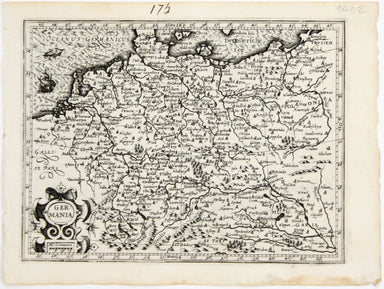
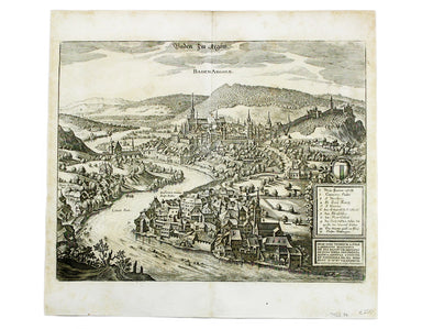
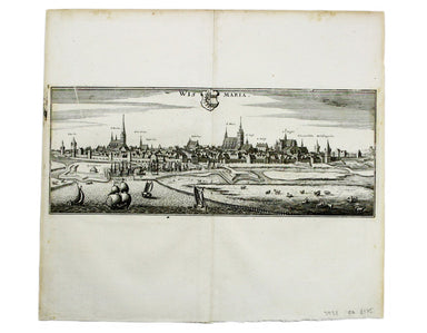
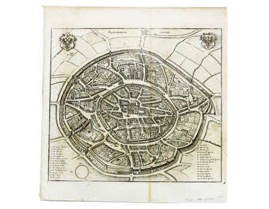
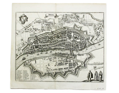
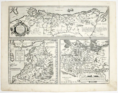
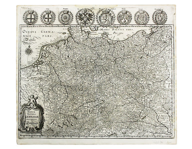
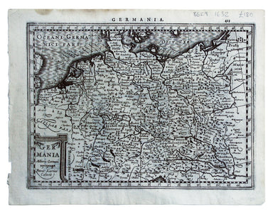
Mercator’s Miniature Map of Germany
This map shows the ‘Germanic’ regions of Europe, including the Low Countries, Poland and Austria, and was engraved by Jodocus Hondius for the ‘Atla...
View full details
This map shows the ‘Germanic’ regions of Europe, including the Low Countries, Poland and Austria, and was engraved by Jodocus Hondius for the ‘Atla...
View full details
This map of Baden in Switzerland was published by Merian and his heirs in various works, including the Archontologia cosmica, Theatrum Europaeum an...
View full details
This map of Stade was published by Merian and his heirs in various works, including the Theatrum Europaeum. Condition & Materials Copper engrav...
View full details
This map of Wismar was published by Merian and his heirs in various works, including the Theatrum Europaeum. Condition & Materials Copper engr...
View full details
This map of Aachen, or Aix-la-Chapelle, was published by Merian and his heirs in various works, including the Theatrum Europaeum. Condition & M...
View full details
This map of Bremen was published by Merian and his heirs in various works, including the Theatrum Europaeum. Condition & Materials Copper engra...
View full details
This map of Rostock was published by Merian and his heirs in various works, including the Theatrum Europaeum. Condition & Materials Copper eng...
View full details
Pomeraniae Wandalicae Regionis Typ. [on sheet with] Livoniae Nova descriptio [and] Ducatus Oswieczensis et Zatoriensis Descriptio An early example ...
View full details
This map of Augsburg was published by Merian and his heirs in various works, including the Archontologia cosmica, Theatrum Europaeum and the Topogr...
View full details
This map of Berne was first published in 'A collection of plans of the capital cities of Europe' in 1771. The plates seem to have been acquired by ...
View full details
This plan of Cologne was first published in 'A collection of plans of the capital cities of Europe' in 1771. The plates seem to have been acquired ...
View full details
Thus plan of Dresden was first published in 'A collection of plans of the capital cities of Europe' in 1771. The plates seem to have been acquired ...
View full details
This map of Ptolemaic Germany and Denmark is from the fourth edition of Ruscelli’s Italian translation of the Geographia. It is illustrated with de...
View full details
Nova Totius Germania Descriptio. Deutschland This map of Germany was published by Merian and his heirs in various works, including editions of the ...
View full details
The Babenburg Family Tree The March or Margraviate of Austria had been governed by the Babenburg family since the late tenth century. In 1156 Austr...
View full details
This map shows the ‘Germanic’ regions of Europe, including the Low Countries, Poland and Austria, engraved by Pieter van den Keere. The 'Atlas Mino...
View full details