

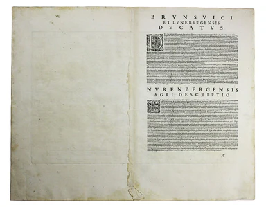
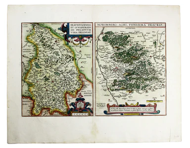
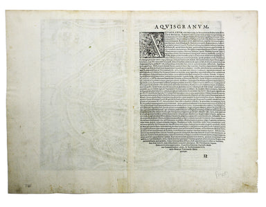
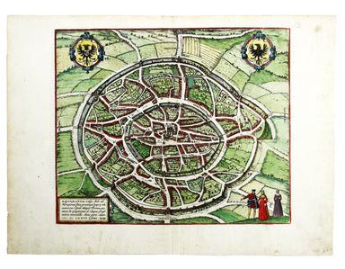
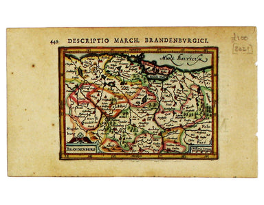
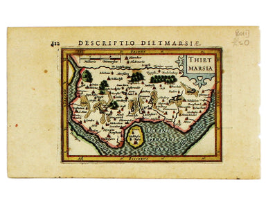
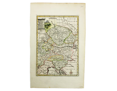
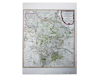
Mercator-Cloppenburgh Map of Pomerania
Pomerania, running along the Baltic coast between Rostock and Gdansk, is now divided between Germany and Poland. The 'Atlas Minor’ was a pocket atl...
View full detailsPomerania, running along the Baltic coast between Rostock and Gdansk, is now divided between Germany and Poland. The 'Atlas Minor’ was a pocket atl...
View full detailsBrunopolis [with] Luneburgum [and] Brema [and] Aldenburgum Holsatiae Four north German towns are shown here on one sheet: Braunschweig, Lüneburg an...
View full detailsMagdeburgum, a Venere quae hic quondam colebatur Parthenopolis dicta, metropolitica Saxoniae urbs The cartouche on this plan of Magdeburg refers to...
View full detailsFribergum Misinae The Civitates Orbis Terrarum was one of the most significant cartographic works of the late sixteenth-century, printed over 45 ye...
View full detailsWesalia in Ducatu Clivensi Urbs Clara Opibus The Civitates Orbis Terrarum was one of the most significant cartographic works of the late sixteenth...
View full detailsBraunsvicensis, et Luneburgensis dvcatvvm vera delineat… Norimberg. Agri, Fidissima descrip… Here we see two maps on one sheet, the Duchy of Brunsw...
View full detailsAquisgranum A plan of Aachen, or Aix-la-Chapelle, Germany. The Civitates Orbis Terrarum was one of the most significant cartographic works of the l...
View full detailsEmuda vulgo Embden A plan of Emden in northern Germany. The Civitates Orbis Terrarum was one of the most significant cartographic works of the lat...
View full detailsThis miniature map of Hesse is from the first edition of Tabularum geographicarum contractarum libri, a geographical work which is normally catalog...
View full detailsThis miniature map of Nassau is from the first edition of Tabularum geographicarum contractarum libri, a geographical work which is normally catalo...
View full detailsThis miniature map of Brandenburg is from the first edition of Tabularum geographicarum contractarum libri, a geographical work which is normally c...
View full detailsThis miniature map of Prussia is from the first edition of Tabularum geographicarum contractarum libri, a geographical work which is normally catal...
View full detailsThis map of Germany is from the first edition of Tabularum geographicarum contractarum libri, a geographical work which is normally catalogued unde...
View full detailsThis map of Eastern Friesland is from the first edition of Tabularum geographicarum contractarum libri, a geographical work which is normally catal...
View full detailsThis map of Southwestern Germany is from the first edition of Tabularum geographicarum contractarum libri, a geographical work which is normally ca...
View full detailsThis map of Northen Bavaria is from the first edition of Tabularum geographicarum contractarum libri, a geographical work which is normally catalog...
View full detailsThis miniature map of the Electoral Palatinate is from the first edition of Tabularum geographicarum contractarum libri, a geographical work which ...
View full detailsThis map of Franconia, including Frankfurt and Nuremberg in modern Bavaria, is from the first edition of Tabularum geographicarum contractarum libr...
View full detailsThis miniature map of Saxony is from the first edition of Tabularum geographicarum contractarum libri, a geographical work which is normally catalo...
View full detailsThus miniature map of Dithmarschen in Holstein, flanked by the Eider and the Elbe isfrom the first edition of Tabularum geographicarum contractarum...
View full detailsAllemagne en General This map of Northern Germany is from Mallet’s Description de l’Univers. Condition & Materials Copper engraving, 15.5 x 11....
View full detailsCercle de Baverie This map of Bavaria is from Mallet’s Description de l’Univers. Condition & Materials Copper engraving, 15 x 11.5 cm, recent h...
View full detailsLes 13 Cantons Suisses et leurs Alliez This map of 13 Swiss Canton is from Mallet’s Description de l’Univers. Condition & Materials Copper engr...
View full detailsCondition & Materials Copper engraving, 23 x 32.5 cm, recent hand-colour, blank verso.
Condition & Materials Copper engraving, 23 x 32.5 cm, recent hand-colour, blank verso.
A miniature map of Salzburg and Carinthia. Condition & Materials Copper engraving, 10 x 13.5 cm, recent hand-colour, Latin text on verso;
German Dominions of the King of Great Britain; Comprized under the name of Electorate of Brunswick-Luneburg and including the Dutchies of Bremen, V...
View full details