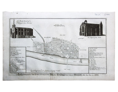
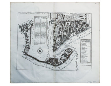
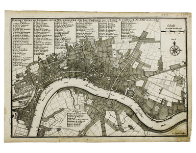
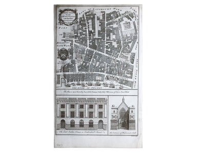
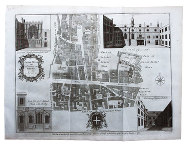
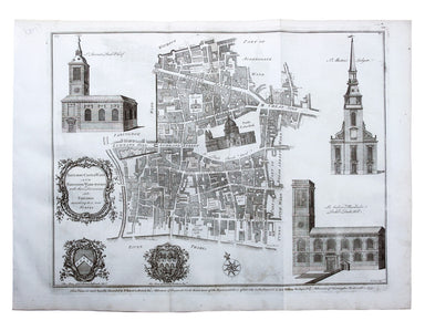
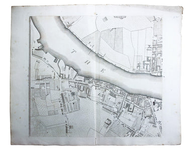
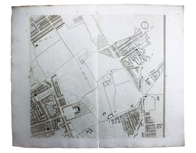
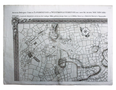
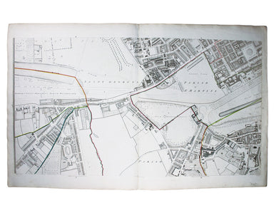
Maitland's Ward Plan of Westminster
A New and Accurate Map of the City of Westminster, the Dutchy of Lancaster and Places Adjacent This ward plan of Westminster was engraved by Benjam...
View full details
A New and Accurate Map of the City of Westminster, the Dutchy of Lancaster and Places Adjacent This ward plan of Westminster was engraved by Benjam...
View full details
London Restored or Sir John Evelyn’s Plan for Rebuilding the Antient Metropolis after the Fire in 1666 Evelyn, Wren and Hooke were among the archit...
View full details
The Parish of St Johns Wapping; The Parish of St. Paul Shadwell This detailed ward plan of Wapping and Shadwell includes Execution Dock, where sent...
View full details
Plan Des Villes De Londres et de Westminster et leurs Faubourgs avec le Bourg de Southwark This is the first version of the map, before the date wa...
View full details
John Stow's A Survey of the Cities of London and Westminster was originally published in 1598 and 1603, but revised and expanded works under his na...
View full details
John Stow's A Survey of the Cities of London and Westminster was originally published in 1598 and 1603, but revised and expanded works under his na...
View full details
Plan of Coleman Street and Bassishaw Wards; Plan of Portsoken Ward; Plan of Cripplegate Ward Condition & Materials Copper engraving, 34 x 22 cm...
View full details
Map of London with John Rennie’s Waterloo and Southwark Bridges (opened 1817 and 1819) shown First published in 1818, the scale, top left on our ex...
View full details
Tower Street Ward with their [sic] divisions into Parishes according to a new survey This plan of Tower Street was published in the greatly expande...
View full details
Cheap Ward with its divisions into Parishes according to a new survey This ward plan of Cheap was published in the greatly expanded second edition ...
View full details
Baynard’s Castle Ward [and] Faringdon Ward with their divisions into Parishes according to a new survey This was plan of Baynard’s Castle and Farin...
View full details
Plan of Lambeth Palace 1750… from the original in the possession of Mr Singleton of Lambeth This plan of Lambeth Palace published in Ducarels’s ‘Th...
View full details
Sheet C4 from Horwood’s ‘Plan of the Cities of London and Westminster…’ Horwood’s plan is a landmark in London mapping on a number of counts. It wa...
View full details
Sheet C1 from Horwood’s ‘Plan of the Cities of London and Westminster…’ Horwood’s plan is a landmark in London mapping on a number of counts. It wa...
View full details
Environs of Wembley from Rocque’s ‘An Exact Survey of the City’s of London, Westminster, ye Borough of Southwark and the Country Near Ten Miles Rou...
View full details
This map (two sheets from Horwood's magnificent 32 sheet survey) includes St James’s Square, the western part of Piccadilly, Green Park, Buckingham...
View full details
Plan du Dock ou du Bassin ‡ flot ‡ Londres dit Katarinen Dock ou Dock St. Katharine. Condition & Materials Lithograph, 35 x 40.5 cm, black and ...
View full details