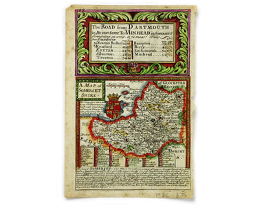
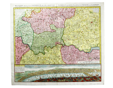
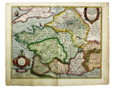
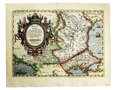
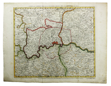
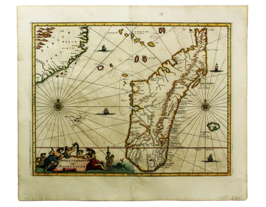
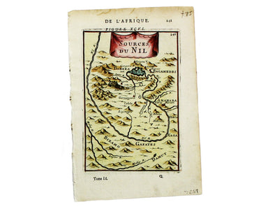
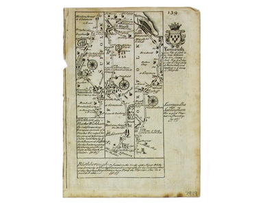
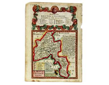
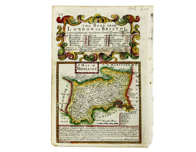
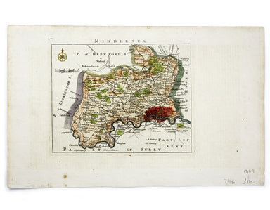
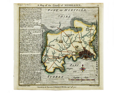
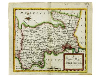
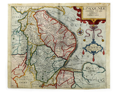
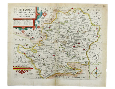
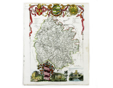
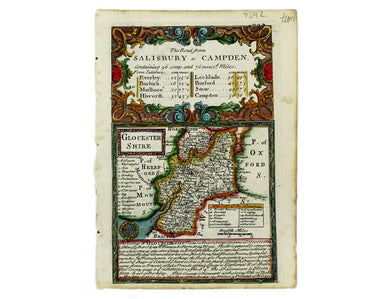
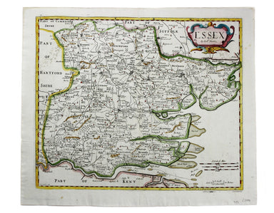
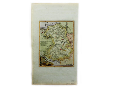
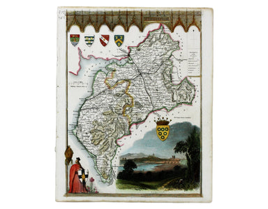
Kitchin’s Miniature Map of Suffolk
This map of Sussex was first issued in The London Magazine, which between 1747 and 1754 published a complete set of English county maps by Thomas K...
View full details
This map of Sussex was first issued in The London Magazine, which between 1747 and 1754 published a complete set of English county maps by Thomas K...
View full details
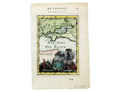
This map of Somerset was engraved by Emanuel Bowen for John Owen’s Britannia Depicta, a pocket road book derived from Ogilby’s innovative atlas of ...
View full details
This map of the Mughal Empire is dedicated by the Blaeu brothers to Joan Huydecoper van Maarsseveen (1599–1661), a prosperous dealer in pelts and a...
View full details
This is the Tuscan island of Elba, a map newly added to the ‘Atlas Novus’ in 1640. Koeman records that it was first published in the French text ed...
View full details
Robert Morden's maps were engraved to illustrate Gibson's edition of William Camden's Britannia, first published in 1695 and reprinted in various 1...
View full details
Joannes Janssonius II (1588-1664) married into the Hondius family and, with Henricus Hondius, worked on a revised edition of the Mercator-Hondius a...
View full details
Blaeu and the rival Golden Age Dutch cartographic publishing house of Janssonius raced to bring out atlases of the British Isles in the 1630s and e...
View full details
This map of Gloucester was engraved by Johannes Kip for 'The Ancient and Present State of Glostershire'. It is one of the earliest views of the cit...
View full details
Cardigan Shyre described with the due forme of the Shiretown as it was surveyed by JS. Anno 1610 John Speed (1552-1629) is unquestionably the most ...
View full details
This map of the northern part of Scotland is from the Hondius-Janssonius map publishing business, which traced its roots back to Gerardus Mercator....
View full details
Regionis, quae est circa Londinum […] This map follows Thomas Bowles’ ‘A New and Correct Map of Thirty Miles round London’ published c. 1740. The f...
View full details
This map of the French island of Corsica, ruled by the Genoese in the 17th century and included in the Italian volume of Blaeu’s atlas, is oriented...
View full details
Van den Broecke stresses the significance of this map of Gaul: “in contrast to plate Ort 194 [Gallia vetus, based on Caesar’s commentaries], this m...
View full details
Provincia Connachtiae. The Province of Connaught Joannes Janssonius II (1588-1664) married into the Hondius family and, with Henricus Hondius, work...
View full details
The East Coast of Scotland with the Isles of Orkney and Shetland This sea chart is from ‘Great Britain’s Coasting Pilot’, the first English Sea Atl...
View full details
Comitatus Dorcestria vulgo Anglice Dorsetshire Joannes Janssonius II (1588-1664) married into the Hondius family and, with Henricus Hondius, worked...
View full details
Schlavoniae, Croatiae, Carniae, Istriae, Bosniae, Finitimarumque Regionum Nova Descriptio Ortelius’ map of the western Balkans drew on the cartogra...
View full details
Braunsvicensis, et Luneburgensis dvcatvvm vera delineat… Norimberg. Agri, Fidissima descrip… Here we see two maps on one sheet, the Duchy of Brunsw...
View full details
Transilvania Copper engraving, 33 x 45 cm, modern hand-colour, Latin text on verso. This is the second version of Ortelius’ map of Transylvania, n...
View full details
Hispaniae veteris typus Our example of this map of Ancient Spain was published by Balthasar Moretus at the Plantin Press, in the final edition of t...
View full details
Romaniae, (quae olim Thracia dicta) Vicinarumque Regionum, uti Bulgariae, Walachiae, Syrfiae, etc. Descriptio This map shows the Lower Danube regio...
View full details
Aeneae Troiani Navigatio, as Virgilii sex priores Aeneidos This of the eastern Mediterranean depicts the wanderings of the legendary Trojan prince ...
View full details
Condition & Materials Copper engraving, 19 x 25 cm, recent hand-colour, blank verso; a plan of Tower Ward published in Noorthouck’s History of ...
View full details
A New and Correct Map of the Countries Twenty Miles round London Condition & Materials Copper engraving, 34 x 39 cm, recent hand-colour, blank ...
View full details
Karte von der Küste von Angola von dem Flusse Bengo bis an den Fluss Quanza This map show the coastline of northern Angola between the rivers Bengo...
View full details
Insula S. Laurentii, vulgo Madagascar The name 'Isle of St Laurence' was given by the Portuguese, who landed on Madagascar on St Laurence's day (Fe...
View full details
Carte de L’Arabie, du Golfe Persique et de la Mer Rouge, avec L’Egypte, La Nubie et L’Abissinie This map of Arabia is from the Atlas de Toutes Part...
View full details
This map of the sources of the Nile is from Mallet’s Description de l’Univers. Condition & Materials Copper engraving, 14.5 x 10.5 cm, recent ...
View full details
Albanie, Grand Armenie, Colchide et Iberie selon les anciens This map of the Ancient Caucasus is from Mallet’s Description de l’Univers. Condition ...
View full details
Condition & Materials Copper engraving, 14.5 x 10.5 cm, recent hand-colour, light waterstaining in upper margin, French text on verso, from Ma...
View full details
This map of São Salvador is from Mallet’s Description de l’Univers. São Salvador was once the capital of the kingdom of Congo, but as M’banza-Kongo...
View full details
Condition & Materials Copper engraving, 15 x 10.5 cm, recent hand-colour, French text on verso, from Mallet’s Description de l’Univers.
Chapelle du St Sepulchre de N.S. Jesus Christ à Jerusalem The Church of the Holy Sepulchre, Jerusalem, from Mallet’s Description de l’Univers. Cond...
View full details
Du Nil et ses Embouchures et des Crocodiles This map of the Nile delta (with crocodiles) is from Mallet’s Description de l’Univers. Condition &...
View full details
Biledulgerid en General This map of North Africa is from Mallet’s Description de l’Univers. Condition & Materials Copper engraving, 15 x 10.5 ...
View full details
This map of Oxfordshire was engraved by Emanuel Bowen for John Owen’s Britannia Depicta, a pocket road book derived from Ogilby’s innovative atlas ...
View full details
Northumbria, Cumberlandia et Dunelmensis Episcopatus This map of northern England is from the first edition of Tabularum geographicarum contractaru...
View full details
This map of Middlesex was engraved by Emanuel Bowen for John Owen’s Britannia Depicta, a pocket road book derived from Ogilby’s innovative atlas of...
View full details
This map of Middlesex was first published in 1746 to accompany Thomas Read’s English Traveller. The the plates were acquired by John Rocque and re-...
View full details
Condition & Materials Copper engraving, 15.5 x 15.5 cm, modern hand-colour, blank verso; a map of Middlesex engraved by Toms for Thomas Badesla...
View full details
This map of Middlesex was published in Geographia Magnae Britanniae, or, Correct Maps of all the Counties in England, Scotland and Wales. It was pr...
View full details
Lincolniae Comitatus ubi olim insederunt Coritani This map of Lincolnshire is from the second edition of Philemon Holland’s translation of Camden’s...
View full details
Hertfordiae Comitatus This map of Hertfordshire is from the second edition of Philemon Holland’s translation of Camden’s Britannia into English, th...
View full details
This map of Herefordshire is by Moule, a bookseller, writer on heraldry and publisher who commissioned what is generally considered to be the last ...
View full details
This map of Gloucestershire was engraved by Emanuel Bowen for John Owen’s Britannia Depicta, a pocket road book derived from Ogilby’s innovative at...
View full details
Condition & Materials Copper engraving, 36 x 42 cm, recent hand-colour, spotting top left, blank verso. A map of Essex engraved to accompany Gi...
View full details
This map of Cambridgeshire was first issued in The London Magazine, which between 1747 and 1754 published a complete set of English county maps by ...
View full details
This map of Cumberland is by Moule, a bookseller, writer on heraldry and publisher who commissioned what is generally considered to be the last rea...
View full details