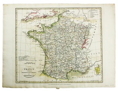
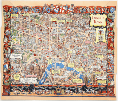
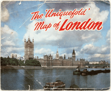
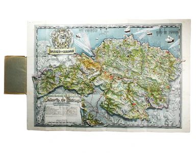
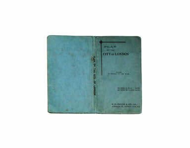
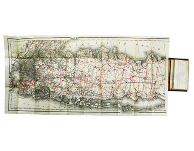
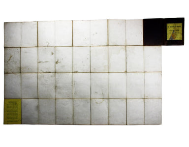
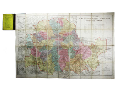
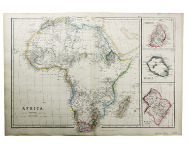
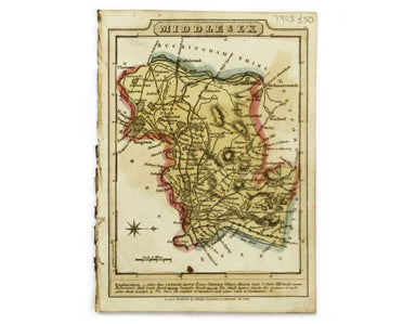
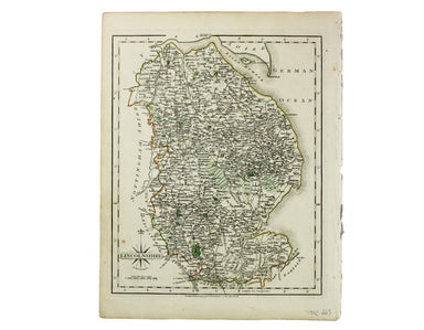
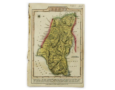
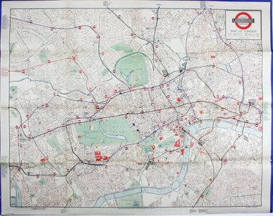
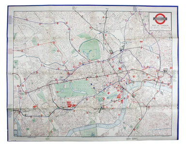
Chiquet’s Map of the Low Countries
Le XVII Provinces des Pays Bas divisées en Provinces Unies connues sous le nom de Hollande, et en Pays Bas Catholiques connues sous le nom de Fland...
View full details
Le XVII Provinces des Pays Bas divisées en Provinces Unies connues sous le nom de Hollande, et en Pays Bas Catholiques connues sous le nom de Fland...
View full details
A Map of the County Palatine of Lancaster Divided into Hundreds and Parishes from an accurate Survey made in the years 1828 and 1829, For Hennet’s ...
View full details
Hollandiae Comitatus una cum Ultrajectino Dominio nec non maximis partibus Geldriae Ducatus, per C. Specht This example of Caspar Specht’s map has ...
View full details
Bradshaw’s map of the railways of England & Wales with part of Scotland, reduced from the highly accurate Ordnance Survey, presented to the sub...
View full details
The focus of this map is Toyama, a significant sea-port in what was once Etchu province on Honshu. On stylistic grounds the map appears to date fro...
View full details
South Pacific Ocean – Society Islands – Tahiti and Moorea (Otaheite and Eimeo) This chart was derived from French surveys of 1869 and 1885. The fir...
View full details
This map of Vienna was published by the SDUK. The Society for the Diffusion of Useful Knowledge was founded in 1826 with the high-minded aim of mak...
View full details
Un-titled, undated and without a printer, this exceptionally scarce early poster was created for display in stations, but establishing which ones p...
View full details
Our example of the map has been annotated in ink to show the early expansion of the railway system, with railways completed and under construction....
View full details
If thou art worn and hard beset with sorrows that thou wouldst forget… Go to the woods and hills; no tears dim the sweet look that nature wears. He...
View full details
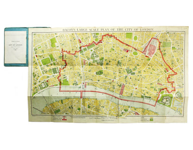
This pictorial map of London employs an unusual form of Turkish fold which makes use of inclined folding lines. The map is a simplified pocket vers...
View full details
MacDonald Gill, brother of Eric, was a successful commercial artist in his own right, and a noted calligrapher who designed the font used on all he...
View full details
This iteration of the UERL common design marks George Philip & Son’s first official map for the Underground Group; the firm had designed the fi...
View full details
The earliest versions of this map advertised the Franco-British Exhibition which closed at the end of October 1908, marked here as ‘Exhibition’. In...
View full details
Our map shows bus, tram and train services operated by the Underground Group and is very similar to the pocket map issued in guidebooks c. 1924. T...
View full details
Carta ilustrada del Muy Noble y Muy Leal Señorio de Vizcaya This map was published to mark the centenary of the Banco de Bilbao, one of the big fou...
View full details
Bacon’s large scale plan of the City of London Condition & Materials Folding map, 42.5 x 71 cm, printed in colours, laid on linen as issued, a ...
View full details
New Map of London with the recent improvements Condition & Materials Folding map, 51.5 x 77.5 cm, dissected into 32 panels and laid on linen as...
View full details
This map of America is from Wyld's New General Atlas. James Wyld senior established a highly successful firm of map publishers, which passed to his...
View full details
This map of Milan shows towns heightened in gold. Condition & Materials Copper engraving, 41.5 x 54 cm, original hand-colour, closed tears, min...
View full details
Bulgaria et Romania: divisa in singulares sangiacatus Silistriam, Nicopolin, Bodinum, Sardiam, Bysantium, Kirkeliam et Gallipolin, una cum finitimi...
View full details
This map of the Baltic, with an inset of St Petersburg, is from the Royal Atlas of Modern Geography. Condition & Materials Lithographed map, 45...
View full details
James Playfair (1738-1819) was Historiographer to the Prince of Wales and Rector of St Andrews. A comprehensively revised edition of his atlas, "el...
View full details
Blaeu's 'carte à figure' map of Europe features ten costume vignettes and nine city views around the edges with galleys, galleons, sea monsters, be...
View full details
Condition & Materials Lithographed in red and black on two sheets, each 38.5 x 80 cm; this map of Long Island is printed on thin india paper; ...
View full details
Magnae Britaniae et Hiberniae Tabula First published in 1631, this map of the British Isles became the Blaeu firm’s principal one for twenty years....
View full details
A Map of the Metropolitan Boroughs within the County of London The date of publication in the lower margin of this map is significant: 25th October...
View full details
Mogg’s New Map of the Roads. A New Travelling Map of England, Wales and Scotland […] Condition & Materials Copper engraving, 77 x 63.5 cm, a ro...
View full details
This map of Africa was drawn and engraved by Edward Weller, and includes insets of Mauritius, Réunion and Natal, Some of the most recent geographi...
View full details
This map of ancient Egypt is from Butler's Atlas of Ancient Geography and was engraved by Sidney Hall. Condition & Materials Copper engraving,...
View full details
This map of Middlesex is from Wallis' Pocket Edition of the English Counties. James Wallis (fl. 1810-1825) was born in Southampton in 1784, the son...
View full details
This characteristically clear and elegant map of Lincolnshire is by John Cary, one of the leading cartographic engravers, publishers and globe-make...
View full details
This map of Kent is from Wallis' Pocket Edition of the English Counties. James Wallis (fl. 1810-1825) was born in Southampton in 1784, the son of a...
View full details
This map of Buckinghamshire was prepared for William Colling Hobson’s Fox-Hunting Atlas. It is overprinted with the names of the hunts and the plac...
View full details
This map of Cheshire wasprepared for William Colling Hobson’s Fox-Hunting Atlas. It is overprinted with the names of the hunts and the places of th...
View full details
This map of County Durham was engraved by J & C Walker after Creighton for Lewis’ Topographical Dictionary. Condition & Materials Steel eng...
View full details
Blome published the first new series of county maps since Speed. In the straightened financial environment of post-Restoration London he had to rep...
View full details
Mappae Imperii Muscovitici pars Septentrionalis This detailed early 18th century map of Muscovy follows the cartography of De l’Isle, which include...
View full details
The first edition of this map was printed in 1932 but the introduction of Beck's diagram in 1933 did not obviate the need for geographically accura...
View full details
Blaeu and the rival Golden Age Dutch cartographic publishing house of Janssonius raced to bring out atlases of the British Isles in the 1630s and e...
View full details
L’Espagne dressée sur la Description qui en a eté faite par Rodrigo Mendez Sylva… par G. de l’Isle/Nova Regni Hispaniae accurata descriptio… Thus ...
View full details
Alsatia Superior cum Suntgoia et Brisgoia The original Mercator Atlas (parts published from 1585 onwards) was not a commercial success; the copper ...
View full details
A map of the French Alps, the Dauphiné, incuding Grenoble. The borders are those defined by the Treaty of Utrecht (1713) and the cartouche (putti m...
View full details
Saxonia Inferior et Mecklenborg Duc The original Mercator Atlas (parts published from 1585 onwards) was not a commercial success; the copper printi...
View full details
Terra Sancta, sive Promissionis, olim Palestina recens delineata, et in lucem edita per Nicolaum Visscher… Visscher’s influential map of the Holy L...
View full details
Jerusalem, cum suburbiis, prout tempore Christi floruit, accurate notatis omnibus insgnibus et praecipuè iis locis, in quibis Christus passus est e...
View full details
This plan of Metz in northeastern France is from the Civitates Orbis Terrarum, one of the most significant cartographic works of the late sixteenth...
View full details
Views of two towns on the Bay of Naples, Pozzuoli and Baia, are here presented on one sheet. The Civitates Orbis Terrarum was one of the most signi...
View full details