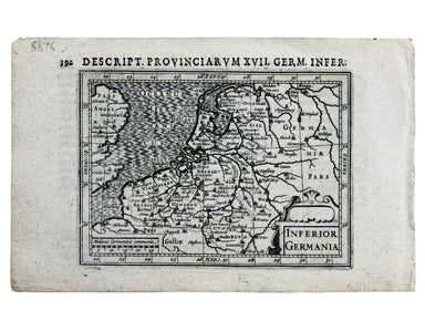
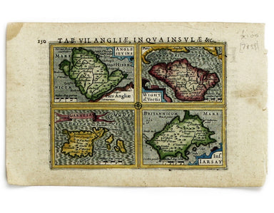
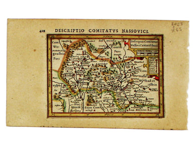
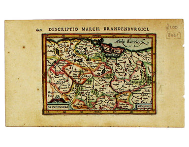
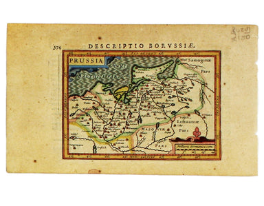
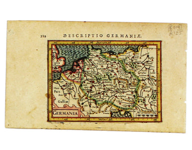
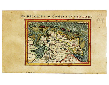
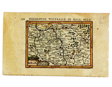
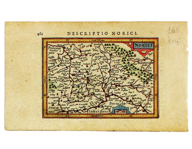
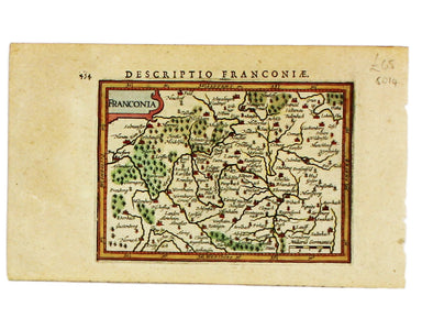
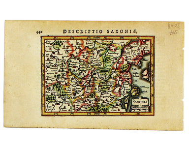
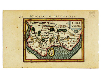
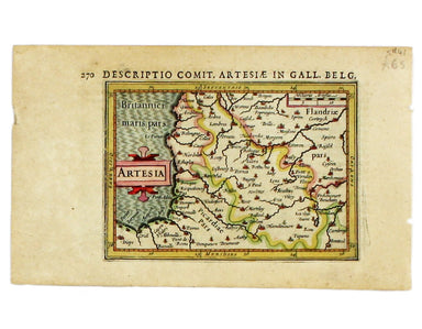
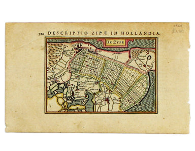
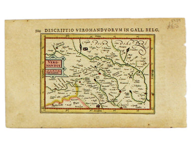
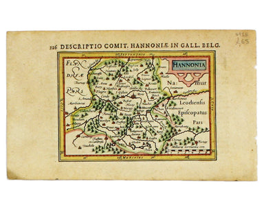
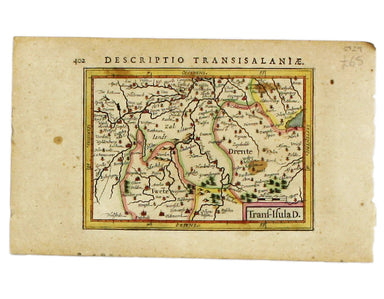
Bertius' Miniature Map of the Low Countries
This miniature map of the Low Countries was published in the first edition of Tabularum geographicarum contractarum libri, a geographical work whic...
View full details
This miniature map of the Low Countries was published in the first edition of Tabularum geographicarum contractarum libri, a geographical work whic...
View full details
Northumbria, Cumberlandia et Dunelmensis Episcopatus This map of northern England is from the first edition of Tabularum geographicarum contractaru...
View full details
This map of Northern Scotland is from the first edition of Tabularum geographicarum contractarum libri, a geographical work which is normally catal...
View full details
This map of Udrone from is the first edition of Tabularum geographicarum contractarum libri, a geographical work which is normally catalogued under...
View full details
Anglesey Insula; Wight olim Vectis; Insula Garnsey; Insula Iarsay This map of Anglesey, the Isle of Wight, Guernsey and Jersey is from the first ed...
View full details
This miniature map of Hesse is from the first edition of Tabularum geographicarum contractarum libri, a geographical work which is normally catalog...
View full details
This miniature map of Nassau is from the first edition of Tabularum geographicarum contractarum libri, a geographical work which is normally catalo...
View full details
This miniature map of Brandenburg is from the first edition of Tabularum geographicarum contractarum libri, a geographical work which is normally c...
View full details
This miniature map of Prussia is from the first edition of Tabularum geographicarum contractarum libri, a geographical work which is normally catal...
View full details
This map of Germany is from the first edition of Tabularum geographicarum contractarum libri, a geographical work which is normally catalogued unde...
View full details
This map of Eastern Friesland is from the first edition of Tabularum geographicarum contractarum libri, a geographical work which is normally catal...
View full details
This map of Southwestern Germany is from the first edition of Tabularum geographicarum contractarum libri, a geographical work which is normally ca...
View full details
This map of Northen Bavaria is from the first edition of Tabularum geographicarum contractarum libri, a geographical work which is normally catalog...
View full details
This miniature map of the Electoral Palatinate is from the first edition of Tabularum geographicarum contractarum libri, a geographical work which ...
View full details
This map of Franconia, including Frankfurt and Nuremberg in modern Bavaria, is from the first edition of Tabularum geographicarum contractarum libr...
View full details
This miniature map of Saxony is from the first edition of Tabularum geographicarum contractarum libri, a geographical work which is normally catalo...
View full details
Thus miniature map of Dithmarschen in Holstein, flanked by the Eider and the Elbe isfrom the first edition of Tabularum geographicarum contractarum...
View full details
Condition & Materials Copper engraving, 9.5 x 13.4 cm, recent hand-colour, Latin text on verso; miniature map of Artois.
Condition & Materials Copper engraving, 9.5 x 13.4 cm, recent hand-colour, Latin text on verso; map of the Zijpe polder.
Veromandui This map of the modern Aisne is named here for the Viromandui, a Belgic tribal name. Condition & Materials Copper engraving, 9.5 x 1...
View full details
Condition & Materials Copper engraving, 9.5 x 13.4 cm, recent hand-colour, Latin text on verso; map of Hainault.
Condition & Materials Copper engraving, 9.5 x 13.4 cm, recent hand-colour, Latin text on verso; map of Liège.
A miniature map of Salzburg and Carinthia. Condition & Materials Copper engraving, 10 x 13.5 cm, recent hand-colour, Latin text on verso;
Trans-Isula D. Condition & Materials Copper engraving, 9.5 x 13.4 cm, recent hand-colour, Latin text on verso; map of Overjissel.