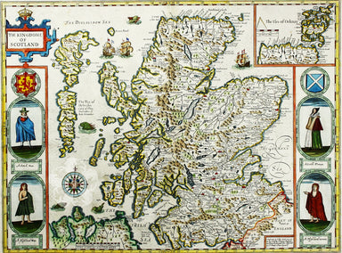
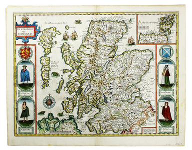
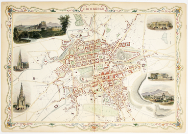
Tallis’ Map of Edinburgh
This map of Edinburgh is one of the town plans in Tallis’ hugely popular ‘Illustrated Atlas’ which was published serially from the mid 1840s onward...
View full details
This map of Edinburgh is one of the town plans in Tallis’ hugely popular ‘Illustrated Atlas’ which was published serially from the mid 1840s onward...
View full details
This map of the northern part of Scotland is from the Hondius-Janssonius map publishing business, which traced its roots back to Gerardus Mercator....
View full details
The East Coast of Scotland with the Isles of Orkney and Shetland This sea chart is from ‘Great Britain’s Coasting Pilot’, the first English Sea Atl...
View full details
This map of Northern Scotland is from the first edition of Tabularum geographicarum contractarum libri, a geographical work which is normally catal...
View full details
Cartographically Speed follows Mercator, but his is one of the most distinctive and decorative early maps of Scotland. The portraits in the borders...
View full details