£150.00


Bellin's Map of Nagasaki
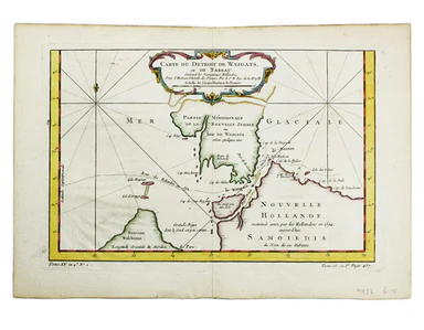
Plan du Port et de la Ville de Nangasaki This is a plan of the port city of Nagaski, one of Japan’s chief points of contact with the outside world ...
View full details