

Rocque’s Environs of Wembley from ‘London… & The Country Near Ten Miles Round’
SKU: 8765
Title:
Rocque’s Environs of Wembley from ‘London… & The Country Near Ten Miles Round’
Date of publication:
Printed Measurement:
Colour:
Mapmaker:
Engraver:
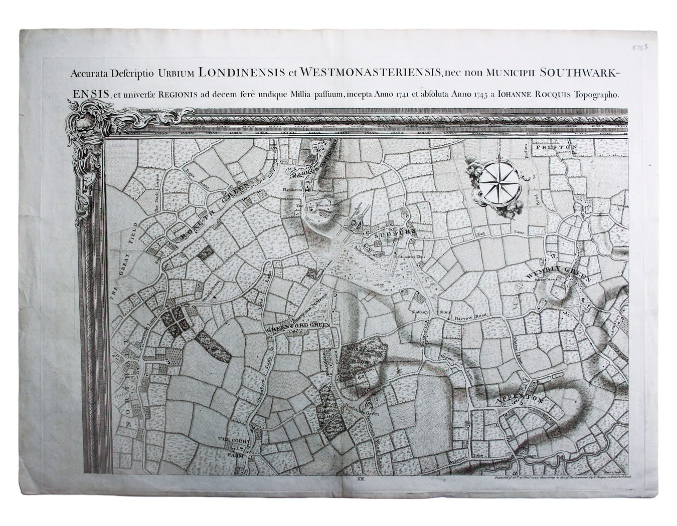
Environs of Wembley from Rocque’s ‘An Exact Survey of the City’s of London, Westminster, ye Borough of Southwark and the Country Near Ten Miles Round
John Rocque (c. 1704-62) was a Huguenot, probably born in Geneva and brought to London as a child. His brother Bartholomew worked as a 'dessinateur des jardins' and Rocque's earliest plans are of parks, gardens and estates. He is credited with completely revitalising English cartography, particularly large-scale map-making, at a time when many English map-sellers were content to re-issue old and outdated material. Read more
Rocque planned his survey of London in the 1730s, and it took him nine years to complete. By 1746 he was able to issue large scale maps of London (24 sheets), and London and environs (16 sheets), the former engraved by John Pine, who was among the leading English engravers of his day.
In 1750 Rocque was appointed cartographer to the Prince of Wales, but for financial support he had to rely upon the burgeoning civic pride of private individuals rather than state sponsorship. He also prepared large-scale maps of several other English towns such as Bath, and several large-scale county maps including Surrey and Middlesex.
Large, original projects led many of Rocque's contemporaries into financial difficulties, but despite a disastrous fire at his premises in 1750 he avoided their fate and died solvent. He seems to have been central to a circle of map-makers of similar Huguenot background, including Andrew Dury and Pierre André, who Anglicised his name to Andrews.
Condition & Materials
Copper engraving, 49 x 67.5 cm, engraved by Richard Parr, black and white as issued, one or two closed marginal nicks and tears, blank verso. The top-left map-sheet from one of the earliest large-scale surveys of the environs of London.
References
Howgego, Printed Maps of London, 94 (1) Read less