

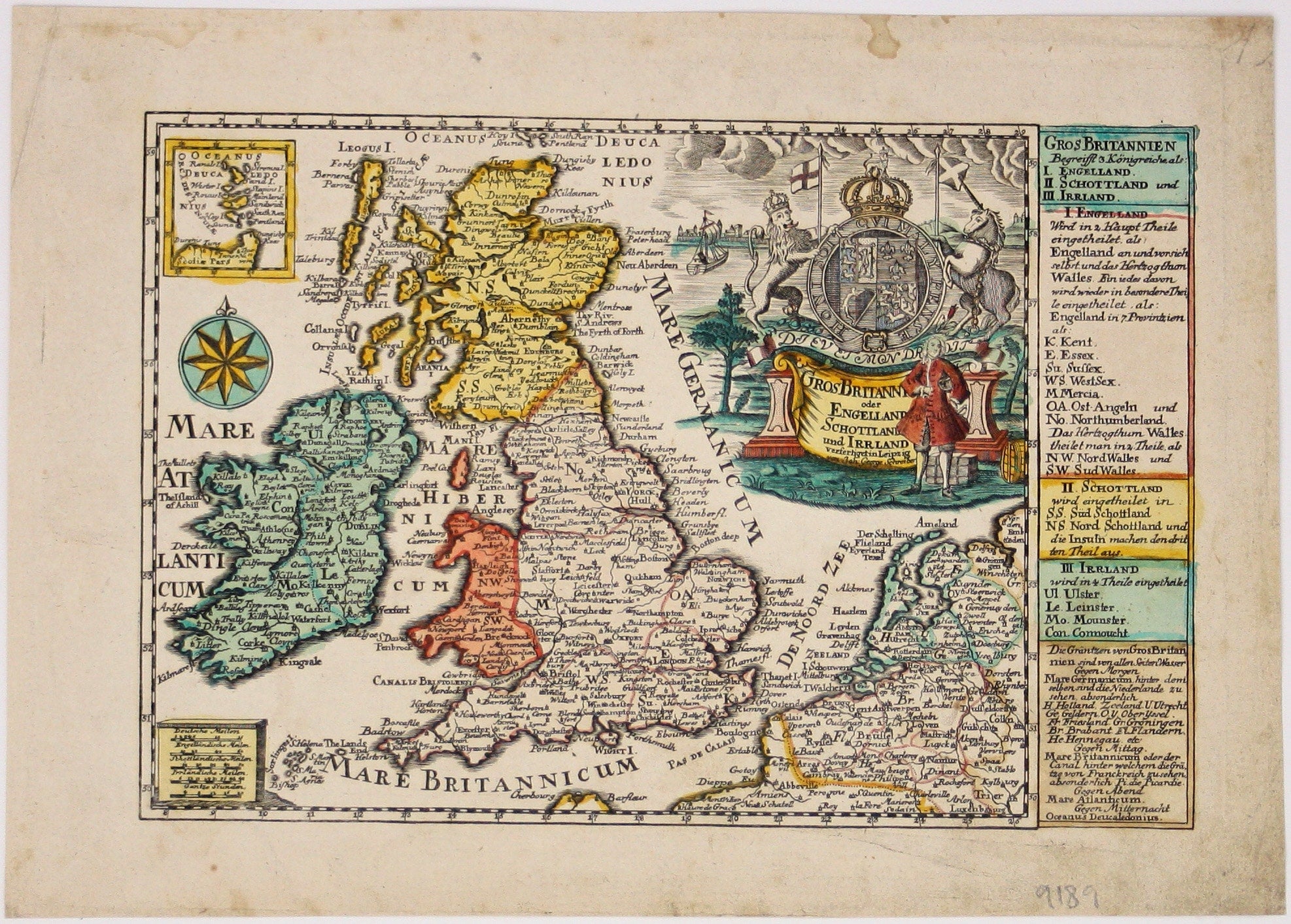
Schreiber’s Map of the British Isles
SKU: 9189
Title:
Schreiber’s Map of the British Isles
Date of publication:
Printed Measurement:
Colour:
Mapmaker:
Gros Britanni[en] oder Engelland Schottland und Irrland
The cartouche of this map is dominated by the Hanoverian coat of arms, and the legend on the right lists counties and regions of the British Isles identified with numbers and abbreviations on the map. Read more
Shirley suggests that Schreiber’s pocket ‘Atlas Selectus’ may have been engraved as early as 1730 and reissued circa 1749-1750.
Condition & Materials
Copper engraving, 16 x 27 cm, original hand colour, margins a little dusty, blank verso.
References
Shirley, Printed maps of the British Isles, Schreiber 1. Read less