

Bacon’s Plan of Marylebone
SKU: 8832
Title:
Bacon’s Plan of Marylebone
Date of publication:
Printed Measurement:
Publisher:
Colour:
Mapmaker:
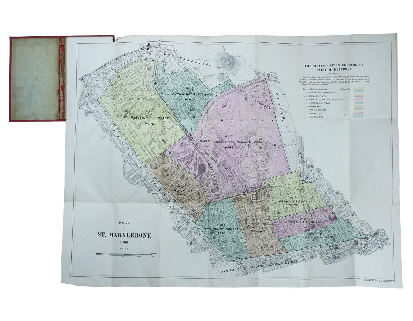
Plan of St Marylebone 1900
Detailed map of the Metropolitan Borough of St Marylebone as created by the London Government Act 1899, coloured to show the different wards. Read more
Condition & Materials
Folding map, sheet size 54 x 72 cm, original hand colour, laid on linen, marginal nick top left, folding into red cloth covers which are somewhat worn and damp-stained. Read less