

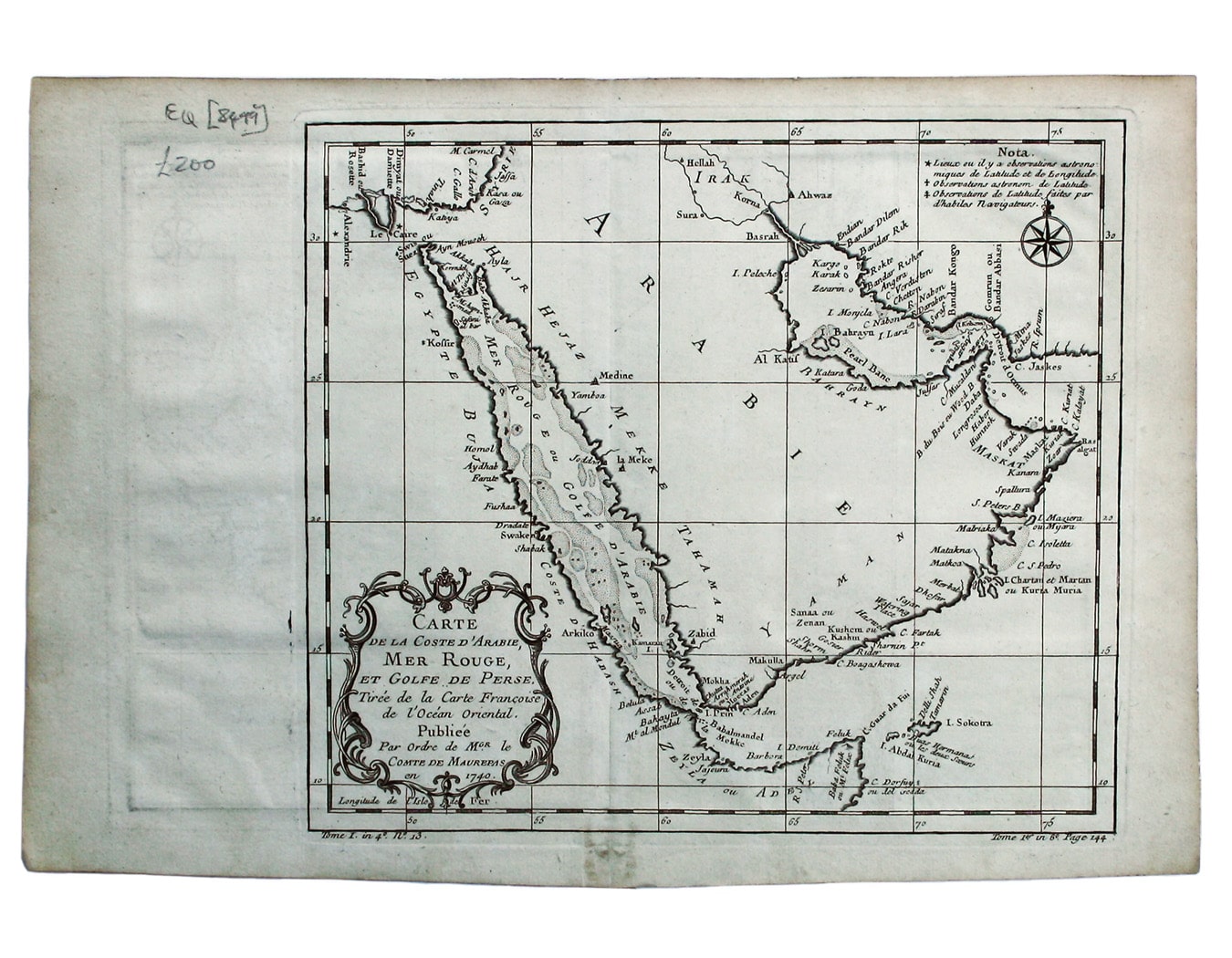
Bellin’s Map of Arabia
SKU: 8499
Title:
Bellin’s Map of Arabia
Date of publication:
Printed Measurement:
Colour:
Mapmaker:
Carte de la Coste d’Arabie, Mer Rouge, et Golfe de Perse.
A map of the Arabian peninsula. Read more
Jacques Nicolas Bellin the elder (1703-1772) was first chief hydrographic engineer of the "Dépôt des cartes, plans et journaux du Ministère de la Marine," charged by the French king with mapping the coasts of France first and then the rest of the world. He was also a member of the Royal Society of London. Bellin compiled the maps for Prévost's Histoire Générale des Voyages, and he later reworked them for his Petit Atlas Francaise and his Petit Atlas Maritime.
Condition & Materials
Copper engraving, 23 x 26 cm, black and white, blank verso.
References
Tibbetts, Arabia in early maps, 269. Read less