

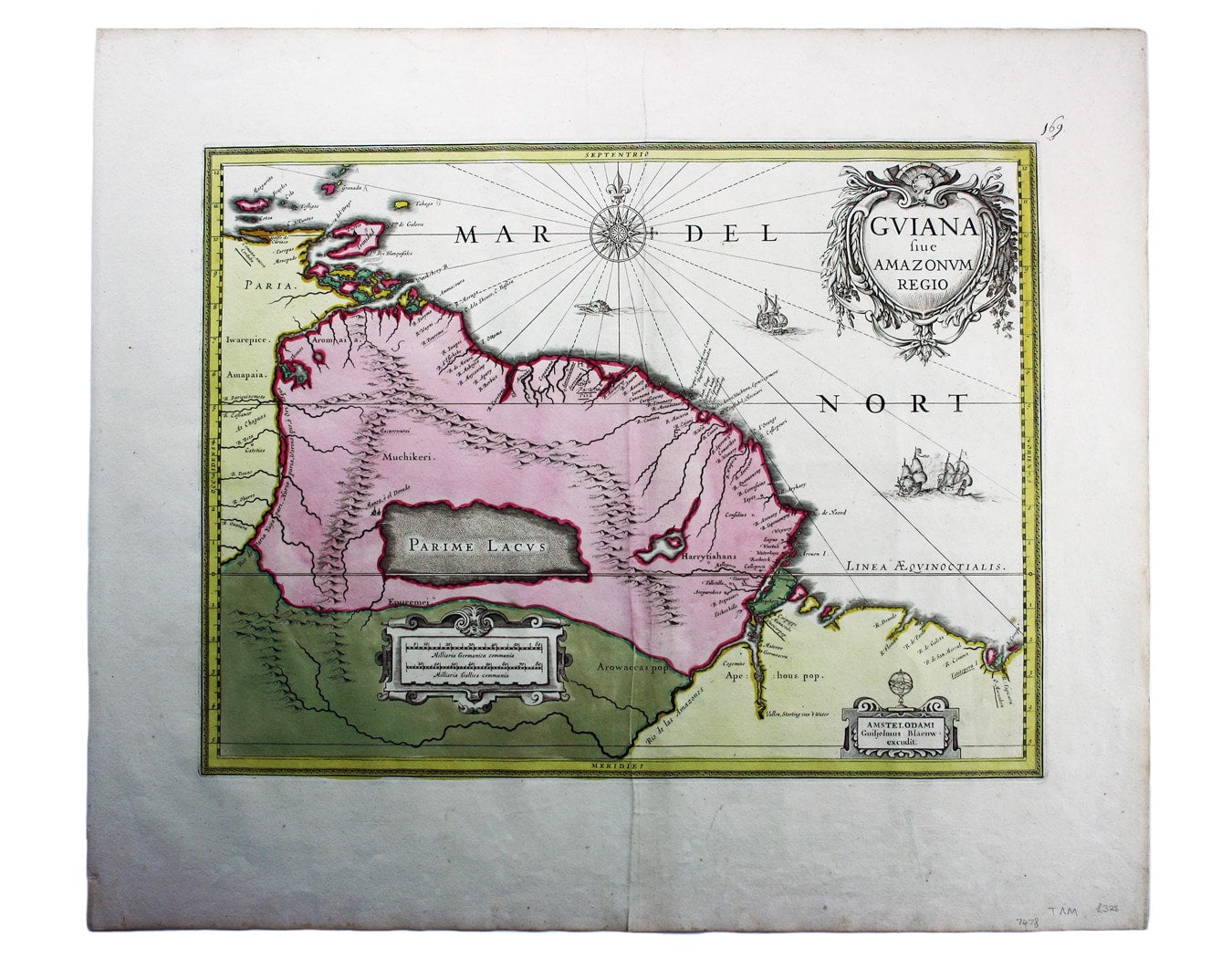
Blaeu’s Map of Guiana
SKU: 7478
Title:
Blaeu’s Map of Guiana
Date of publication:
Printed Measurement:
Colour:
Mapmaker:
This is a late issue of Blaeu’s map of Guiana, with full-body colour typical of the later seventeenth-century.
Seventeenth and eighteenth century maps modelled on Raleigh’s discoveries typically show the ‘mythical’ Lake Parime, as here, with the equally mythical city of Manoa, or el Dorado, on its shores. Read more
Long assumed to be entirely fictitious, geologists have now discovered traces of a great extinct lake in Roraima, Brazil. Slowly draining away, it disappeared before it could be mapped by later explorers, but a substantial body of water may well have existed in Raleigh’s day.
Condition & Materials
Copper engraving, 37.5 x 49.5 cm, original hand-colour, blank verso. Read less