

Blaeu’s Map of Liddesdale
SKU: 9406
Title:
Blaeu’s Map of Liddesdale
Date of publication:
Printed Measurement:
Colour:
Mapmaker:
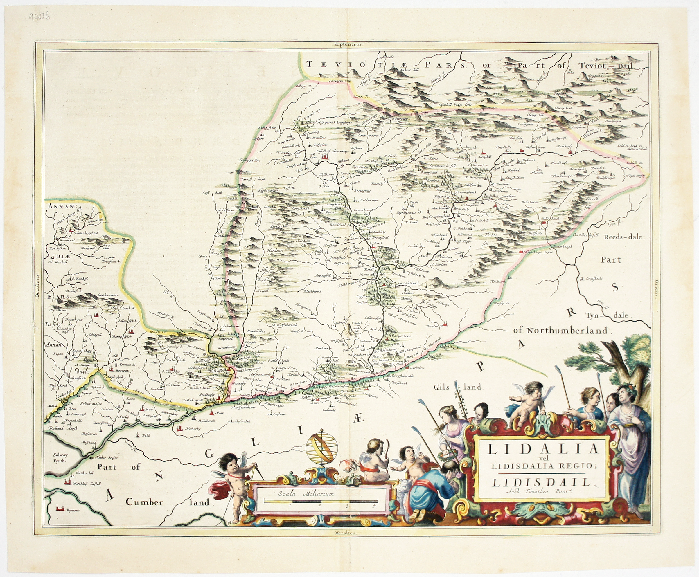
This map of Liddesdale, in the Scottish borders, is from Golden Age Dutch cartographer Blaeu’s Scottish atlas.
First published in 1654, the atlas was the first truly detailed printed survey of Scotland. It relied heavily on manuscript maps prepared at the turn of the 17th century by Timothy Pont which had never previously been published, with some additional material provided by Robert Gordon of Straloch and others, all saved for posterity and put into Blaeu’s hands by his local correspondent Sir John Scot of Scotstarvit. Read more
As a map publisher, Blaeu carefully cultivated people in every country who could provide him with accurate information. This strategic focus on local knowledge meant that, at a stroke, Scotland became one of the best mapped countries in 17th century Europe.
Condition & Materials
Copper engraving, 41.5 x 52.5 cm, with original hand-colour, Latin text on verso.
References
Koeman, Atlantes Neerlandici, Bl 49. Read less