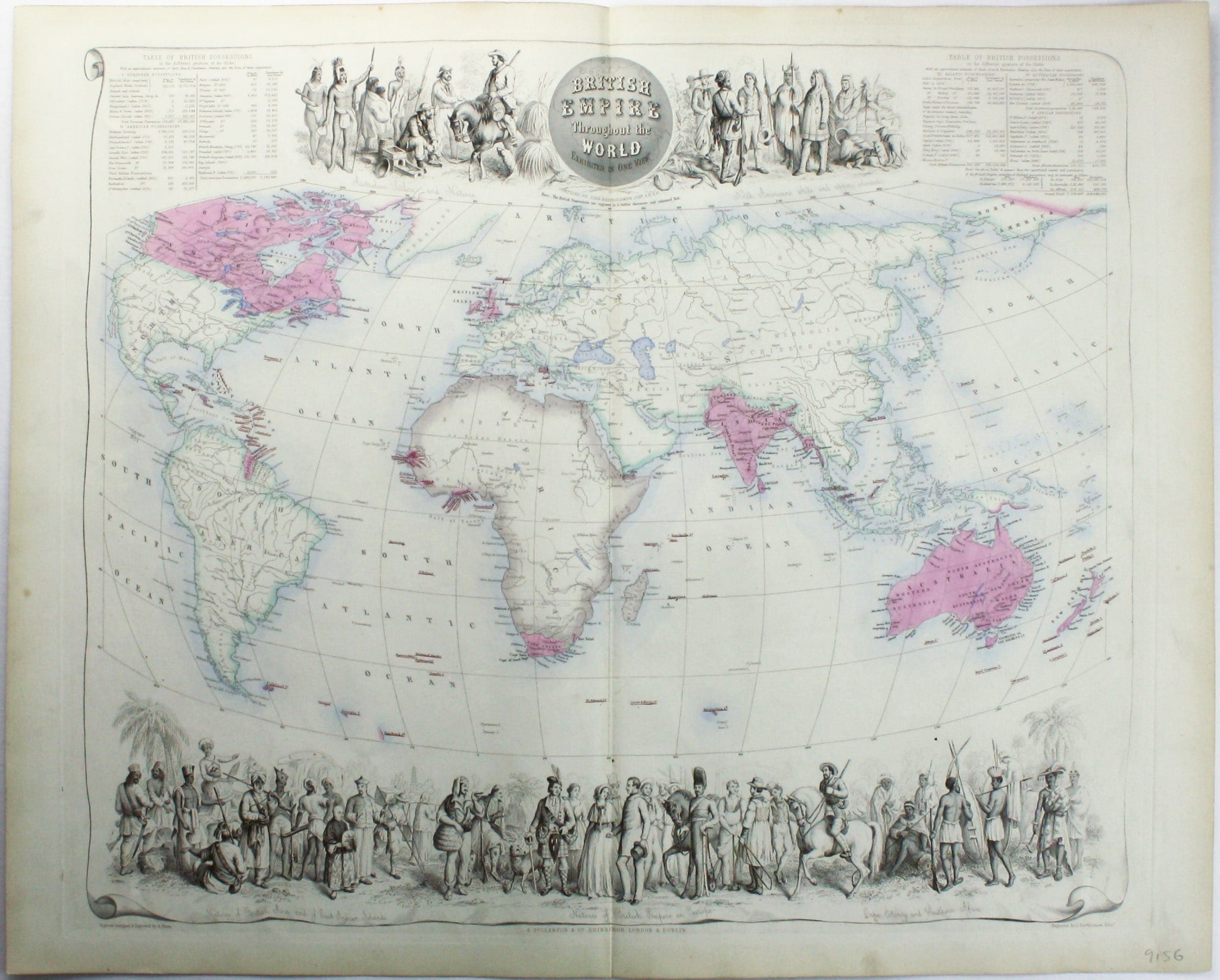
Fullarton’s Map of the British Empire
SKU: 9156
Title:
Fullarton’s Map of the British Empire
Date of publication:
Printed Measurement:
Colour:
British Empire Throughout the World Exhibited in One View
This is a highly decorative map of the British Empire by John Bartholemew, with British possessions coloured red. Ethnographic figures engraved by Andrew Thom surround the map, representing the inhabitants of each colony or dominion, whether settlers or indigenous to the region. The tables detail the total size and population of British possessions around the world, and the date of their acquisition.
Read more
The map was published in Fullarton's ‘Royal Illustrated Atlas’, perhaps the last great decorative work of this type published in the British Isles; it was issued in 27 parts from 1854-62 and first published as a complete atlas in 1864. Early examples were printed from an engraved steel plate, later editions were printed lithographically.
There are further subtle differences between editions. For example, our map shows ‘North Australia’, while the 1872 edition shows ‘Queensland’; Queensland was formally separated from New South Wales in 1859. Curiously part of the southern coast of Papua New Guinea is shown as under British control on all editions of the map, even though the first formal attempt to annex it (by the Colony of Queensland) did not take place until 1883, and a protectorate was not established by the British government until the following year, after Germany began to colonise the north.
This map predates the rapid territorial expansion towards the end of the century, particularly during the ‘scramble’ for Africa; the British Empire reached its greatest territorial extent half a century later in the 1920s, after a large part of the German colonial empire was mandated to Britain at Versailles.
Condition & Materials
Steel engraving, 44.5 x 53 cm, original hand-colour, blank verso. Read less


