


Niebuhr’s Map of Yemen
SKU: 8544
Title:
Niebuhr’s Map of Yemen
Date of publication:
Printed Measurement:
Colour:
Mapmaker:
Engraver:
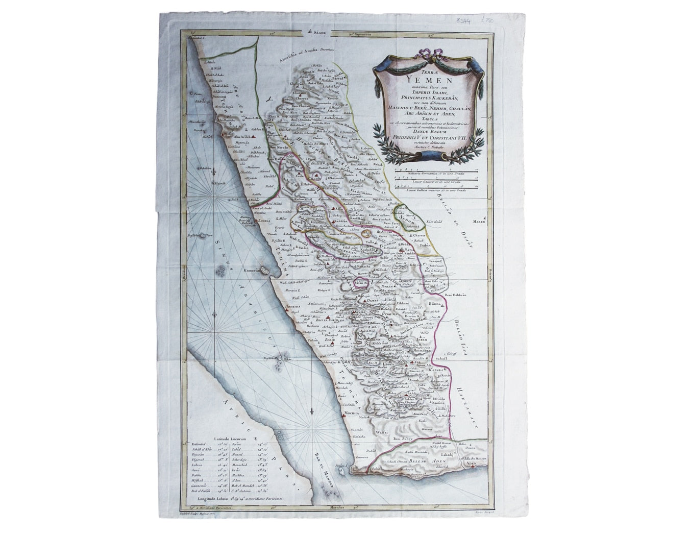
Terrae Yemen maxima Pars seu Imperii Imami, Principatus Kaukebân, nec non ditionum Haschid u Bekîl, Nehhm, Chaulân, Abu Arîsch Et Aden, Tabula ex observationibus astronomicis et hodometricia jussu et sumtibus Potentissimor Daniae Regnum Friderici V. Et Christiani VII. institutis delineata Auctore C. Niebuhr
Engraved in Copenhagen in 1771, our map of Yemen is from one of the original Copenhagen editions of Niebuhr’s account of his travels published in 1772-1773, rather the Amsterdam editions of 1774 onwards. Read more
Niebuhr was the sole survivor of the Royal Danish Arabia Expedition of 1761-1767, and this is the earliest reliable, detailed printed map of Yemen.
Condition & Materials
Copper engraving, 59 x 39.5 cm, map of Yemen engraved by Defehrt after Martin, modern hand-colour, blank verso. Read less