

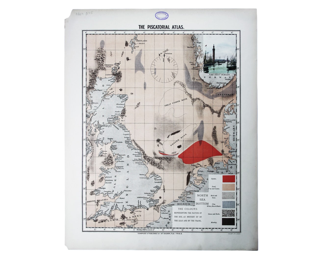

Olsen’s Chart of The North Sea Bottom
SKU: 8869
Title:
Olsen’s Chart of The North Sea Bottom
Date of publication:
Printed Measurement:
Publisher:
Colour:
Mapmaker:
This map was published in the ‘Piscatorial Atlas of the North Sea, English and George’s Channels’, a series of 50 lavishly chromolithographed charts recording the distribution – spawning grounds and abundance – of the major edible species of fish, shellfish and crustacea caught in the North Sea and off the coasts of the British Isles.
There are insets showing the fish themselves, and the vessels and gear used to catch them, with a table of detailed information covering time of spawning, number of eggs, when and how caught, bait and food, size and weight, ‘quality’, when in season and other remarks, the product of a decade or more of reports and correspondence with British fishermen.
Read more
The atlas was published under a joint London and Grimsby imprint, in the year of the International Fisheries Exhibition. By the 1850s the railway carried fresh Grimsby fish to Billingsgate and beyond, and in the second half of the nineteenth century Grimsby became one of the greatest fishing ports in the country – at the forefront of technological developments in the fishing industry. It was here that Ole Theodor Olsen (1838-1925) made his home.
Olsen was a Fellow of the Royal Astronomical Society. His obituary in the society’s transactions reveals that he was born in Christansand, Norway, went to sea at an early age and learned navigation on an English ship trading with India: “Although he never lost touch with Scandinavia, he became completely English in his sympathies. He had an extensive knowledge, gained from his own investigations, of the movements of fish in the North Sea, and he collected and collated deep sea soundings, so that he was often able to settle disputes as to the depth of ocean beds. After his life at sea he settled down in Grimsby as a maker of nautical instruments and a publisher of books for fishermen. He received honours in several countries, including Norway, Sweden and Japan.”
Condition & Materials
Chromolithographed chart, sheet size 55.5 x 44 cm, map 46 x 36 cm, printed in colours ‘representing the nature of the soil as brought up by the lead and by the trawl’, inset of the Fish Dock, Grimsby, old ink stamp to upper margin, blank verso, laid on archival tissue, small area of marginal loss to left hand corners. Read less