

Porcacchi’s Map of the Orkneys & Hebrides
SKU: 7842
Title:
Porcacchi’s Map of the Orkneys & Hebrides
Date of publication:
Printed Measurement:
Colour:
Mapmaker:
Engraver:
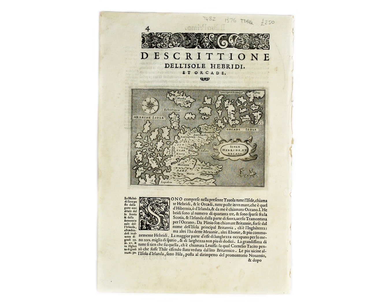
Isola Hebride, et Orcade
First published in 1572, our map of the Hebrides and Orkney islands is from the second edition of L’Isole piu famose del Mondo, one of the most beautifully engraved of the Italian Isolaria or Island books. Read more
Condition & Materials
Copper engraving, 11 x 15 cm, engraved by Girolamo Porro, set in descriptive Italian text with woodcut headpiece and historiated initial, black and white. Read less