

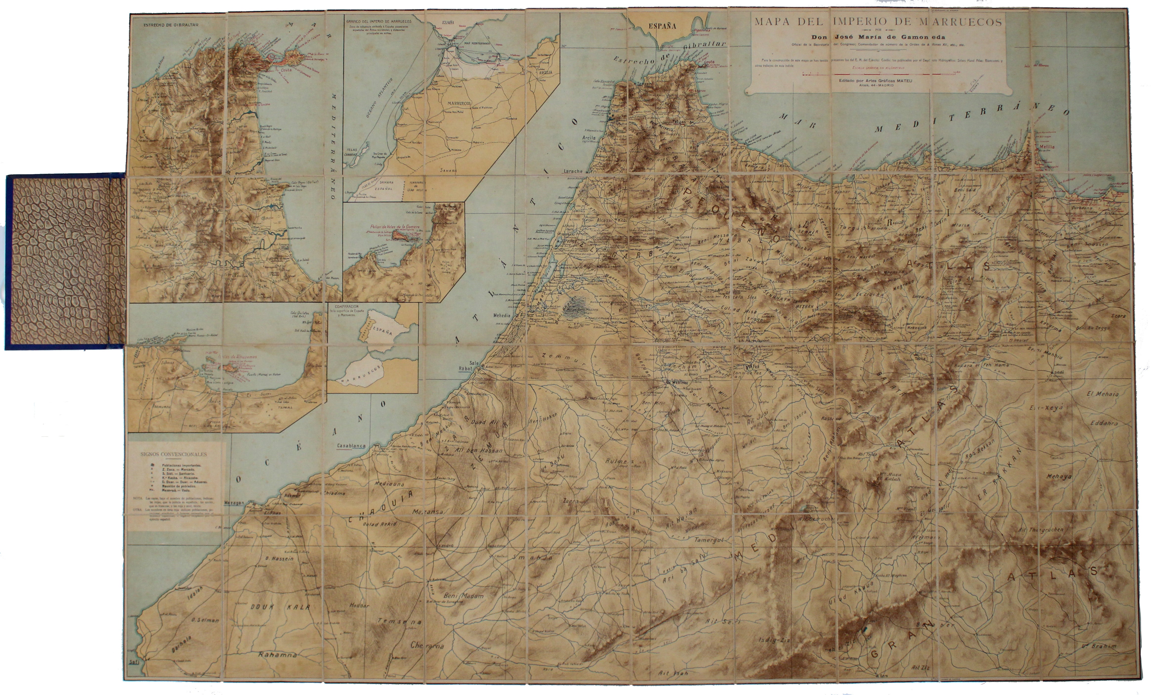
Rif War Map of Morocco
SKU: 9603
Title:
Rif War Map of Morocco
Date of publication:
Place of publication:
Publisher:
Colour:
Mapmaker:
The Empire of Morocco, since 1912, had been divided between the Spanish and French. Our map dates to the period of the Rif War, 1921-26, in which allied Franco-Spanish forces suppressed the Berber tribes of the Rif region in a brutal and drawn out campaign.
Condition & Materials Read more
Folding map, 75 x 112 cm, printed in colours, 5 inset maps including environs of Ceuta and a sketch map of Morocco and the Iberian peninsula for location and scale, dissected into 40 panels and laid on linen, folding into blue cloth covers, minor wear; one annotation (calculation) next to scale.
References
We have located 2 institutional copies of a smaller version (57 x 81 cm): OCLC 1026093143/914939664. The University of Wisconsin has an example with approximately these dimensions (74 x 110 cm): OCLC: 503078140. Read less