

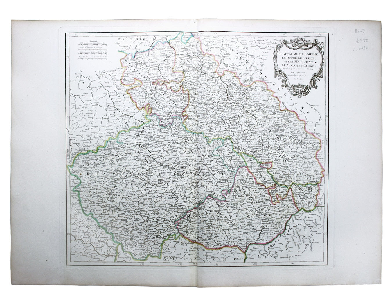
Robert de Vaugondy’s Map of the Czech Republic
SKU: 8803
Title:
Robert de Vaugondy’s Map of the Czech Republic
Date of publication:
Printed Measurement:
Colour:
Mapmaker:
Le Royaume de Boheme, le Duche de Silesie, et les Marquisats de Moravie et Lusace, dressés d’apres les cartes de Muller
The second state of Robert de Vaugondy’s map of the present day Czech Republic and parts of neighbouring Germany and Poland was first published in 1751. Read more
Condition & Materials
Copper engraving, 50 x 58 cm, original hand colour in outline, blank verso.
References
Pedley, Bel et Utile: the Work of the Robert de Vaugondy Family of Mapmakers, 285 (2). Read less