

Robert de Vaugondy’s Old Testament Map of the Holy Land
SKU: 9096
Title:
Robert de Vaugondy’s Old Testament Map of the Holy Land
Date of publication:
Printed Measurement:
Colour:
Mapmaker:
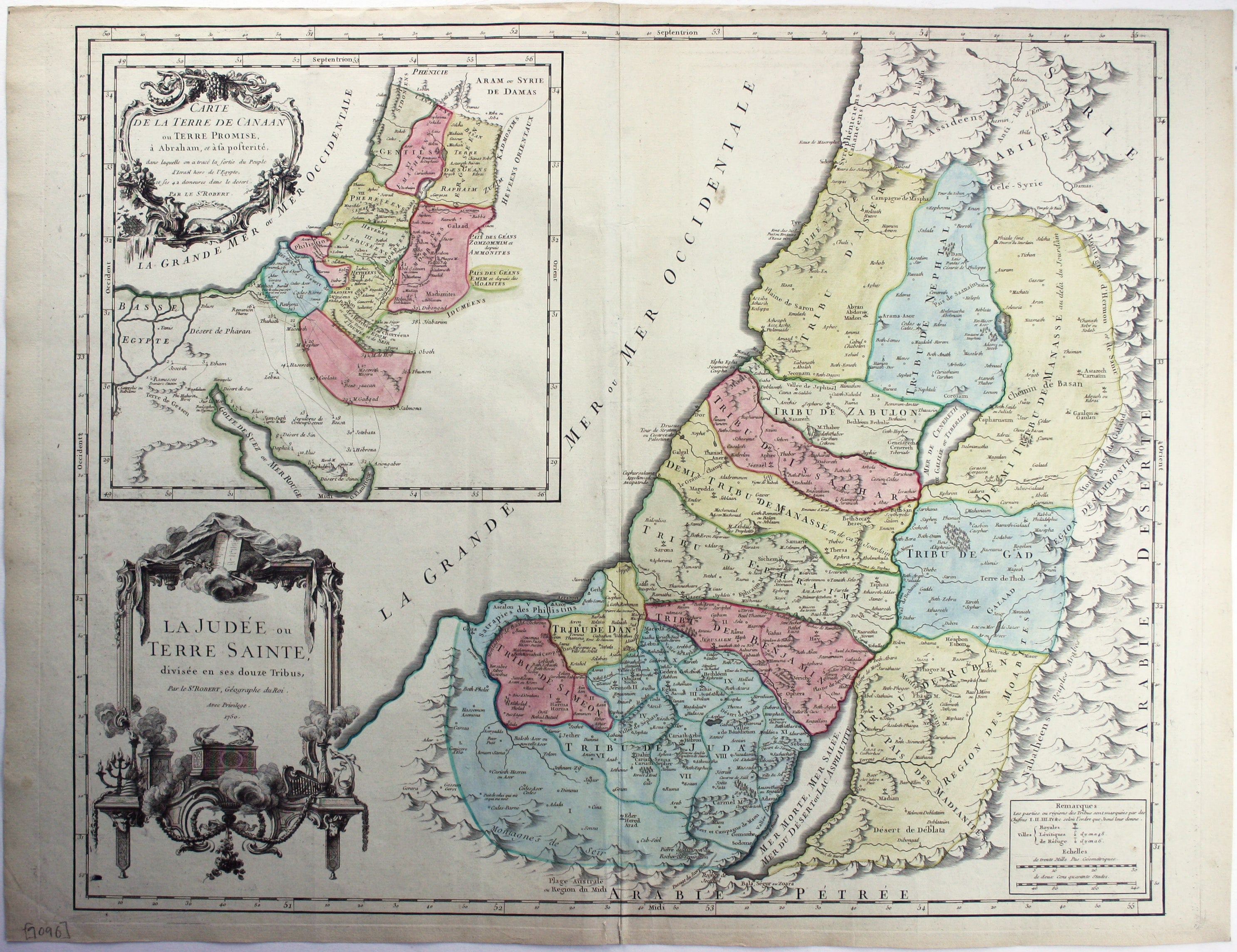
La Judée ou Terre Sainte, divisée en ses douze Tribus
This is the second state of Robert de Vaugondy’s Old Testament map of the Holy Land. The map is still dated 1750, but the peninsula of Seboim has been added in the Dead Sea. Read more
Condition & Materials
Copper engraving, 49.5 x 62.5 cm, inset ‘Carte de la Terre de Canaan’, original hand colour, blank verso.
References
Pedley, Bel et Utile: the Work of the Robert de Vaugondy Family of Mapmakers, 393 (2). Read less