

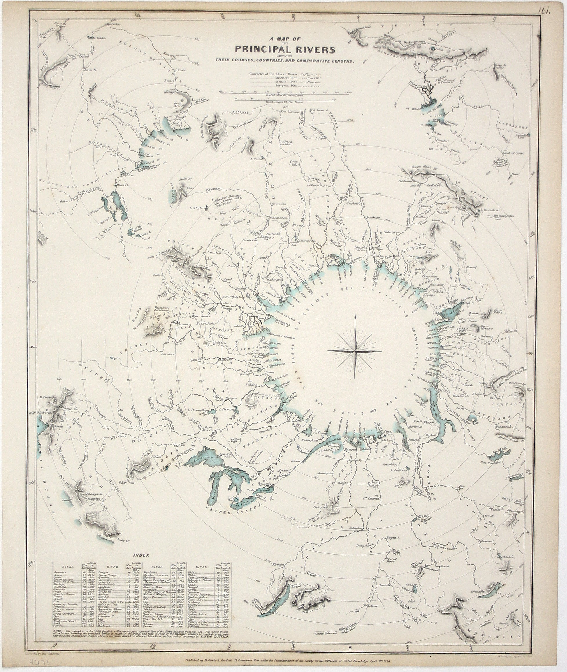
SDUK Map of Principal World Rivers
SKU: 9471
Title:
SDUK Map of Principal World Rivers
Date of publication:
Printed Measurement:
Publisher:
Colour:
Mapmaker:
Engraver:
A Map of the Principal Rivers shewing their courses, countries and comparative lengths
The Society for the Diffusion of Useful Knowledge was founded in 1826 with the high-minded aim of making 'useful' information available to the self-taught. Read more
Some of the material was decidedly abstruse, subscribers fell away and the Society was wound up in 1848; however, the series of 209 maps published over a 14 year period from 1829 onwards were highly praised for their superior quality, accuracy and aesthetic appeal and remain an outstanding achievement.
Condition & Materials
Steel engraving, 40.5 x 32.5 cm, engraved by Thomas Starling, original hand colour in outline, trivial spotting, numbered in an old hand, blank verso. Read less