

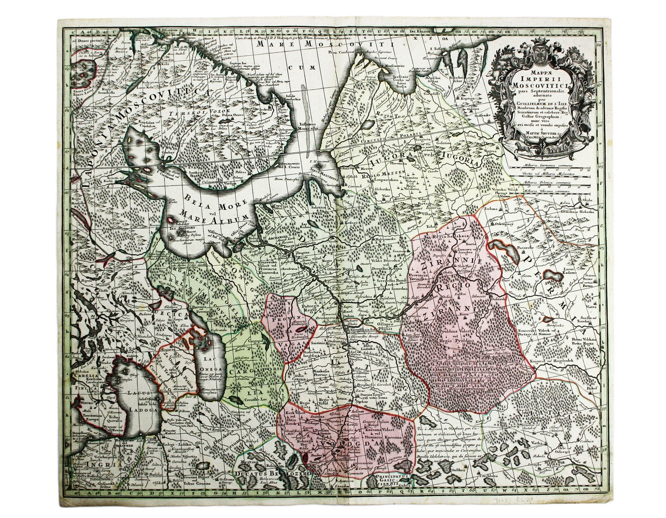
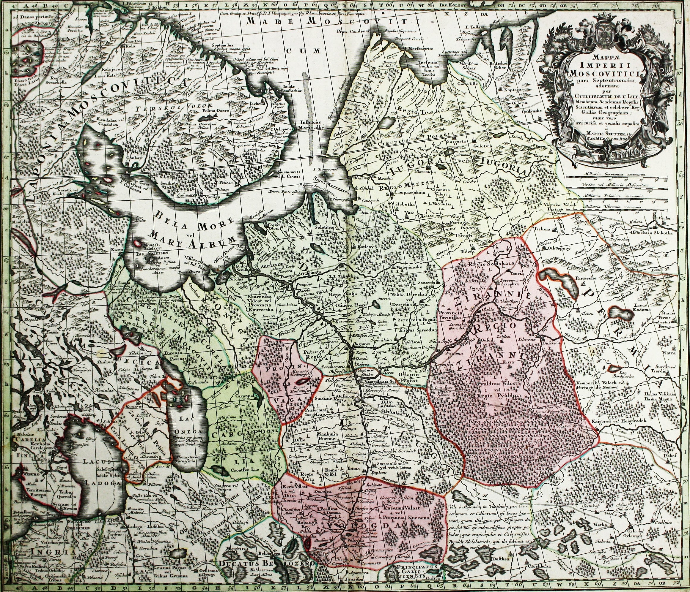
Seutter’s Map of Muscovy
SKU: 7195
Title:
Seutter’s Map of Muscovy
Date of publication:
Printed Measurement:
Colour:
Mapmaker:
Mappae Imperii Muscovitici pars Septentrionalis
This detailed early 18th century map of Muscovy follows the cartography of De l’Isle, which includes the recently-established settlement of St Petersburg, described on the map as a city built by the Tsar. Read more
Matthäus Seutter (1678-c.1757) was apprenticed to Johann Baptist Homann in Nuremburg in 1697, but in 1707 returned to Augsburg and founded his own map publishing house, which became the primary competitor of the Homann firm. The rival businesses dominated the German, and to a significant extent the international map markets throughout the eighteenth-century; Tobias Conrad Lotter inherited half of his father-in-law's business and in 1758 he established his own firm, taking his share of the copper printing plates.
Condition & Materials
Copper engraving, 49.5 x 58 cm, original hand-colour, blank verso. Read less