

Stanford’s Khaki Election Map of London
SKU: 6263
Title:
Stanford’s Khaki Election Map of London
Date of publication:
Printed Measurement:
Colour:
Mapmaker:
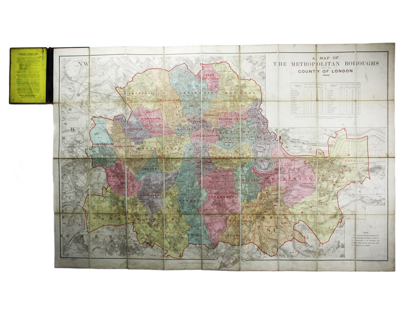
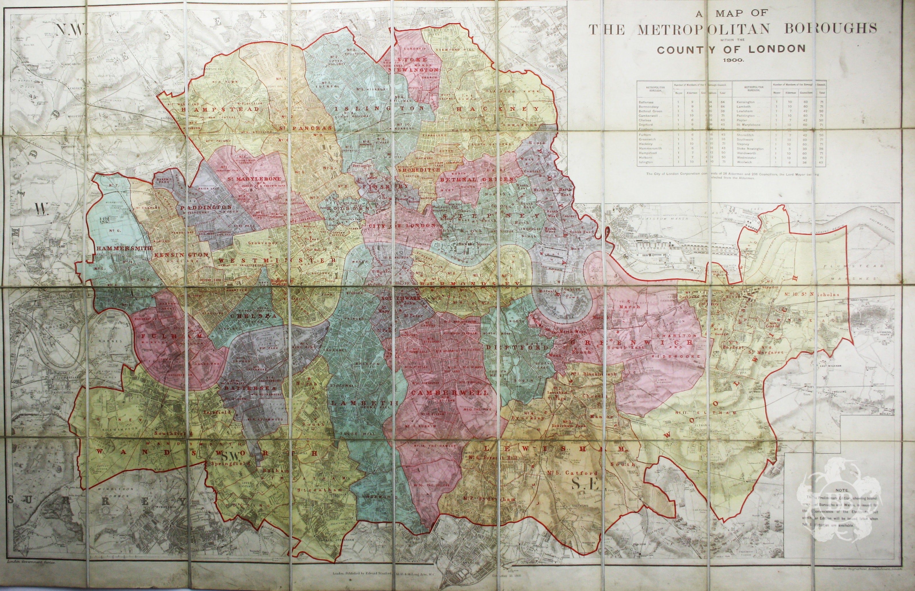
A Map of the Metropolitan Boroughs within the County of London
The date of publication in the lower margin of this map is significant: 25th October 1900, the date of the original "Khaki election" which returned Salisbury's government to power during the second Boer War. (1900 was also the year of the foundation of the Labour Party, who won two seats in the election, but not in London.) The note bottom right indicates that this is a 'preliminary' edition, and that another will be issued "when statistics are available". Read more
Condition & Materials
Lithographed map, 67.5 x 103 cm, colour printed, dissected into 36 sheets and laid on linen, folding into maroon cloth covers with printed paper label (worn but legible). Read less