

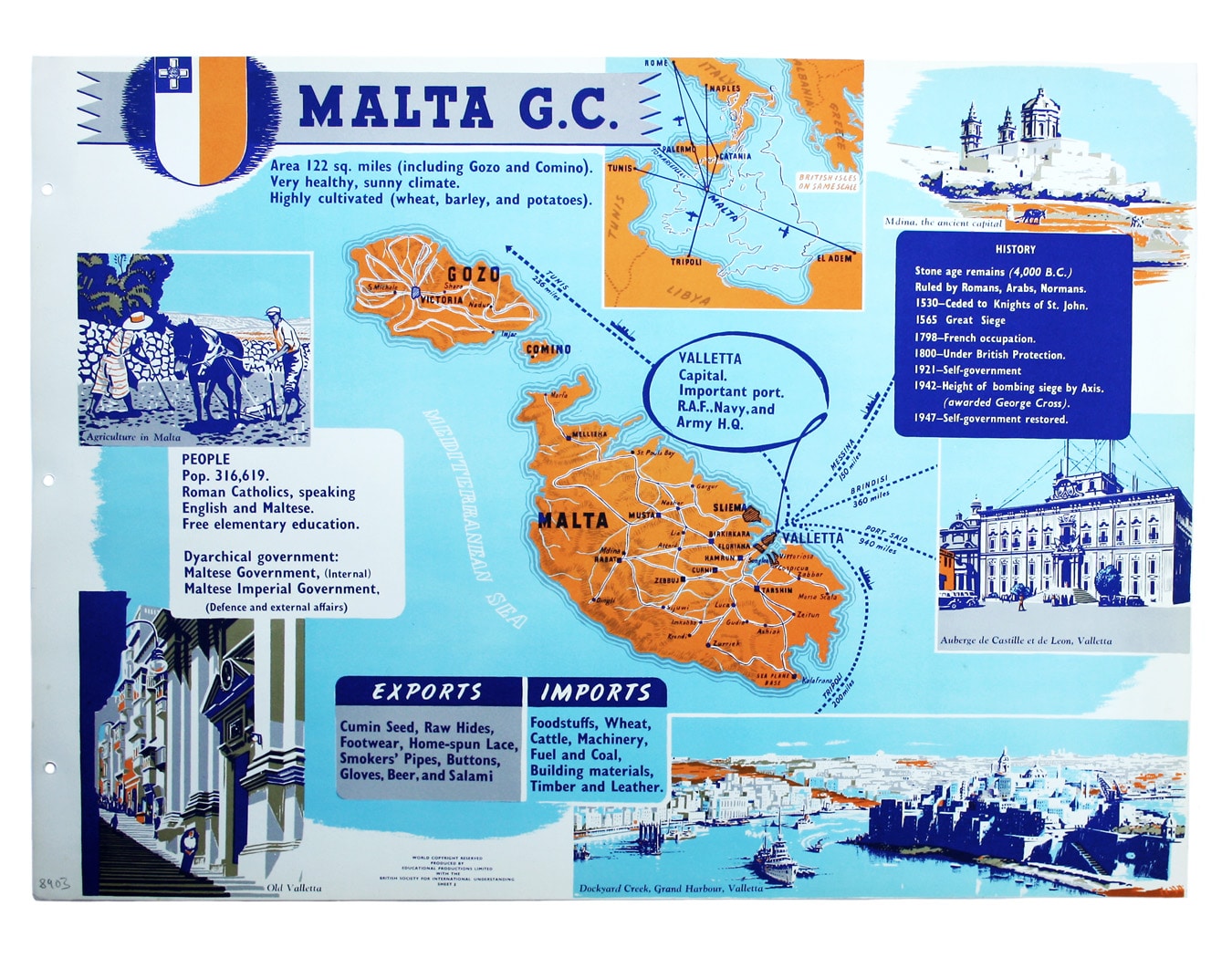
The Empire Information Project Map of Malta
SKU: 8903
Title:
The Empire Information Project Map of Malta
Date of publication:
Printed Measurement:
Publisher:
Colour:
Come for the Stone Age remains, stay for the rawhide...
This simplified map of Malta and Gozo is surrounded by views, statistics and historical information considered suitable for teaching purposes. The location map of the central Mediterranean has an overlay of the British Isles for scale. Read more
Condition & Materials
Lithographed map sheet, 44.5 x 61 cm, printed in colours on stiff paper, blank verso, a visual aid published as sheet 3 in a portfolio titled ‘Empire Information Project’; holes punched for a binder in left hand margin. Read less