

War Office Map of Malta
SKU: 9372
Title:
War Office Map of Malta
Date of publication:
Printed Measurement:
Publisher:
Colour:
Mapmaker:
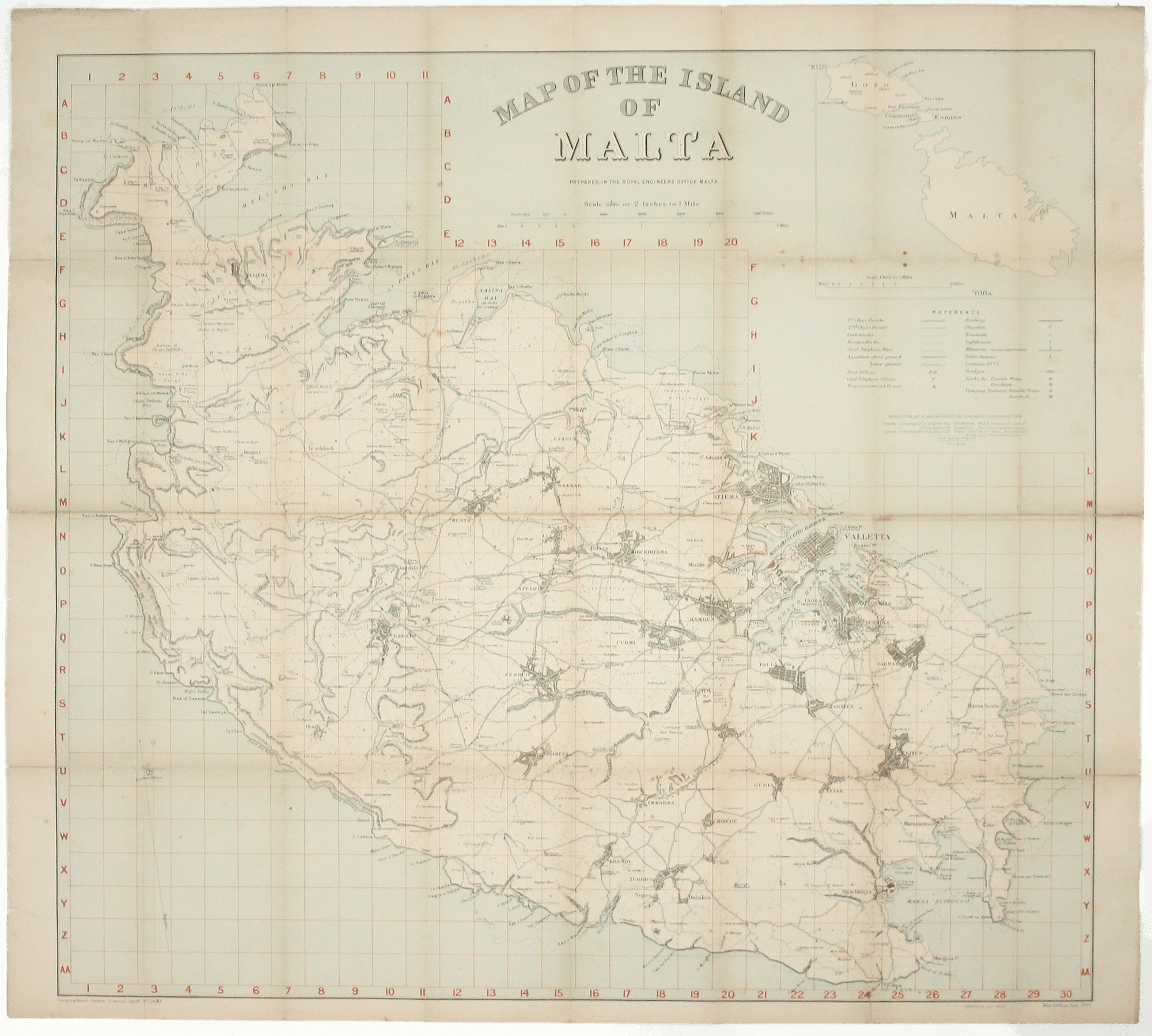
In the 1920s Valletta was the location of the Royal Navy's Mediterranean Fleet's headquarters. Prepared on the island, this map of Malta has a grid over-printed in red that shows key features including railways, civil telephone lines and offices, aqueducts and water tanks (‘brackish’ and ‘potable’).
Revised to January 1923, and based on the 1910 War Office map, it is GSGS sheet no. 2430, but was advertised as available for public purchase from Stanford’s, Sifton Praed and others.
Read more
Condition & Materials
Lithographed map, sheet size 76 x 85 cm, printed in colours, old folds with neat restoration to wear along fold lines and to fold intersections on verso, blank verso.
References
OCLC: 225626840. Read less