

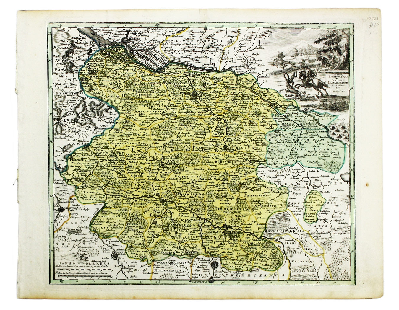
Weigel’s Map of the Principality of Lüneburg
SKU: 7981
Title:
Weigel’s Map of the Principality of Lüneburg
Date of publication:
Printed Measurement:
Colour:
Mapmaker:
This map of the Principality of Lüneburg incorporates the former County of Dannenberg.
The cartouche illustrates a stag hunting scene, perhaps on Lüneburg Heath. Read more
Condition & Materials
Copper engraving, 33.5 x 39 cm, original hand-colour, blank verso. Read less