‘Oh the blue of the Danube is greener than green’
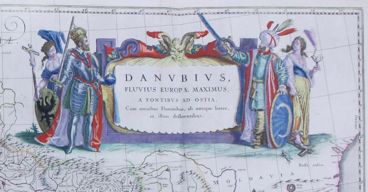
The mighty Danube is the subject of one of the largest and most decorative maps to appear in a Blaeu atlas. It was printed on two, joined folio sheets and made its first appearance in 1635; a near identical map was published by Blaeu’s rival Janssonius in 1636. Our example, printed in Amsterdam in the 1640s, has bright original hand colour. I have seen some very green Danubes over the years, but on this cartouche Blaeu’s colourist has opted for the traditional blue. Sorry, Spike Jones!


Showing the course of one of the commercial arteries of Europe, from source to sea, the Danube is an obvious choice for special treatment, but Blaeu has chosen to emphasise the strategic importance of the region, which was on the frontier of repeated Ottoman attempts to expand into southeastern Europe. The decorative title cartouche features the Austrian emperor Ferdinand II (died 1637) facing a more generic Turkish Sultan (bearded, but not readily identifiable with Murad IV), with swords drawn. An allegorical figure representing Europe holds the cross aloft, shielded by the Holy Roman Emperor, while a personification of Asia (bearing a censer) tramples it underfoot behind the Sultan. Beneath them is a lizard or salamander, and this has me a bit puzzled. It isn’t a force for good, this lizard, but is it a general reference to evil or the occult, or does it specifically represent the serpent in the Garden of Eden? Thoughts on the back of a postcard, please…


Surrounding the scale in the lower left corner is a decorative vignette, with allegorical figures of the river and its tributaries, which are shown adding their waters to the main channel. The tributaries get progressively younger, less bearded and less muscular as they get closer to the delta at the river’s mouth. All in all, a fascinating and magnificent example of Golden Age Dutch map-making.


Leave a comment