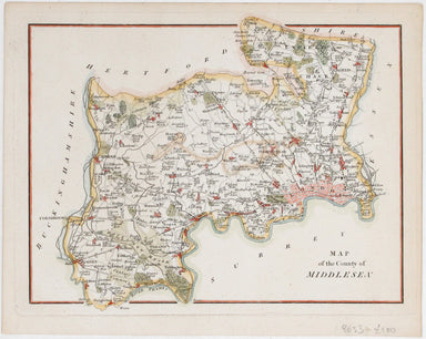
Anonymous Map of Middlesex
This attractive, detailed map of the county of Middlesex is unsigned; as yet, we have been unable to identify the engraver. Do feel free to write t...
View full details

This attractive, detailed map of the county of Middlesex is unsigned; as yet, we have been unable to identify the engraver. Do feel free to write t...
View full details

Plan du Port et de la Ville de Nangasaki This is a plan of the port city of Nagaski, one of Japan’s chief points of contact with the outside world ...
View full details
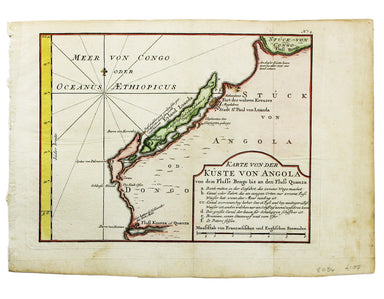
Karte von der Küste von Angola von dem Flusse Bengo bis an den Fluss Quanza This map show the coastline of northern Angola between the rivers Bengo...
View full details
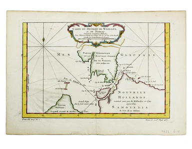
Carte du Dètriot de Waeigats, ou de Nassau This is map of the Yugorsky Strait in the Arctic Sea, separating Vaygach Island from the mainland. It il...
View full details
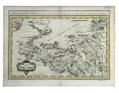
Carte du Grand Thibet. Pour Servir à l’Histoire Generale des Voyages. Tirée des Auteurs Anglois… Bellin notes that his map of Tibet was compiled fr...
View full details

This miniature map of Gujarat and northern India was published in one of the earlier editions of Bertius’ Tabularum Geographicarum Contractum issue...
View full details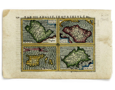
Anglesey Insula; Wight olim Vectis; Insula Garnsey; Insula Iarsay This map of Anglesey, the Isle of Wight, Guernsey and Jersey is from the first ed...
View full details
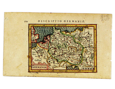
This map of Germany is from the first edition of Tabularum geographicarum contractarum libri, a geographical work which is normally catalogued unde...
View full details
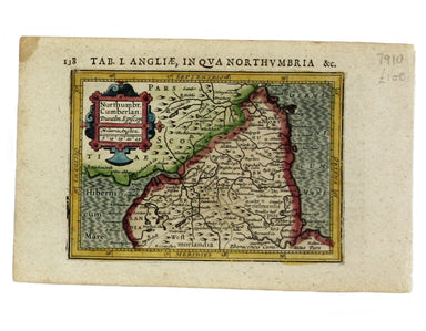
Northumbria, Cumberlandia et Dunelmensis Episcopatus This map of northern England is from the first edition of Tabularum geographicarum contractaru...
View full details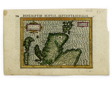
This map of Northern Scotland is from the first edition of Tabularum geographicarum contractarum libri, a geographical work which is normally catal...
View full details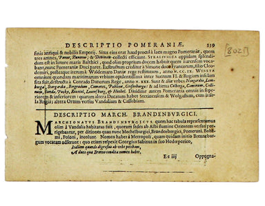
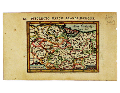
This miniature map of Brandenburg is from the first edition of Tabularum geographicarum contractarum libri, a geographical work which is normally c...
View full details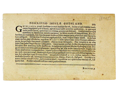
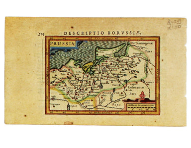
This miniature map of Prussia is from the first edition of Tabularum geographicarum contractarum libri, a geographical work which is normally catal...
View full details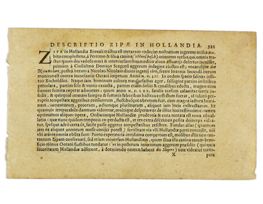
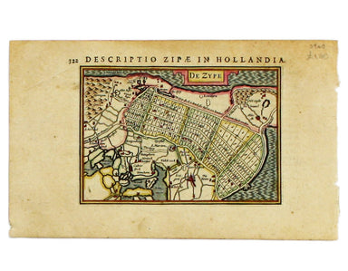
Condition & Materials Copper engraving, 9.5 x 13.4 cm, recent hand-colour, Latin text on verso; map of the Zijpe polder.


A Mapp of the Parish of St Giles’s in the Fields John Stow's A Survey of the Cities of London and Westminster was originally published in 1598 and ...
View full details
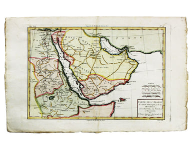
Carte de L’Arabie, du Golfe Persique et de la Mer Rouge, avec L’Egypte, La Nubie et L’Abissinie This map of Arabia is from the Atlas de Toutes Part...
View full details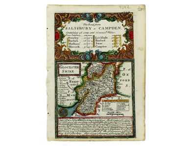
This map of Gloucestershire was engraved by Emanuel Bowen for John Owen’s Britannia Depicta, a pocket road book derived from Ogilby’s innovative at...
View full details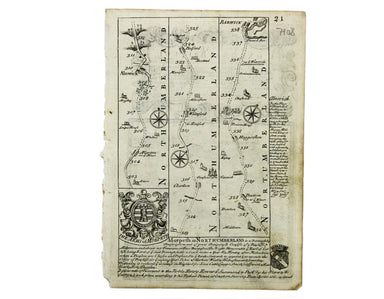
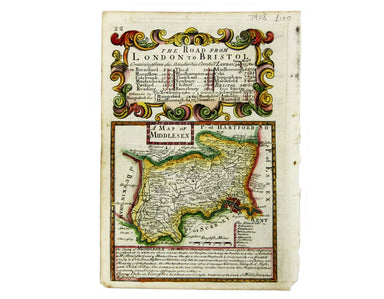
This map of Middlesex was engraved by Emanuel Bowen for John Owen’s Britannia Depicta, a pocket road book derived from Ogilby’s innovative atlas of...
View full details
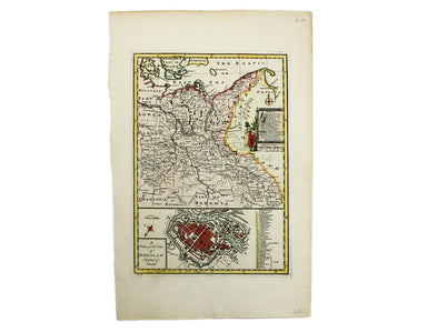
Condition & Materials Copper engraving, 23 x 32.5 cm, recent hand-colour, blank verso.
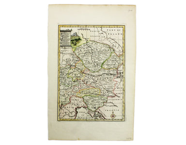
Condition & Materials Copper engraving, 23 x 32.5 cm, recent hand-colour, blank verso.
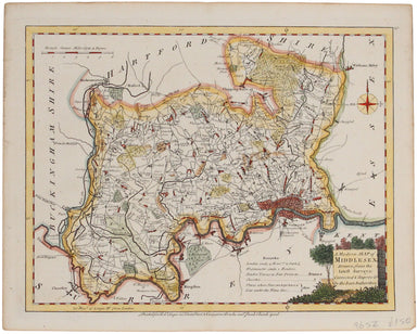
Ellis' map of Middlesex conveys a wealth of detailed information: borough towns are shown with stars identifying the number of Members returned to ...
View full details
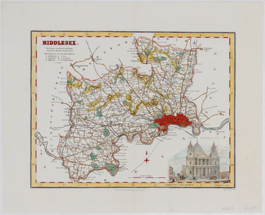
This map of Middlesex included a vignette of St. Paul's Cathedral. It was published in James Bell’s 'New and Comprehensive Gazetteer of England and...
View full details
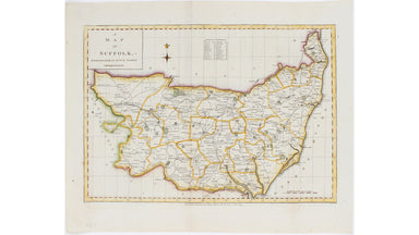
This map of Suffolk is from a series of maps engraved between 1787-1791 by Edward Sudlow after John Haywood. It was subsequently published in atlas...
View full details
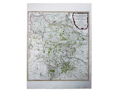
German Dominions of the King of Great Britain; Comprized under the name of Electorate of Brunswick-Luneburg and including the Dutchies of Bremen, V...
View full details
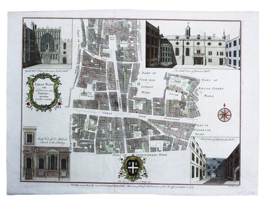
Cheap Ward with its Divisions into Parishes according to a New Survey This ward plan of Cheap was published in the greatly expanded second edition ...
View full details
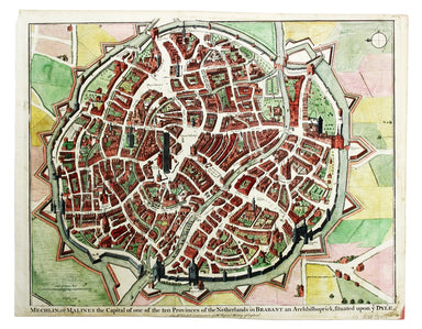
Mechelin, or Malines, the Capital of one of the ten Provinces of the Netherlands in Brabant This map of Mechelen was engraved by James Basire and p...
View full details

Pomerania, running along the Baltic coast between Rostock and Gdansk, is now divided between Germany and Poland. The 'Atlas Minor’ was a pocket atl...
View full details
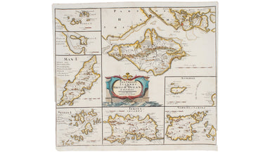
Robert Morden's maps were engraved to illustrate Gibson's edition of William Camden's Britannia, first published in 1695 and reprinted in 1722 and ...
View full details

Robert Morden's county maps, like this one of Northumberland, were engraved to illustrate Gibson's edition of William Camden's Britannia, first pub...
View full details

Robert Morden's country maps, like this one of Suffolk, were engraved to illustrate Gibson's edition* of William Camden's Britannia. Camden was an ...
View full details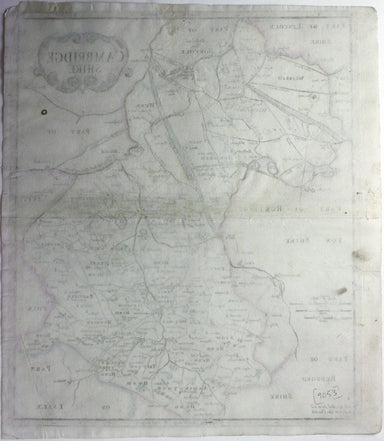
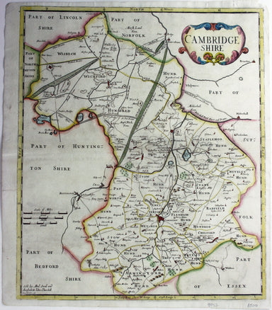
Robert Morden's maps were engraved to illustrate Gibson's edition of William Camden's Britannia, first published in 1695 and reprinted in various 1...
View full details
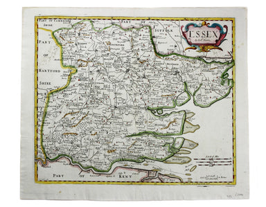
Condition & Materials Copper engraving, 36 x 42 cm, recent hand-colour, spotting top left, blank verso. A map of Essex engraved to accompany Gi...
View full details
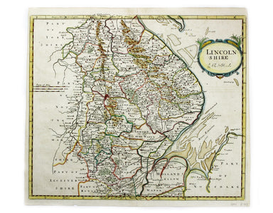
This map of Lincolnshire was engraved to accompany Gibson’s edition of Camden’s Britannia, first published in 1695. Condition & Materials Coppe...
View full details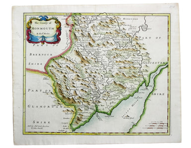
This map of Monmouthshire was engraved to accompany Gibson’s edition of Camden’s Britannia, first published in 1695. Condition & Materials Copp...
View full details
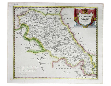
Robert Morden's map of Northumberland was engraved to illustrate Gibson's edition of William Camden's Britannia, first published in 1695 and reprin...
View full details
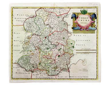
This map of Shropshire was engraved to accompany Gibson’s edition of Camden’s Britannia, first published in 1695. Condition & Materials Copper ...
View full details
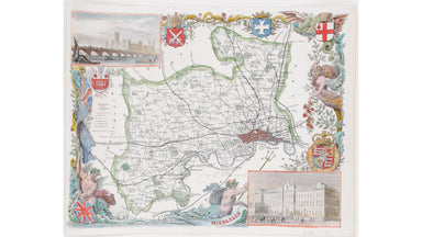
This map of Middlesex is illustrated with vignettes of Buckingham Palace (before its early 20th century re-modelling) and the ‘new’ Houses of Parli...
View full details
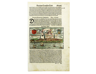
This view of the Latvian capital Riga is fromfrom Sebastian Münster's Cosmographia. A compendium of topographical information, folklore and travels...
View full details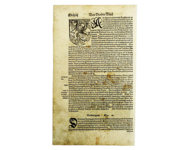
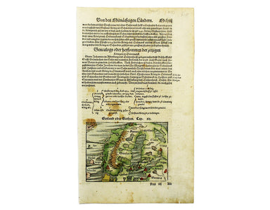
This map of Scandinavia is from Sebastian Münster's Cosmographia. A compendium of topographical information, folklore and travels, it was first pub...
View full details
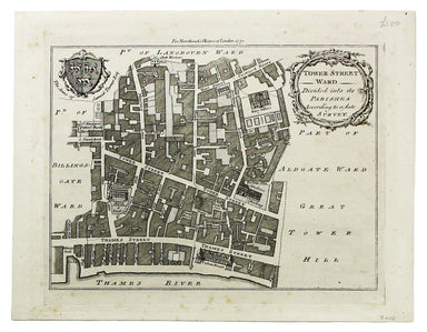
Condition & Materials Copper engraving, 19 x 25 cm, recent hand-colour, blank verso; a plan of Tower Ward published in Noorthouck’s History of ...
View full details
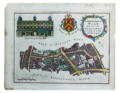
Limestreet Ward divided into Parishes according to a late Survey Possibly engraved by Thomas Bowen and first published in the London Magazine, this...
View full details

This miniature map of Austria was engraved by brothers Ambrose and Ferdinand Arsenius circa 1601 for a third ‘epitome’ (or pocket version) of Ortel...
View full details

Fessae et Marocci Regna – a miniature map of Morocco. Condition & MaterialsCopper engraving, printed area measurement 7.8 x 10.6 cm. Modern ha...
View full details

This miniature map of Normandy was engraved by brothers Ambrose and Ferdinand Arsenius circa 1601 for a third ‘epitome’ (or pocket version) of Orte...
View full details
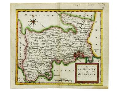
This map of Middlesex was published in Geographia Magnae Britanniae, or, Correct Maps of all the Counties in England, Scotland and Wales. It was pr...
View full details
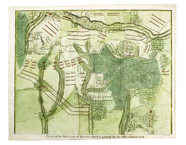
Plan of the Battle of Malplaquet gained by the Allies Sep. 11 1709 Marlborough’s bloodiest victory was often regarded as pyrrhic even by contempora...
View full details
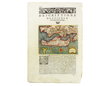
Negroponte (Euboea) This map of Negropoonte was engraved by Girolamo Porro and is set in descriptive Italian text with a woodcut headpiece and hist...
View full details
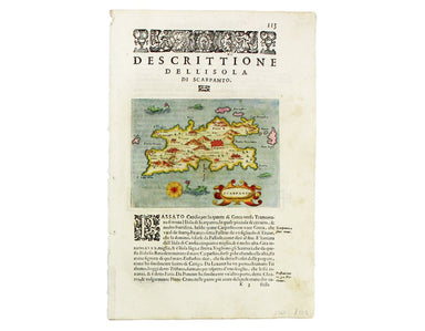
Scarpanto (Karpathos) This map of Karpathos was engraved by Girolamo Porro and is set in descriptive Italian text with a woodcut headpiece and hist...
View full details
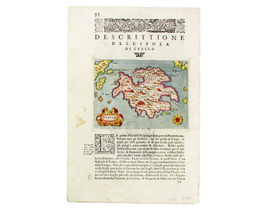
Cerigo (Kythera) This map of Kythera was engraved by Girolamo Porro and is set in descriptive Italian text with a woodcut headpiece and historiated...
View full details
