18th Century Plan of Lambeth Palace
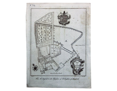
Plan of Lambeth Palace 1750… from the original in the possession of Mr Singleton of Lambeth This plan of Lambeth Palace published in Ducarels’s ‘Th...
View full details

Plan of Lambeth Palace 1750… from the original in the possession of Mr Singleton of Lambeth This plan of Lambeth Palace published in Ducarels’s ‘Th...
View full details
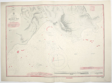
West Indies – Tobago – Scarborough – Rockly Bay This chart of Rockly Bay shows soundings etc, with interior detail of relief, roads and settlements...
View full details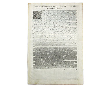
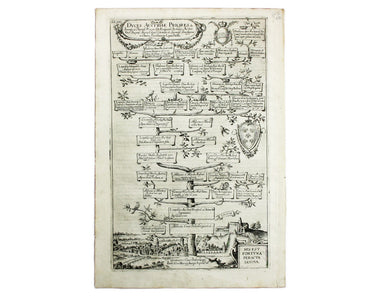
The Babenburg Family Tree The March or Margraviate of Austria had been governed by the Babenburg family since the late tenth century. In 1156 Austr...
View full details
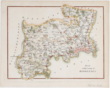
This attractive, detailed map of the county of Middlesex is unsigned; as yet, we have been unable to identify the engraver. Do feel free to write t...
View full details
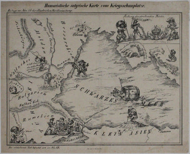
Humoristiche satyrische Karte von Kriegsschauplatze This Austrian pictorial map satirising the Crimean War was published in July 1854 in No. 55 the...
View full details
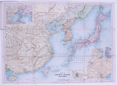
Map of China, Japan and Korea. / [Cover title:] The Eastern Crisis. Bacon's large-scale map of Japan, Korea, China, Manchuria Produced to illustrat...
View full details
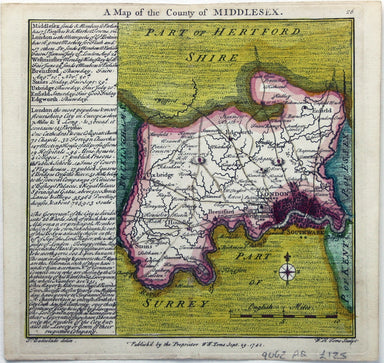
This map of Middlesex was engraved by Toms for Thomas Badeslade’s ‘Chorographia Britanniae’, an attractive pocket atlas which according to Badeslad...
View full details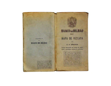
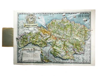
Carta ilustrada del Muy Noble y Muy Leal Señorio de Vizcaya This map was published to mark the centenary of the Banco de Bilbao, one of the big fou...
View full details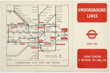
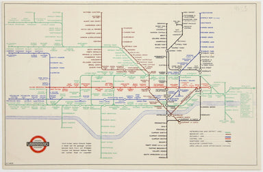
This was the first official London Underground passenger map to be printed since spring 1943, at least partly due to paper shortages. When printed ...
View full details

Plan du Port et de la Ville de Nangasaki This is a plan of the port city of Nagaski, one of Japan’s chief points of contact with the outside world ...
View full details
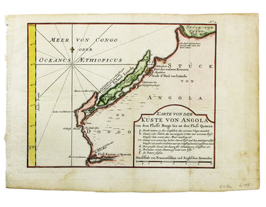
Karte von der Küste von Angola von dem Flusse Bengo bis an den Fluss Quanza This map show the coastline of northern Angola between the rivers Bengo...
View full details
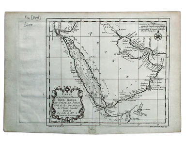
Carte de la Coste d’Arabie, Mer Rouge, et Golfe de Perse. A map of the Arabian peninsula. Jacques Nicolas Bellin the elder (1703-1772) was first ch...
View full details
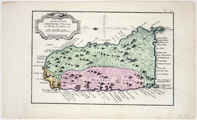
Karte von der Insel St Lucia This map of the Caribbean island of St Lucia was published in the Dutch edition of Prévost's Histoire Générale des Voy...
View full details
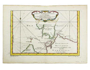
Carte du Dètriot de Waeigats, ou de Nassau This is map of the Yugorsky Strait in the Arctic Sea, separating Vaygach Island from the mainland. It il...
View full details
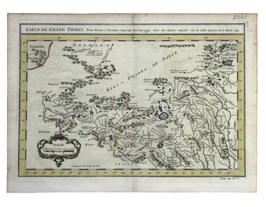
Carte du Grand Thibet. Pour Servir à l’Histoire Generale des Voyages. Tirée des Auteurs Anglois… Bellin notes that his map of Tibet was compiled fr...
View full details

This miniature map of Gujarat and northern India was published in one of the earlier editions of Bertius’ Tabularum Geographicarum Contractum issue...
View full details
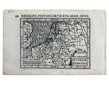
This miniature map of the Low Countries was published in the first edition of Tabularum geographicarum contractarum libri, a geographical work whic...
View full details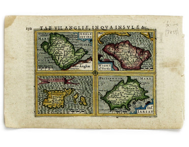
Anglesey Insula; Wight olim Vectis; Insula Garnsey; Insula Iarsay This map of Anglesey, the Isle of Wight, Guernsey and Jersey is from the first ed...
View full details
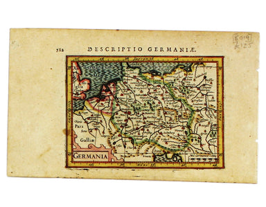
This map of Germany is from the first edition of Tabularum geographicarum contractarum libri, a geographical work which is normally catalogued unde...
View full details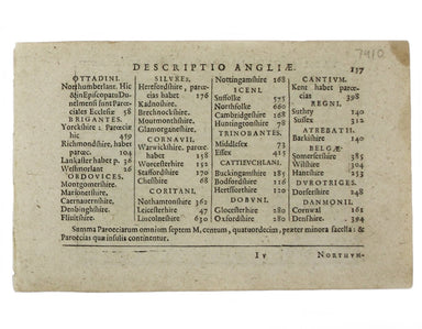
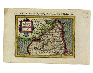
Northumbria, Cumberlandia et Dunelmensis Episcopatus This map of northern England is from the first edition of Tabularum geographicarum contractaru...
View full details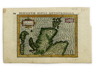
This map of Northern Scotland is from the first edition of Tabularum geographicarum contractarum libri, a geographical work which is normally catal...
View full details
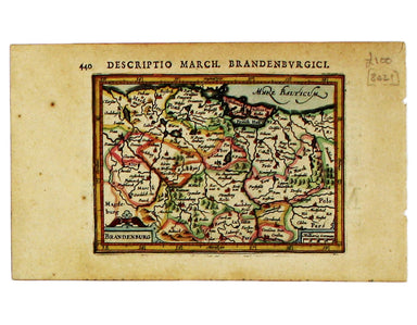
This miniature map of Brandenburg is from the first edition of Tabularum geographicarum contractarum libri, a geographical work which is normally c...
View full details
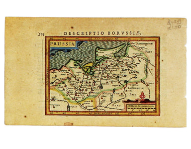
This miniature map of Prussia is from the first edition of Tabularum geographicarum contractarum libri, a geographical work which is normally catal...
View full details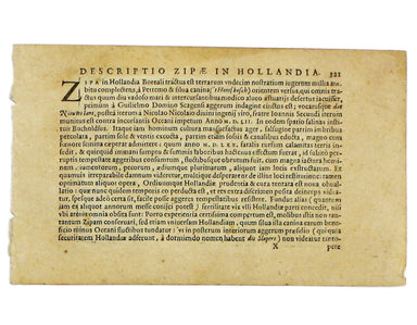
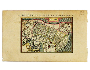
Condition & Materials Copper engraving, 9.5 x 13.4 cm, recent hand-colour, Latin text on verso; map of the Zijpe polder.
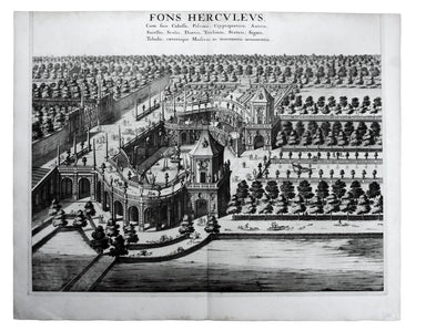
Fons Herculeus: Cum Suis Colosso, Cryptoporticu, Antris, Sacellis, Scalis, Dioetis, Tricliniis, Statuis, Signis, Tabulis, Coeterisque Musivis, ac m...
View full details
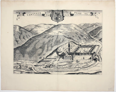
Cartusia Vallis Pisii, fundata 1173 This is the Charterhouse of Pesio, a Carthusian foundation near Cuneo in Piedmont. Blaeu’s townbook of Savoy an...
View full details

A Mapp of the Parish of St Giles’s in the Fields John Stow's A Survey of the Cities of London and Westminster was originally published in 1598 and ...
View full details
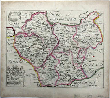
Blome published the first new series of county maps in the sixty years since the appearance of John Speed’s ‘Theatre’. In the straightened financia...
View full details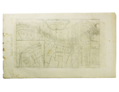
John Stow's A Survey of the Cities of London and Westminster was originally published in 1598 and 1603, but revised and expanded works under his na...
View full details
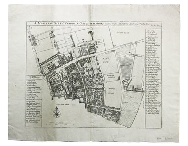
John Stow's A Survey of the Cities of London and Westminster was originally published in 1598 and 1603, but revised and expanded works under his na...
View full details
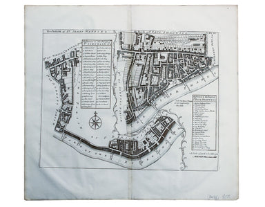
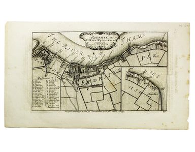
The Parish of St Johns Wapping; The Parish of St. Paul Shadwell This detailed ward plan of Wapping and Shadwell includes Execution Dock, where sent...
View full details
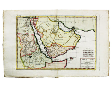
Carte de L’Arabie, du Golfe Persique et de la Mer Rouge, avec L’Egypte, La Nubie et L’Abissinie This map of Arabia is from the Atlas de Toutes Part...
View full details
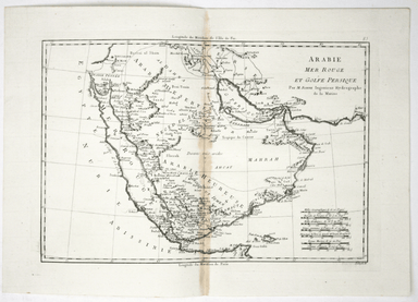
Carte de L’Arabie, du Golfe Persique et de la Mer Rouge, avec L’Egypte, La Nubie et L’Abissinie This map of Arabia was published in an Italian edit...
View full details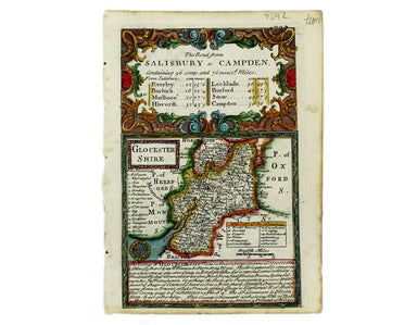
This map of Gloucestershire was engraved by Emanuel Bowen for John Owen’s Britannia Depicta, a pocket road book derived from Ogilby’s innovative at...
View full details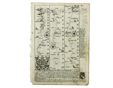
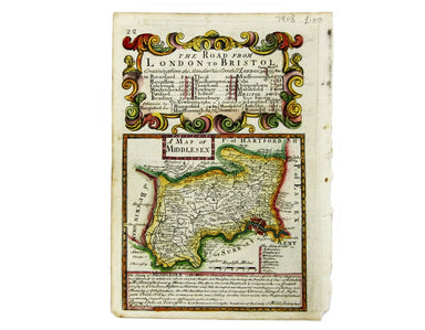
This map of Middlesex was engraved by Emanuel Bowen for John Owen’s Britannia Depicta, a pocket road book derived from Ogilby’s innovative atlas of...
View full details
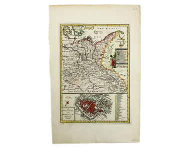
Condition & Materials Copper engraving, 23 x 32.5 cm, recent hand-colour, blank verso.
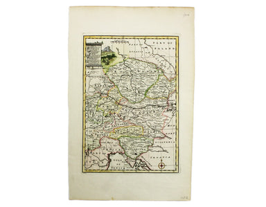
Condition & Materials Copper engraving, 23 x 32.5 cm, recent hand-colour, blank verso.
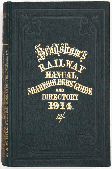
Bradshaw’s Railway Manual, Shareholder’s Guide and Official Directory, 1914; containing the History and Financial Position of every Railway Company...
View full details
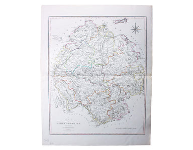
This characteristically clear and elegant map of Herefordshire is by John Cary, one of the leading cartographic engravers, publishers and globe-mak...
View full details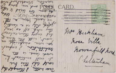
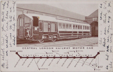
The Central London Railway produced a considerable quantity of advertising material in the Edwardian period. Other postcards included views of Lots...
View full details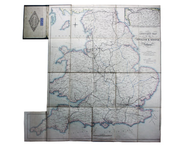
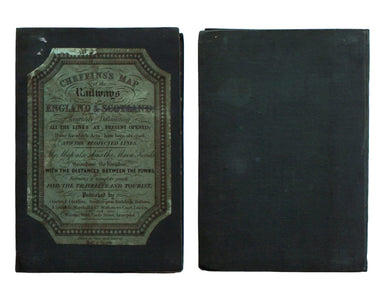
Cheffins’s Map of the English & Scotch Railways Cheffins’s Map of the Railways in England & Scotland, accurately delineating all the lines ...
View full details
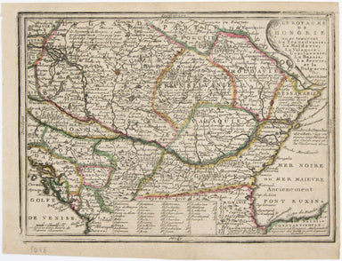
Le Royaume de Hongrie, ou se trouvent la Transilvanie, la Moldavie, la Valaquie, la Bosnie la Servie et la Bulgarie, &c Our map of Hungary and ...
View full details
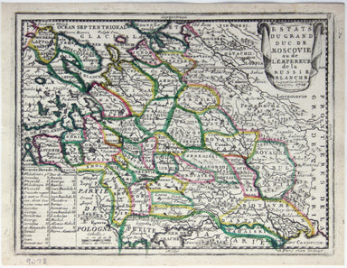
Estats du Grand Duc de Moscovie ou de l’Empereur de la Russie Blanche This map of Muscovy, or European Russia, was published in Chiquet’s ‘Le nouve...
View full details
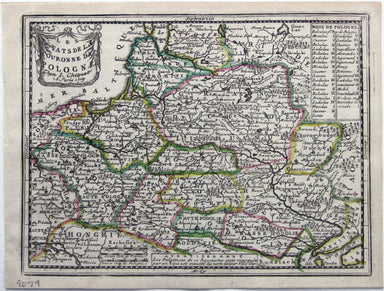
Les estats de la Couronne de Pologne This map of the Crown of the Kingdom of Poland was published in Chiquet’s ‘Le nouveau et curieux atlas géograp...
View full details
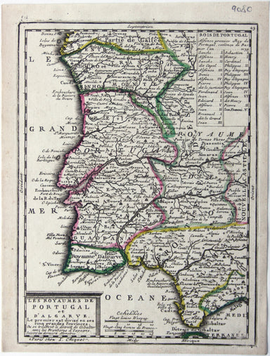
Les Royaumes de Portugal et d’Algarve This map of Portugal was published in Chiquet’s ‘Le nouveau et curieux atlas géographique et historique ...’....
View full details
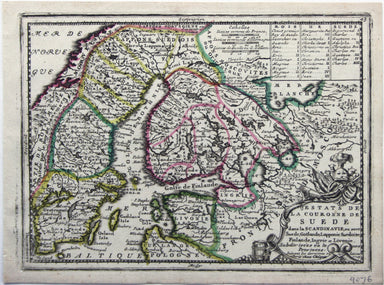
This map shows the Swedish Empire, including Finland and Swedish Livonia. It waspublished in Chiquet’s ‘Le nouveau et curieux atlas géographique et...
View full details
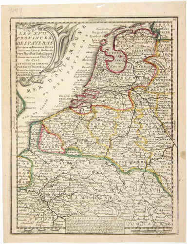
Le XVII Provinces des Pays Bas divisées en Provinces Unies connues sous le nom de Hollande, et en Pays Bas Catholiques connues sous le nom de Fland...
View full details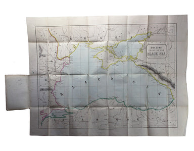
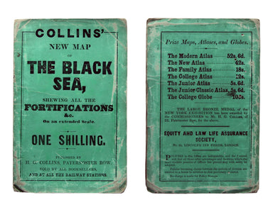
Collins’ Chart of the Black Sea/Collins’ New Map of the Black Sea, shewing all the fortifications &c on an extended scale. Contemporary with th...
View full details
