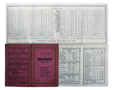
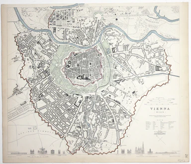
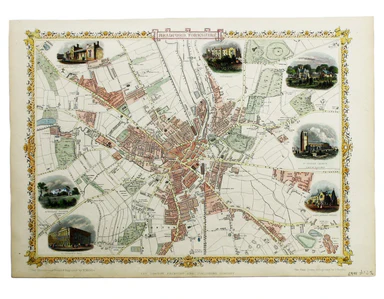
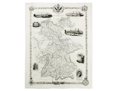
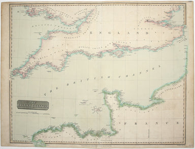
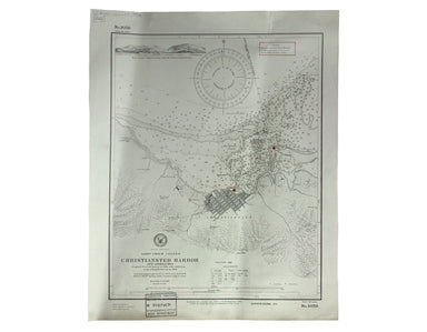
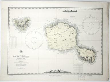
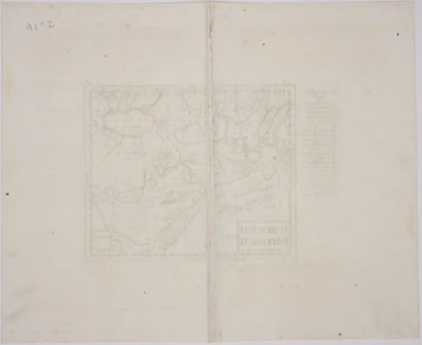
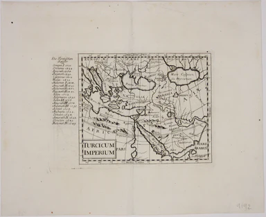
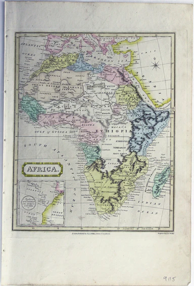
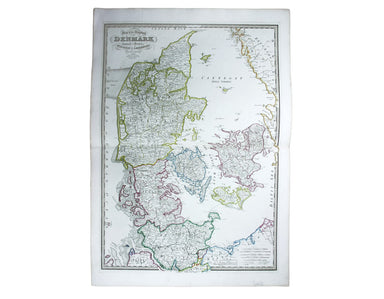
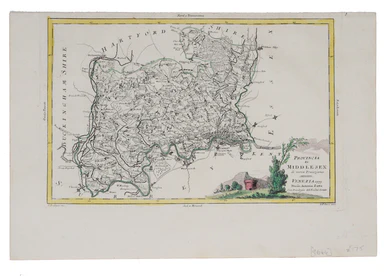
Saxton-Kip Map of Denbighshire
This map of Denbighshire was published in the second edition of Philemon Holland’s translation of Camden’s Britannia into English, the third printi...
View full detailsThis map of Denbighshire was published in the second edition of Philemon Holland’s translation of Camden’s Britannia into English, the third printi...
View full detailsEboracensis Comitatus […] pars Orientalis, vulgo East Riding. This map of the East Riding is from the second edition of Philemon Holland’s translat...
View full detailsThis map of Africa reflects the state of European knowledge of the interior before the mid 19th century search for the sources of the Nile. It mark...
View full detailsThis map of Antwerp, engraved by Benjamin Rees Davies after William Barnard Clarke, includes elevations of principal buildings and a view of the ci...
View full detailsThis map of Australia has a table in the bottom left, showing the European population (supposedly revised to 1846 but with the original figure give...
View full detailsThis map of Dresden engraved by William Henshall after William Barnard Clarke. Condition & Materials Steel engraving, 33 x 37 cm, original han...
View full detailsThis map of Frankfurt, view of the city at the foot of the map, was published by the SDUK. The Society for the Diffusion of Useful Knowledge was fo...
View full detailsThis map of Lisbon was engraved by Josiah Henshall after William Barnard Clarke. It was published by the Society for the Diffusion of Useful Knowle...
View full detailsAt the foot of this map are architectural elevations of some of Rome’s most famous post-classical buildings, dominated by St Peter’s. Rome was then...
View full detailsThis map of Naples was published by the SDUK. The Society for the Diffusion of Useful Knowledge was founded in 1826 with the high-minded aim of mak...
View full detailsThis map includes a panoramic view of Parma at its foot, blank. The Society for the Diffusion of Useful Knowledge was founded in 1826 with the high...
View full detailsA Map of the Principal Rivers shewing their courses, countries and comparative lengths The Society for the Diffusion of Useful Knowledge was founde...
View full detailsThis map of South Africa, including an inset of Cape Town, was engraved by John & Charles Walker. It was published by the SDUK. The Society for...
View full detailsThis map of Stockholm, with a view of of the city on a scroll bottom left, was published by the SDUK. The Society for the Diffusion of Useful Knowl...
View full detailsThis map of Toulon was engraved by BR Davies after WB Clarke. Condition & Materials Steel engraving, 33 x 40 cm, original hand colour, blank ve...
View full detailsThis map of Turin was published by the SDUK. The Society for the Diffusion of Useful Knowledge was founded in 1826 with the high-minded aim of maki...
View full detailsThis map of Vienna was published by the SDUK. The Society for the Diffusion of Useful Knowledge was founded in 1826 with the high-minded aim of mak...
View full detailsGallia Augustiniana in suas provincias divisa… A map of Roman Gaul, with Lotter’s imprint. In 1756 Lotter succeeded his father-in-law, Georg Mattha...
View full detailsCondition & Materials Steel engraving, 28.5 x 45 cm, black and white, slight spotting; plan of the East India Dock from ‘Public Works of Great ...
View full detailsMary Sims and Mary Camidge, both signing as 'of Maps and Guides, Ltd', each produced posters for British Railways (Eastern Region) in 1960. They th...
View full detailsHistorical Recollections of Hyde Park, compiled and arranged from numerous authentic works, public records, private documents, &c. London: prin...
View full detailsThis map of Buckinghamshire is from the so-called miniature Speed. This miniature atlas used maps by van den Keere to illustrate a pocket edition o...
View full detailsThis map of Wales is from an edition of the pocket atlas which is often referred to as the ‘miniature Speed’: maps by Pieter van den Keere illustra...
View full detailsThis map of Burma was published in the second trade edition of Stanford’s London Atlas. Edward Stanford (senior) acquired Arrowmsith's stock in 187...
View full detailsThis map of Sri Lanka was published in the first trade edition of Stanford’s ‘London Atlas’. Edward Stanford (senior) acquired Arrowmsith's stock i...
View full detailsOutline Map shewing Railways of Nigeria The map shows the railways of Nigeria completed and under construction. A gummed Nigerian revenue stamp has...
View full detailsUnderground Map of Central London/A Guide to Underground Travel, Through Service Sth. Harrow and the West End Leboff and Demuth draw attention to t...
View full detailsThis map of Central America was engraved by John Rapkin for John Tallis' popular ‘Illustrated Atlas’. It includes black and white vignettes of Beli...
View full detailsThis map of Natal was engraved by John Rapkin for John Tallis' popular ‘Illustrated Atlas’. It includes vignettes of Port Natal engraved by William...
View full detailsThis map of Nova Scotia was engraved by John Rapkin for John Tallis' popular ‘Illustrated Atlas’; it includes black and white vignettes of Halifax,...
View full detailsThis map of West Canada was engraved by John Rapkin for the ‘Illustrated Atlas’. The map also includes black and white vignettes of Kingston, Ontar...
View full detailsCondition & Materials Steel engraving, 25 x 33 cm, recent hand colour, blank verso; map of Bradford
This map of Germany was engraved by John Rapkin for the Illustrated Atlas. John Rogers engraved a number of vignettes: the Palace at Saxe Gotha, bi...
View full detailsThis map of Hungary was engraved by John Rapkin for the ‘Illustrated Atlas’. It features vignettes, including Budapest, engraved by John Rogers. Co...
View full detailsThis map of Peru and Bolivia was engraved by John Rapkin for the ‘Illustrated Atlas’. It has vignettes including a view of Potosi engraved by James...
View full detailsThis map of Tasmania was engraved by John Rapkin for the ‘Illustrated Atlas'. John Rogers engraved the black and white vignettes including Hobart T...
View full detailsThis map of the Baltic Sea was engraved by John Rapkin for the Illustrated Atlas. Vignettes including Kronstadt and St Petersburg were engraved by ...
View full detailsThis map of the Black Sea has been updated to show the 300 miles of submarine telegraph cable laid between Varna and Balaclava by Robert Stirling N...
View full detailsThibet, Mongolia, and Mandchouria This map was engraved by John Rapkin for the ‘Illustrated Atlas’; with vignettes including Leh in Ladakh, a stret...
View full detailsThis chart of the Pacific Ocean features two regions named New South Wales. Cook’s New South Wales in Australia remains familiar, but the other, on...
View full detailsMae Nam Wen and Entrance, Surveyed by the Hydrographic Department, Royal Thai Navy, March-May 1944 This is a Thai chart of the Mae Nam Welu estuary...
View full detailsChronicles of London Bridge: by an antiquary. London: Smith, Elder, and Co. 1827. Richard Thomson (1794-1865) wrote extensively on London history (...
View full detailsThis map covers the southern part of the subcontinent (Mumbai is near the upper border), and includes the northern part of Sri Lanka. Pink denotes ...
View full detailsJohn Thomson's maps, like this one of the Channel, are characteristic of the Edinburgh school of cartography. It flourished at the beginning of the...
View full details[Title-page] Anglorum Indoles Studia et Actiones In attempting to define the character of the English there is a strong emphasis on trade and disco...
View full details[Title-page] Atlas Historique The classical muses on this title page represent Chronology, History, Navigation and Geography. Atlas braces himself ...
View full detailsOriginally published in the series ‘Twenty-Four Views in Hindostan’, a part-work issued 1802-1805 to illustrate Francis Blagdon’s ‘Brief History of...
View full detailsWest Indies – St Croix Island – Christiansted Harbour This is a US naval chart of Christiansted, the largest town on St Croix in the United States ...
View full details