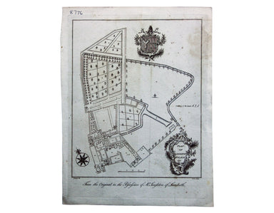
18th Century Plan of Lambeth Palace
Plan of Lambeth Palace 1750… from the original in the possession of Mr Singleton of Lambeth This plan of Lambeth Palace published in Ducarels’s ‘Th...
View full details

Plan of Lambeth Palace 1750… from the original in the possession of Mr Singleton of Lambeth This plan of Lambeth Palace published in Ducarels’s ‘Th...
View full details
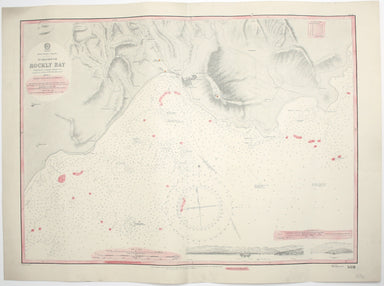
West Indies – Tobago – Scarborough – Rockly Bay This chart of Rockly Bay shows soundings etc, with interior detail of relief, roads and settlements...
View full details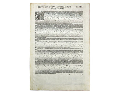
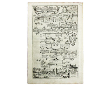
The Babenburg Family Tree The March or Margraviate of Austria had been governed by the Babenburg family since the late tenth century. In 1156 Austr...
View full details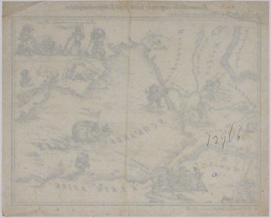
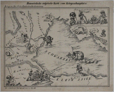
Humoristiche satyrische Karte von Kriegsschauplatze This Austrian pictorial map satirising the Crimean War was published in July 1854 in No. 55 the...
View full details
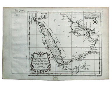
Carte de la Coste d’Arabie, Mer Rouge, et Golfe de Perse. A map of the Arabian peninsula. Jacques Nicolas Bellin the elder (1703-1772) was first ch...
View full details
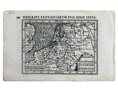
This miniature map of the Low Countries was published in the first edition of Tabularum geographicarum contractarum libri, a geographical work whic...
View full details
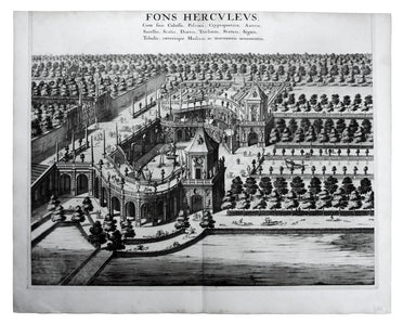
Fons Herculeus: Cum Suis Colosso, Cryptoporticu, Antris, Sacellis, Scalis, Dioetis, Tricliniis, Statuis, Signis, Tabulis, Coeterisque Musivis, ac m...
View full details
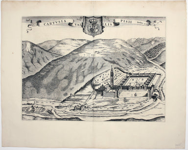
Cartusia Vallis Pisii, fundata 1173 This is the Charterhouse of Pesio, a Carthusian foundation near Cuneo in Piedmont. Blaeu’s townbook of Savoy an...
View full details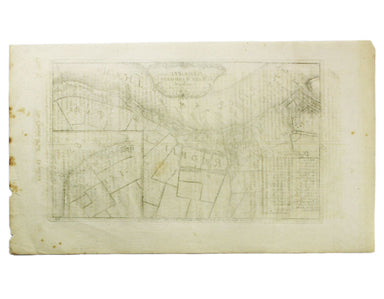
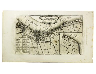
John Stow's A Survey of the Cities of London and Westminster was originally published in 1598 and 1603, but revised and expanded works under his na...
View full details
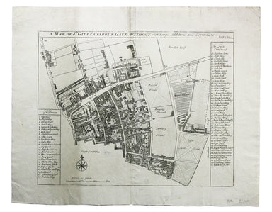
John Stow's A Survey of the Cities of London and Westminster was originally published in 1598 and 1603, but revised and expanded works under his na...
View full details
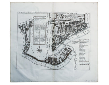
The Parish of St Johns Wapping; The Parish of St. Paul Shadwell This detailed ward plan of Wapping and Shadwell includes Execution Dock, where sent...
View full details
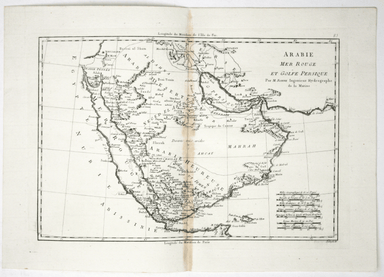
Carte de L’Arabie, du Golfe Persique et de la Mer Rouge, avec L’Egypte, La Nubie et L’Abissinie This map of Arabia was published in an Italian edit...
View full details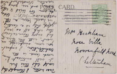

The Central London Railway produced a considerable quantity of advertising material in the Edwardian period. Other postcards included views of Lots...
View full details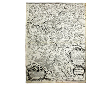
Governo Generale dell’Isola Di Francia (Île-de-France) This map of Île-de-France is from Mercurio Geografico, an unusual and finely engraved work. ...
View full details
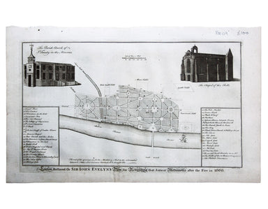
London Restored or Sir John Evelyn’s Plan for Rebuilding the Antient Metropolis after the Fire in 1666 Evelyn, Wren and Hooke were among the archit...
View full details
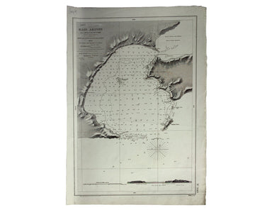
Japón – Cote Est de Yesso – Baie Akishi This is a French chart of Akkeshi Bay, located in Kushiro Subprefecture on the east coast of Hokkaido, the ...
View full details
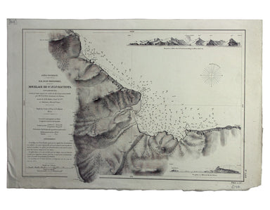
Océan Pacifique – Ile Juan Fernandez – Mouillage de San Juan Bautista This French naval chart shows the anchorage at San Juan Bautista located on C...
View full details
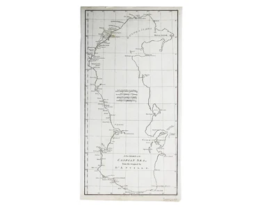
Condition & Materials Copper engraving, 52.5 x 26.5 cm; a chart of the Caspian Sea after Jean Baptiste Bourguignon d'Anville, black and white, ...
View full details
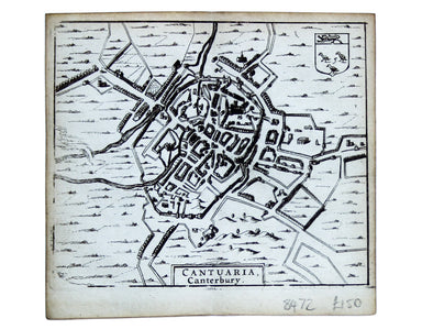
This map of Canterbury is from Hermannides' Magna Britannia. Nearly all of the plans are based on the small inset plans shown on John Speed's count...
View full details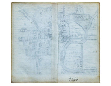
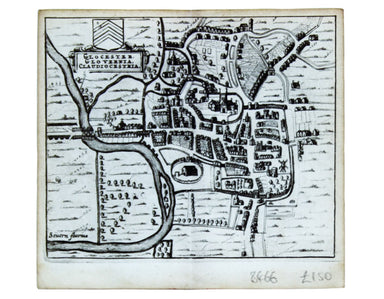
This map of Gloucester is from Hermannides' Magna Britannia. Nearly all of the plans are based on the small inset plans shown on John Speed's count...
View full details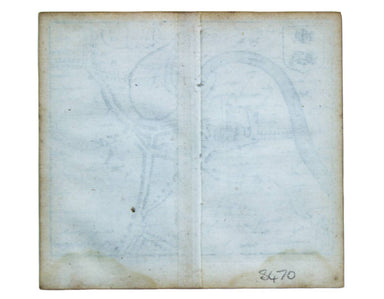
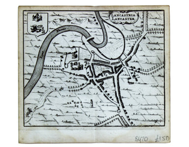
This map of Lancaster is from Hermannides' Magna Britannia. Nearly all of the plans are based on the small inset plans shown on John Speed's county...
View full details
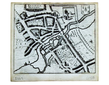
This map of Reading is from Hermannides' Magna Britannia. Nearly all of the plans are based on the small inset plans shown on John Speed's county m...
View full details
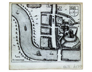
This map of Rochester is from Hermannides' Magna Britannia. Nearly all of the plans are based on the small inset plans shown on John Speed's county...
View full details

Moluccae Insulae This map shows the Maluku Islands (or Moluccas), part of the volcanic Indonesian archipelago known to contemporary Europeans as th...
View full details
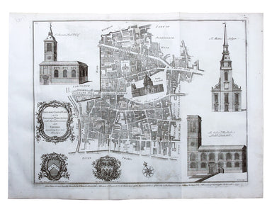
Baynard’s Castle Ward [and] Faringdon Ward with their divisions into Parishes according to a new survey This was plan of Baynard’s Castle and Farin...
View full details
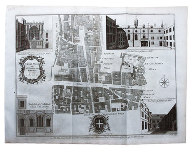
Cheap Ward with its divisions into Parishes according to a new survey This ward plan of Cheap was published in the greatly expanded second edition ...
View full details
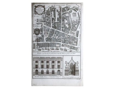
Tower Street Ward with their [sic] divisions into Parishes according to a new survey This plan of Tower Street was published in the greatly expande...
View full details
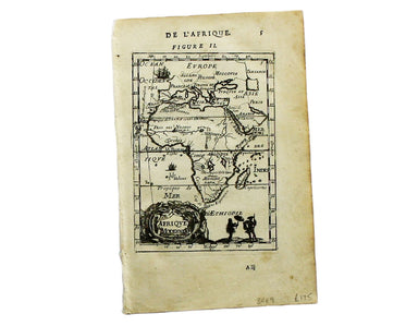
This map of the continent of Africa is from Mallet’s Description de l’Univers, first published in Paris in 1683 and reprinted with German text in F...
View full details
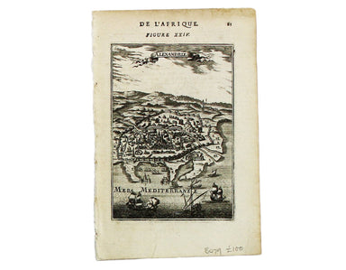
This map of Alexandria is from Mallet’s Description de l’Univers, first published in Paris in 1683 and reprinted with German text in Frankfurt the ...
View full details
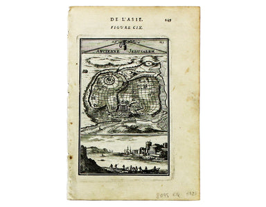
This map of Ancient Jerusalem is from Mallet’s Description de l’Univers, first published in Paris in 1683 and reprinted with German text in Frankfu...
View full details
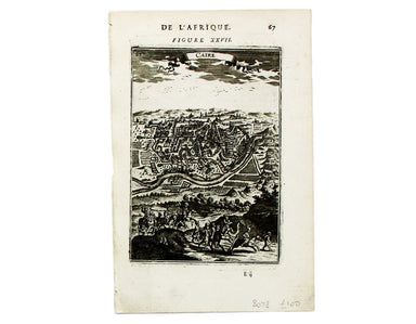
This map of Cairo is from Mallet’s Description de l’Univers. It derives, ultimately, from Matteo Pagano’s magnificent 21 sheet wall map, published ...
View full details
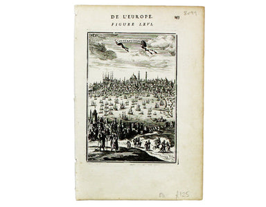
This view of Constantinople isfrom Mallet’s Description de l’Univers, first published in Paris in 1683 and reprinted with German text in Frankfurt ...
View full details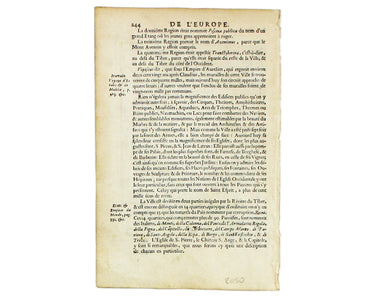
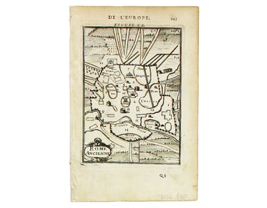
Rome Ancienne This plan of ancient Rome is from Mallet’s Description de l’Univers, first published in Paris in 1683 and reprinted with German text ...
View full details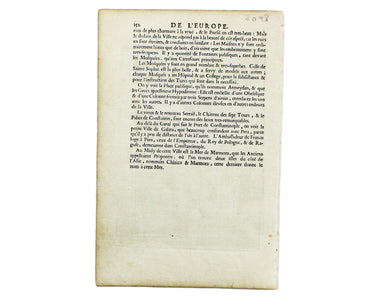
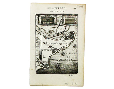
This plan of Constantinople is from Mallet’s Description de l’Univers, first published in Paris in 1683 and reprinted with German text in Frankfurt...
View full details
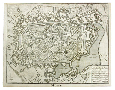
Condition & Materials Copper engraving, 39.5 x 49.5 cm, engraved by J. Basire, black and white as issued, blank verso; map of Mons.
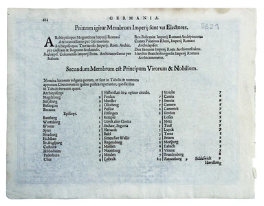
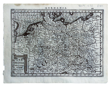
This map shows the ‘Germanic’ regions of Europe, including the Low Countries, Poland and Austria, engraved by Pieter van den Keere. The 'Atlas Mino...
View full details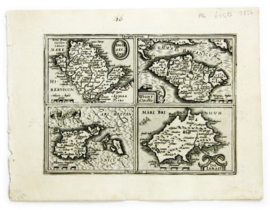
Anglesey Ins[ula]; Wight ol[im] Vectis; Ins[ula] Garnsey; Ins[ula] Iarsay This map of Anglesey, the Isle of Wight, Guernsey and Jersey was engraved...
View full details
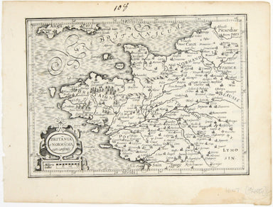
Britannia et Normandia cum consiniis This map of Brittany and Normandy was engraved by Jodocus Hondius for the ‘Atlas Minor’. Condition & Mater...
View full details
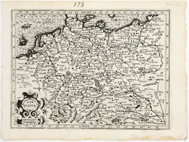
This map shows the ‘Germanic’ regions of Europe, including the Low Countries, Poland and Austria, and was engraved by Jodocus Hondius for the ‘Atla...
View full details
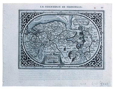
This map of the province of Groningen in the Netherlands, set within an elaborate strapwork border, was published in the ‘Atlas Minor’. A new serie...
View full details
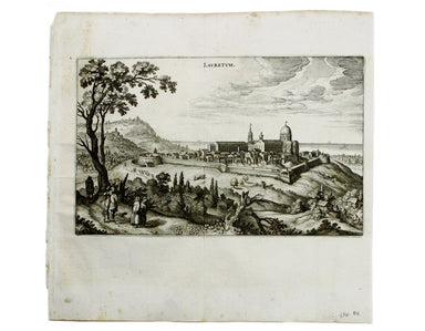
This plan of Loreto (site of the Basilica della Santa Casa) was published by Merian and his heirs in various works, including the Itinerarium Itali...
View full details
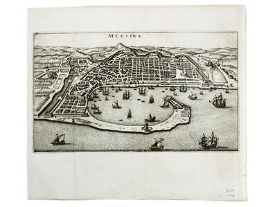
This plan of Messina was published by Merian and his heirs in various works, including the Itinerarium Italiae of 1640 and editions of the Theatrum...
View full details
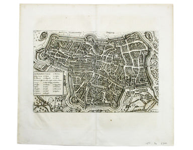
This map of Augsburg was published by Merian and his heirs in various works, including the Archontologia cosmica, Theatrum Europaeum and the Topogr...
View full details
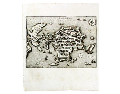
This map of Gallipoli in Apulia was published by Merian and his heirs in various works, including the Itinerarium Italiae of 1640, the Archontologi...
View full details
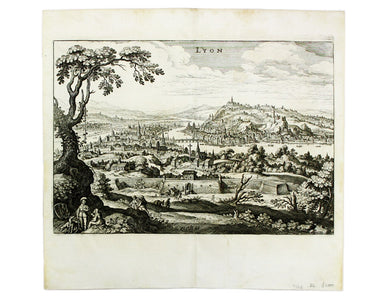
This map of Lyons was published by Merian and his heirs in various works, including the Archontologia Cosmica and Theatrum Europaeum. Condition &am...
View full details
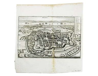
This map of Stade was published by Merian and his heirs in various works, including the Theatrum Europaeum. Condition & Materials Copper engrav...
View full details
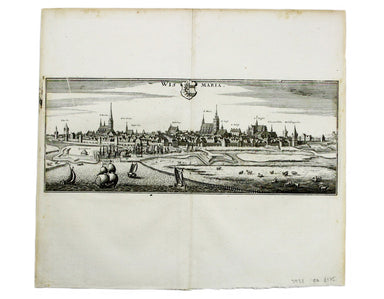
This map of Wismar was published by Merian and his heirs in various works, including the Theatrum Europaeum. Condition & Materials Copper engr...
View full details
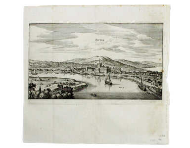
This plan of of Ostia was published by Merian and his heirs in various works, including the Itinerarium Italiae of 1640, the Archontologia cosmica ...
View full details
