

Ortelius' Miniature Epitome Map of Austria
This miniature map of Austria was engraved by brothers Ambrose and Ferdinand Arsenius circa 1601 for a third ‘epitome’ (or pocket version) of Ortel...
View full details

This miniature map of Austria was engraved by brothers Ambrose and Ferdinand Arsenius circa 1601 for a third ‘epitome’ (or pocket version) of Ortel...
View full details

Fessae et Marocci Regna – a miniature map of Morocco. Condition & MaterialsCopper engraving, printed area measurement 7.8 x 10.6 cm. Modern ha...
View full details

This miniature map of Normandy was engraved by brothers Ambrose and Ferdinand Arsenius circa 1601 for a third ‘epitome’ (or pocket version) of Orte...
View full details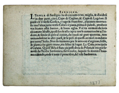
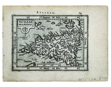
This map of Sicily is from the second series of maps engraved by Philip Galle for the Epitome, the pocket atlas version of Ortelius’ Theatrum. Cond...
View full details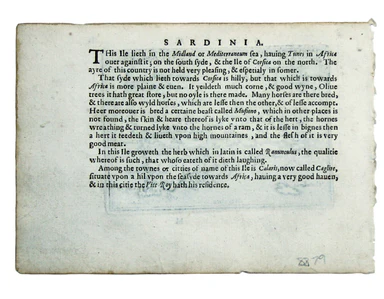
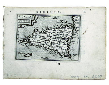
Two English printers dipped a toe in the vernacular atlas market at approximately the same time with pocket editions of the Ortelius atlas: ‘These ...
View full details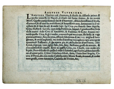
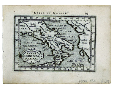
Typus Regni Neapolitani This map of the Kingdom of Naples is from the second series of maps engraved by Philip Galle for the Epitome, the pocket at...
View full details
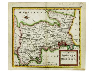
This map of Middlesex was published in Geographia Magnae Britanniae, or, Correct Maps of all the Counties in England, Scotland and Wales. It was pr...
View full details
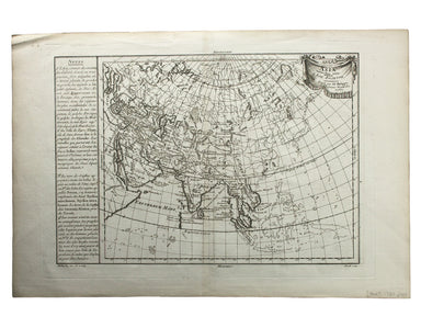
Asia veteribus nota. L’Asie ancienne, dirigée par M. Philippe This is a map of Asia as it was understood in the Greco-Roman world in classical anti...
View full details
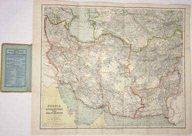
This map of Persia, Afghanistan and Balochistan is part of the Authentic Imperial Maps series published by the London Geographical Institute. Condi...
View full details
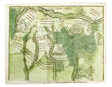
Plan of the Battle of Malplaquet gained by the Allies Sep. 11 1709 Marlborough’s bloodiest victory was often regarded as pyrrhic even by contempora...
View full details
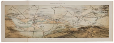
This plan of the Manchester Shipping Canal was published as a supplement to ‘The Illustrated London News’, February 3rd 1883. Construction began in...
View full details
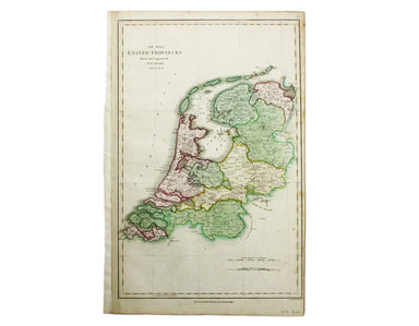
The Seven United Provinces This map of the Netherlands was prepared for Playfair’s New General Atlas. Condition & Materials Copper engraving, ...
View full details
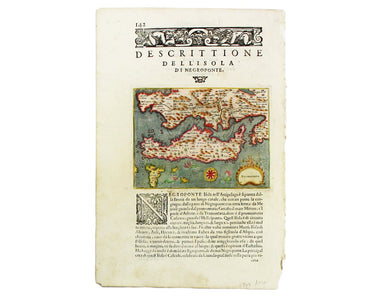
Negroponte (Euboea) This map of Negropoonte was engraved by Girolamo Porro and is set in descriptive Italian text with a woodcut headpiece and hist...
View full details
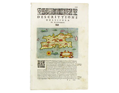
Scarpanto (Karpathos) This map of Karpathos was engraved by Girolamo Porro and is set in descriptive Italian text with a woodcut headpiece and hist...
View full details
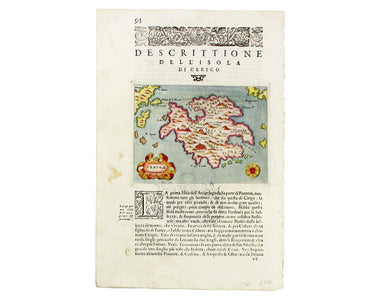
Cerigo (Kythera) This map of Kythera was engraved by Girolamo Porro and is set in descriptive Italian text with a woodcut headpiece and historiated...
View full details
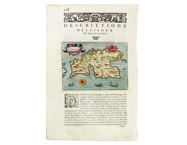
Metellino (Mytilene, Lesbos) This map of Mitilini was engraved by Girolamo Porro and is set in descriptive Italian text with a woodcut headpiece an...
View full details
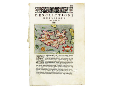
Milo (Milos) This map of Milos was engraved by Girolamo Porro and is set in descriptive Italian text with a woodcut headpiece and historiated initi...
View full details
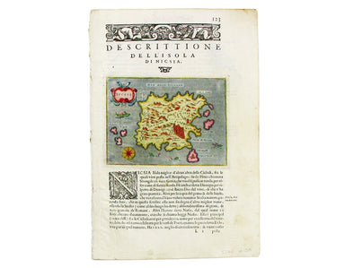
Nicsia (Naxos) This map of Naxos was engraved by Girolamo Porro and is set in descriptive Italian text with a woodcut headpiece and historiated ini...
View full details
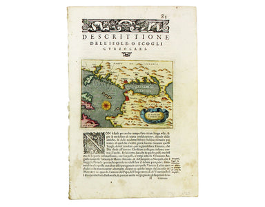
Il Sito de Curzolari (and Gulf of Lepanto) This map of the gulf of Lepanto was engraved by Girolamo Porro and is set in descriptive Italian text wi...
View full details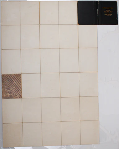
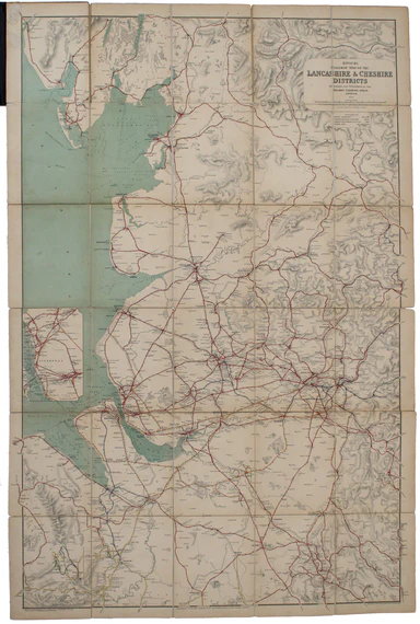
The Railway Clearing House allocated revenue on occasions where one company’s train ran over another’s track, and promoted standardisation (of ever...
View full details

Plan of Cardona, a strong City and Castle of Catalonia, upon the River Cardoner as besieged by the French and defended by the Allies This plan of t...
View full details
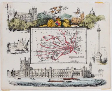
This map of Middlesex was published in Reuben Ramble's ‘Travels through the Counties of England’, an uncommon county atlas for children. Reuben Ram...
View full details
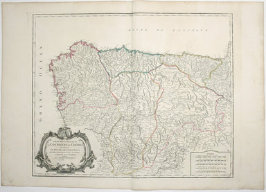
Partie Septentrionale de la Couronne de Castille où se trouvent les Royaumes de Castille Vieille, de Leon, de Gallice, des Asturies, la Biscaye et ...
View full details
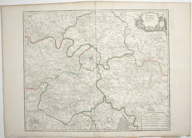
Environs de Paris This is a later state of Robert de Vaugondy’s road map of Italy, showing the Venetian Republic, Papal States, Kingdom of Naples e...
View full details
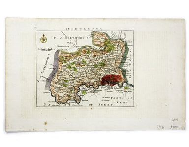
This map of Middlesex was first published in 1746 to accompany Thomas Read’s English Traveller. The the plates were acquired by John Rocque and re-...
View full details

Rogers' poem was printed in both quarto and octavo formats in 1819, the year of its first publication. Eclipsed by some of his great contemporaries...
View full details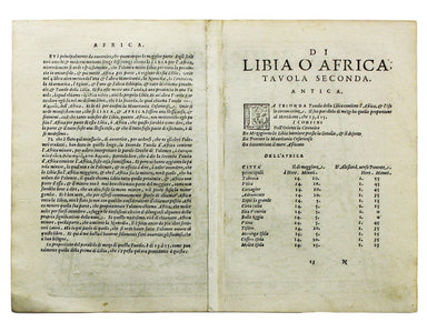
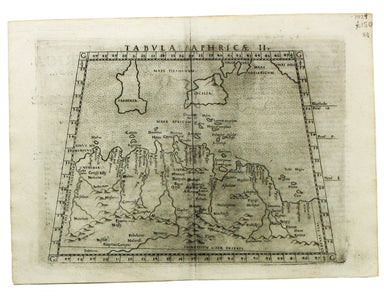
Tabula Aphricae II Ruscelli’s map of North Africa, following Gastaldi, was first issued in his edition of Ptolemy’s Geographia printed by Valgrisi ...
View full details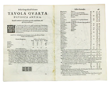
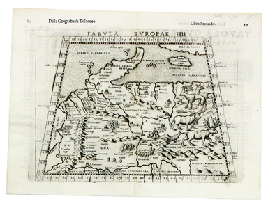
This map of Ptolemaic Germany and Denmark is from the fourth edition of Ruscelli’s Italian translation of the Geographia. It is illustrated with de...
View full details
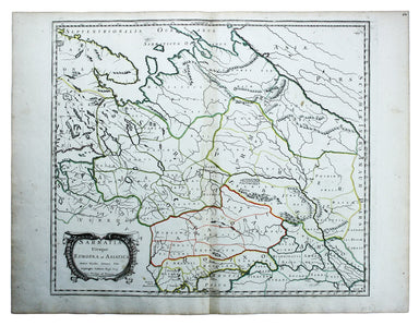
Sarmatia utraque Europaea et Asiatica This map shows parts of European Russia and Ukraine in antiquity. For Greco-Roman geographers and ethnographe...
View full details
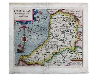
This map of Cardiganshire was published in the second edition of Philemon Holland’s translation of Camden’s Britannia into English, the third print...
View full details
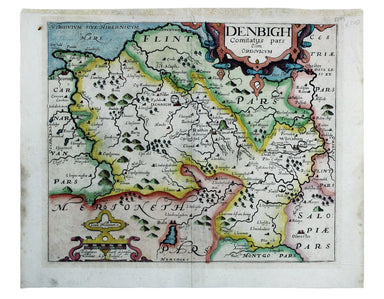
This map of Denbighshire was published in the second edition of Philemon Holland’s translation of Camden’s Britannia into English, the third printi...
View full details
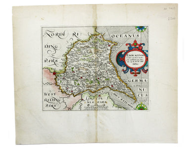
Eboracensis Comitatus […] pars Orientalis, vulgo East Riding. This map of the East Riding is from the second edition of Philemon Holland’s translat...
View full details
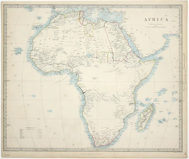
This map of Africa reflects the state of European knowledge of the interior before the mid 19th century search for the sources of the Nile. It mark...
View full details
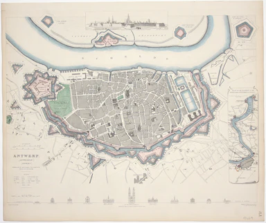
This map of Antwerp, engraved by Benjamin Rees Davies after William Barnard Clarke, includes elevations of principal buildings and a view of the ci...
View full details
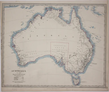
This map of Australia has a table in the bottom left, showing the European population (supposedly revised to 1846 but with the original figure give...
View full details

This map of Calcutta includes inset views of the Writers’ Buildings, Government House and Esplanade Row. Calcutta expanded rapidly under the Gover...
View full details
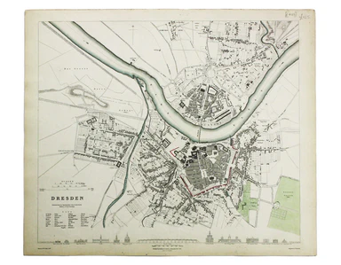
This map of Dresden engraved by William Henshall after William Barnard Clarke. Condition & Materials Steel engraving, 33 x 37 cm, original han...
View full details

This map of Dublin was engraved by Edmund Turrell after William Barnard Clarke for The Society for the Diffusion of Useful Knowledge. The SDUK was ...
View full details
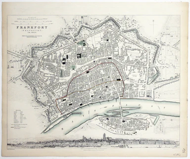
This map of Frankfurt, view of the city at the foot of the map, was published by the SDUK. The Society for the Diffusion of Useful Knowledge was fo...
View full details
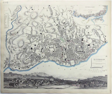
This map of Lisbon was engraved by Josiah Henshall after William Barnard Clarke. It was published by the Society for the Diffusion of Useful Knowle...
View full details
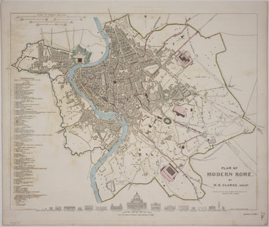
At the foot of this map are architectural elevations of some of Rome’s most famous post-classical buildings, dominated by St Peter’s. Rome was then...
View full details
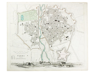
This map includes a panoramic view of Parma at its foot, blank. The Society for the Diffusion of Useful Knowledge was founded in 1826 with the high...
View full details
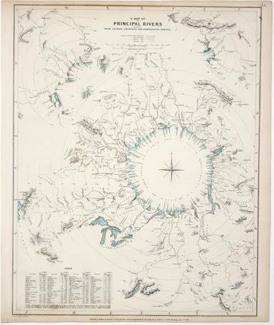
A Map of the Principal Rivers shewing their courses, countries and comparative lengths The Society for the Diffusion of Useful Knowledge was founde...
View full details
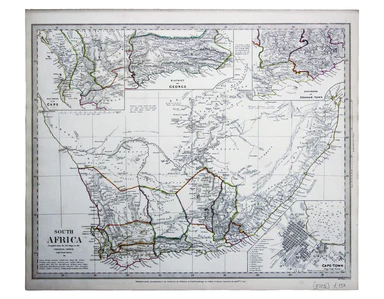
This map of South Africa, including an inset of Cape Town, was engraved by John & Charles Walker. It was published by the SDUK. The Society for...
View full details
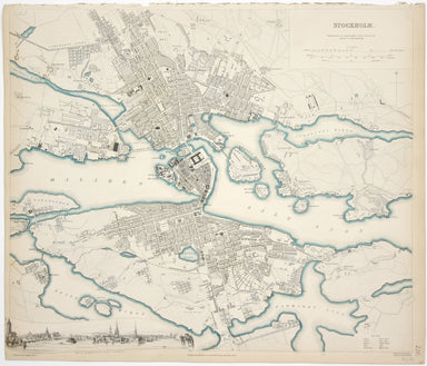
This map of Stockholm, with a view of of the city on a scroll bottom left, was published by the SDUK. The Society for the Diffusion of Useful Knowl...
View full details
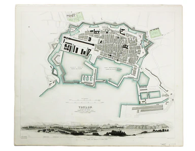
This map of Toulon was engraved by BR Davies after WB Clarke. Condition & Materials Steel engraving, 33 x 40 cm, original hand colour, blank ve...
View full details
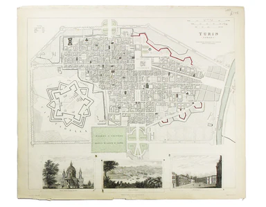
This map of Turin was published by the SDUK. The Society for the Diffusion of Useful Knowledge was founded in 1826 with the high-minded aim of maki...
View full details
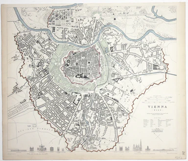
This map of Vienna was published by the SDUK. The Society for the Diffusion of Useful Knowledge was founded in 1826 with the high-minded aim of mak...
View full details
