£1,000.00
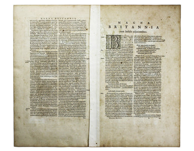
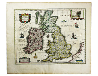
Blaeu’s Map of the British Isles
Magnae Britaniae et Hiberniae Tabula First published in 1631, this map of the British Isles became the Blaeu firm’s principal one for twenty years....
View full detailsMagnae Britaniae et Hiberniae Tabula First published in 1631, this map of the British Isles became the Blaeu firm’s principal one for twenty years....
View full detailsA Map of the County Palatine of Lancaster Divided into Hundreds and Parishes from an accurate Survey made in the years 1828 and 1829, For Hennet’s ...
View full detailsDistrict within ¼ mile radius [of] Paddington Praed Street Stanford’s was a firm of map publishers as well as map retailers until after the Second ...
View full details