£300.00
Tallis’ Map of Glasgow
This map of Glasgow is one of the town plans published in Tallis’ hugely popular ‘Illustrated Atlas’ which was published serially from the mid 1840...
View full detailsThis map of Glasgow is one of the town plans published in Tallis’ hugely popular ‘Illustrated Atlas’ which was published serially from the mid 1840...
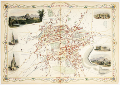
View full detailsThis map of Edinburgh is one of the town plans in Tallis’ hugely popular ‘Illustrated Atlas’ which was published serially from the mid 1840s onward...
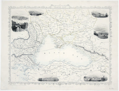
View full detailsThis map of the Black Sea has been updated to show the 300 miles of submarine telegraph cable laid between Varna and Balaclava by Robert Stirling N...
View full details