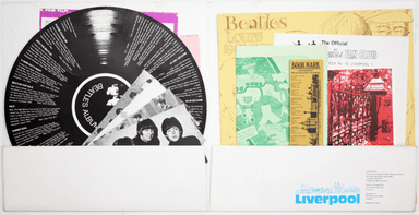
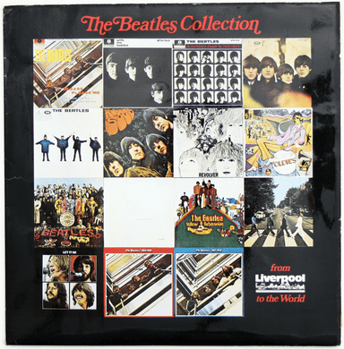
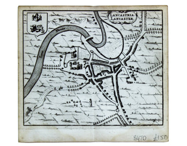
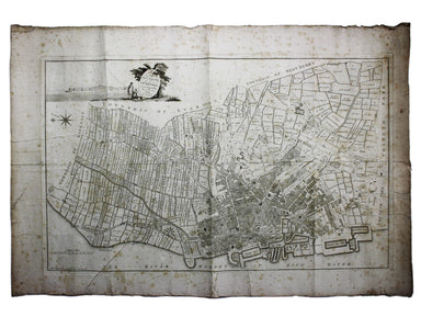
Ogilby's Road from York to Lancaster
Thousands of miles of roads were surveyed for John Ogilby’s pioneering road atlas, the ‘Britannia’. The decorative cartouche on this map of the roa...
View full details
Thousands of miles of roads were surveyed for John Ogilby’s pioneering road atlas, the ‘Britannia’. The decorative cartouche on this map of the roa...
View full details
The Railway Clearing House allocated revenue on occasions where one company’s train ran over another’s track, and promoted standardisation (of ever...
View full details
This map of Lancaster is from Hermannides' Magna Britannia. Nearly all of the plans are based on the small inset plans shown on John Speed's county...
View full details
Map of the Grand Junction Railway and its Adjacent Country. [Copied by permission from the Company’s official map.] Shewing all the the stations on...
View full details
This pictorial map of Liverpool is folded into a souvenir record-sleeve style pack which comprises: ‘Nothing to get hung up about’, a 30 page shor...
View full details
A Map of the County Palatine of Lancaster Divided into Hundreds and Parishes from an accurate Survey made in the years 1828 and 1829, For Hennet’s ...
View full details
A Plan of the Town and Township of Liverpool, from an actual survey taken in the year 1785 by C. Eyes This map of Liverpool was surveyed and publis...
View full details
This is an LNER colliery map covering the midlands and north of England and Wales ('Collieries in Yorkshire, Nottinghamshire, Derbyshire, Lancashir...
View full details