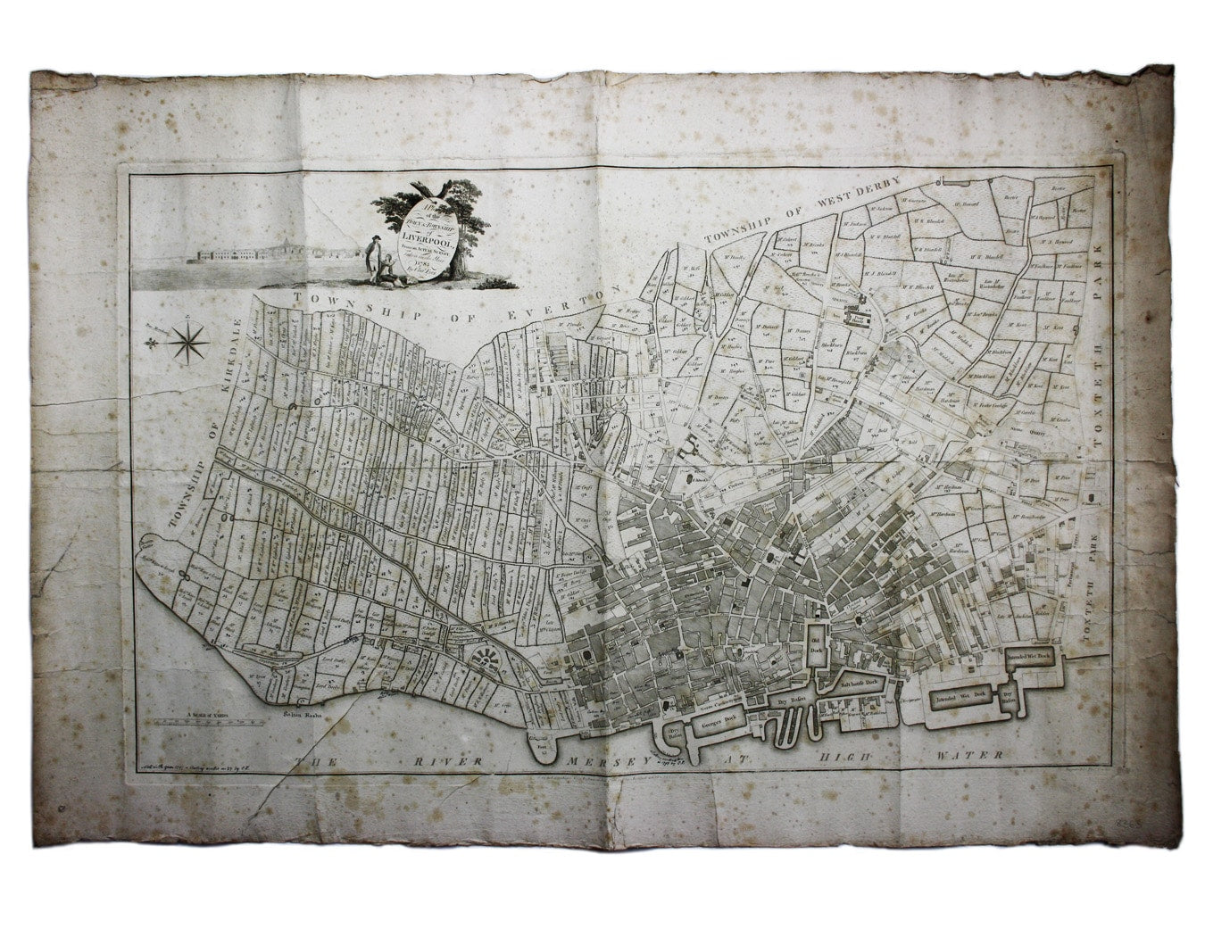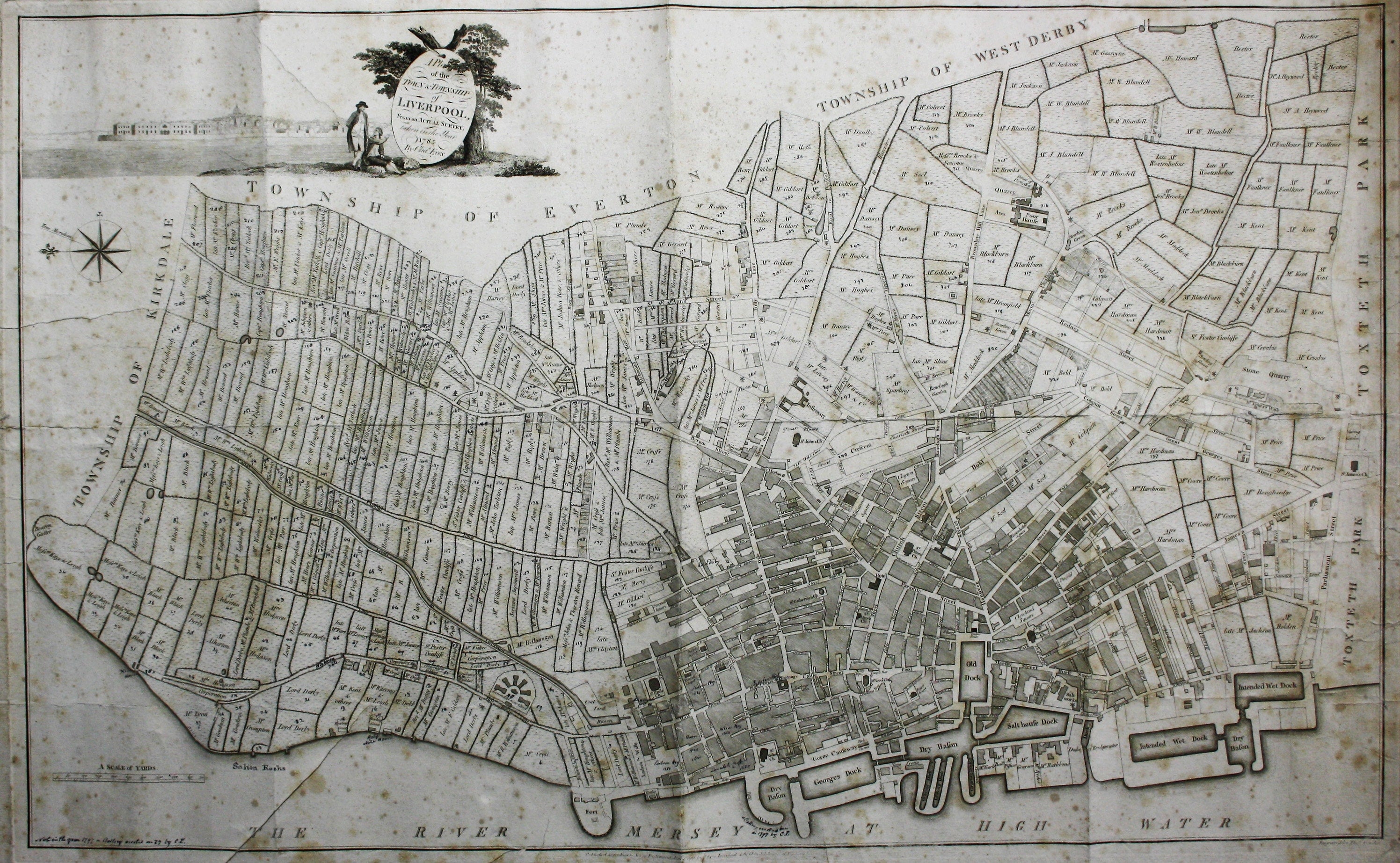
Eyes’ Plan of Liverpool
SKU: 8363
Title:
Eyes’ Plan of Liverpool
Date of publication:
Printed Measurement:
Colour:
Mapmaker:
Engraver:
A Plan of the Town and Township of Liverpool, from an actual survey taken in the year 1785 by C. Eyes
This map of Liverpool was surveyed and published by Charles Eyes (fl. 1754-1803), who succeeded his uncle John Eyes as Town Surveyor in 1777, and was succeeded in turn by his son Edward. Read more
Charles became a member of Liverpool’s Art Society in 1760, and in 1774 he exhibited a plan of Liverpool as it was in 1725, probably copied from a plan made by his father, James; he exhibited his plan of the Town and Township of Liverpool in 1784.
Eyes’ plan may have remained in circulation long after the publication of Richard Horwood’s survey in 1803: correspondence in the Gentleman’s Magazine in 1814, thirty years’ later (Vol 84, part 1, p. 39), notes that ‘Plans of the Town of Liverpool may be had from the Grandson of old Mr Eyes, who was Surveyor to the Corporation’.
Though showing Liverpool at a time of rapidly increasing prosperity, due to demand for cotton from northern textile mills and heavy involvement with the Atlantic slave trade, the map has become scarce.
Condition & Materials
Copper engraving, 54 x 88 cm, plan of Liverpool engraved by Thomas Conder, black and white, foxing, blank verso; a separately issued map which shows considerable signs of use: several closed marginal tears and creases, and annotations in a near contemporary hand, mostly numbering for an accompanying schedule, now lost. A note on the verso suggests that these additions were by by Edward Eyes, son of the map-maker, which seems highly probable.
References
Copies are located in the British Library (OCLC 556355832), Leiden University Library (OCLC 71570956, incorrectly but understandably giving ‘Eves’ as publisher) and in Liverpool Record Office.
see Ronald Stewart-Brown: ‘Maps and Plans of Liverpool and District by the Eyes Family’, 1911 Read less


