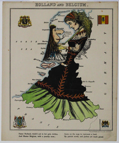
Aleph's Caricature Map of Holland & Belgium
Thus anthropomorphic map of Holland and Belgium was published in “Geographical Fun: Being Humorous Outlines of Various Countries.”. Though credited...
View full details
Thus anthropomorphic map of Holland and Belgium was published in “Geographical Fun: Being Humorous Outlines of Various Countries.”. Though credited...
View full details
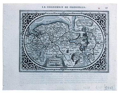
This map of the province of Groningen in the Netherlands, set within an elaborate strapwork border, was published in the ‘Atlas Minor’. A new serie...
View full details
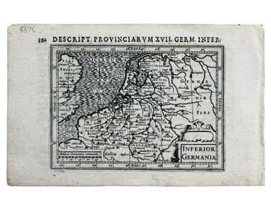
This miniature map of the Low Countries was published in the first edition of Tabularum geographicarum contractarum libri, a geographical work whic...
View full details
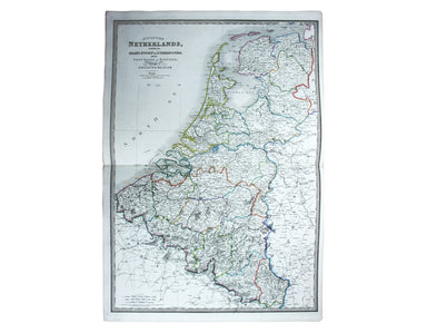
Map of the Netherlands including the Grand Duchy of Luxembourg. With the post roads and stations and the limites of Holland and Belgium This map of...
View full details
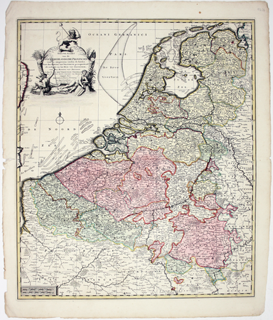
Nieuwe Kaarte van der XVII Nederlandsche Provincien: waar in aangewezen worden de landen door den Koning van Vrankryk geconquesteerd als mede die v...
View full details
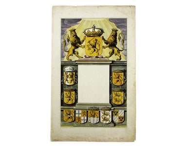
This is the general title page for Blaeu’s town books of the Netherlands. The first volume features plans and views of the towns of the Northern p...
View full details
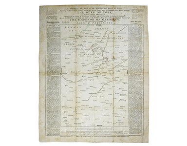
A correct sketch of the northern seat of war, exhibiting the whole of the country, wherein the British troops under the command of His Royal Highne...
View full details
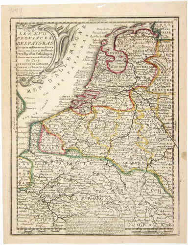
Le XVII Provinces des Pays Bas divisées en Provinces Unies connues sous le nom de Hollande, et en Pays Bas Catholiques connues sous le nom de Fland...
View full details
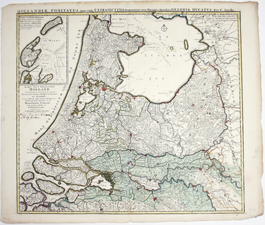
Hollandiae Comitatus una cum Ultrajectino Dominio nec non maximis partibus Geldriae Ducatus, per C. Specht This example of Caspar Specht’s map has ...
View full details
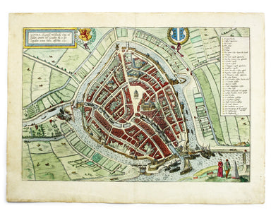
This plan of Gouda in the Netherlands is from the Civitates Orbis Terrarum, one of the most significant cartographic works of the late sixteenth-ce...
View full details
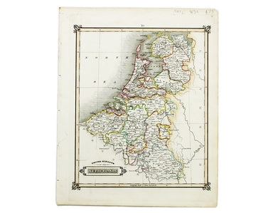
This map of the United Kingdom of the Netherlands is from 'A Modern and Ancient General Atlas, comprehending all the Empires, Kingdoms, States in t...
View full details
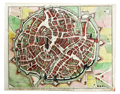
Mechelin, or Malines, the Capital of one of the ten Provinces of the Netherlands in Brabant This map of Mechelen was engraved by James Basire and p...
View full details
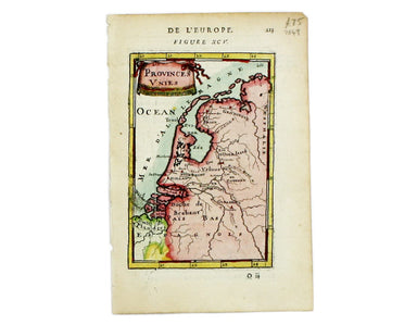
This map of the Netherlands is from Mallet’s Description de l’Univers. Condition & Materials Copper engraving, 15 x 10 cm, recent hand-colour, ...
View full details
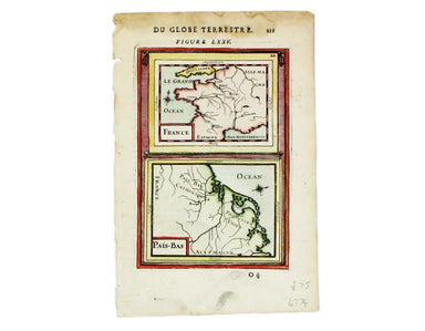
France/Paîs Bas This map of France and the Low Countries is from Mallet’s ‘Description de l’Univers. Condition & Materials Copper engraving, 15...
View full details
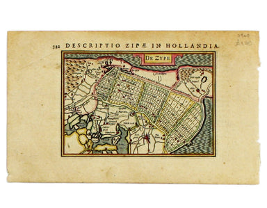
Condition & Materials Copper engraving, 9.5 x 13.4 cm, recent hand-colour, Latin text on verso; map of the Zijpe polder.
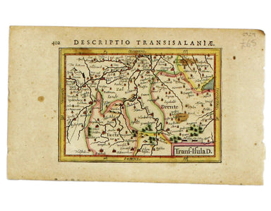
Trans-Isula D. Condition & Materials Copper engraving, 9.5 x 13.4 cm, recent hand-colour, Latin text on verso; map of Overjissel.
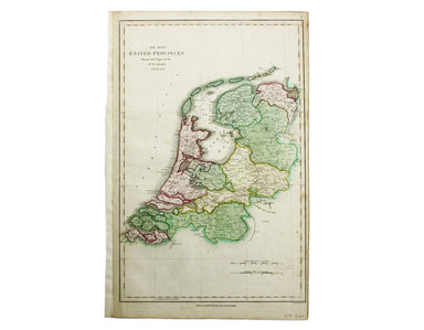
The Seven United Provinces This map of the Netherlands was prepared for Playfair’s New General Atlas. Condition & Materials Copper engraving, ...
View full details
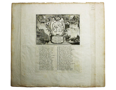
Afbeeldinge van’t zeer vermaarde Eiland Geks-Kop This Dutch ‘fool’s cap’ map satirises the bursting of the financial bubbles of 1720. Cartographic ...
View full details
