

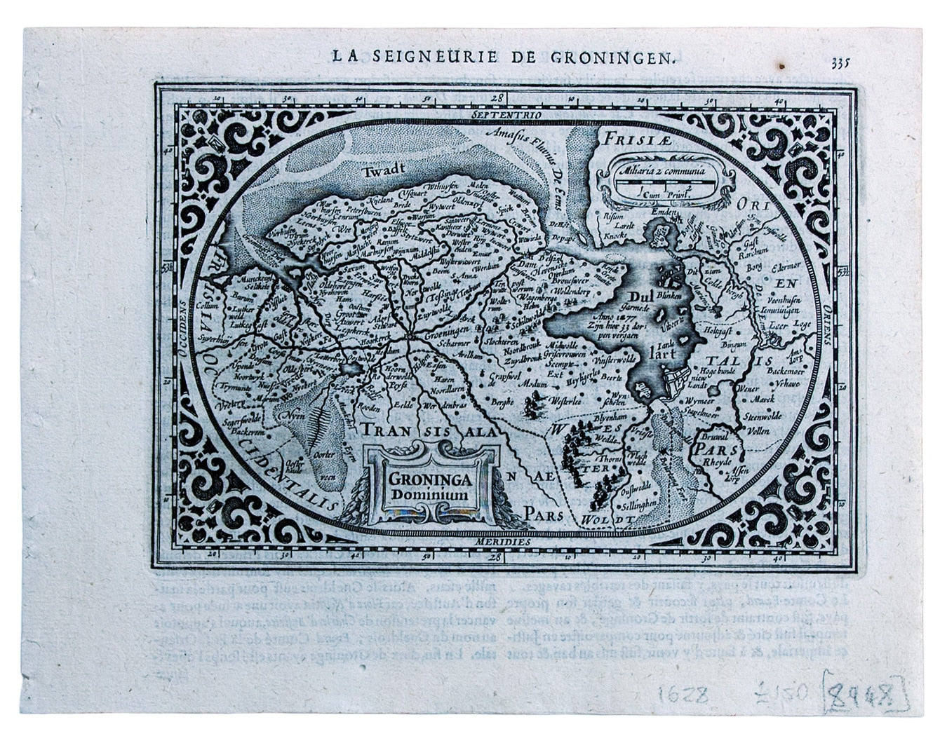
Mercator’s Miniature Map of Groningen
SKU: 8948
Title:
Mercator’s Miniature Map of Groningen
Date of publication:
Printed Measurement:
Colour:
Mapmaker:
This map of the province of Groningen in the Netherlands, set within an elaborate strapwork border, was published in the ‘Atlas Minor’.
A new series of maps, replacing those by Jodocus Hondius, was engraved by Abraham Goos and Pieter van den Keere for the 1628 edition. Koeman notes that a slip of paper bearing 1630 as the date of issue was pasted over the date 1628 on the title-page of the example he examined. Read more
Condition & Materials
Copper engraving, 12.3 x 17.8 cm, black and white, French text on verso.
References
Koeman, Atlantes Neerlandici, Me 196 Read less