

Greenwood’s Map of North Wales
SKU: 9462
Title:
Greenwood’s Map of North Wales
Date of publication:
Printed Measurement:
Colour:
Mapmaker:
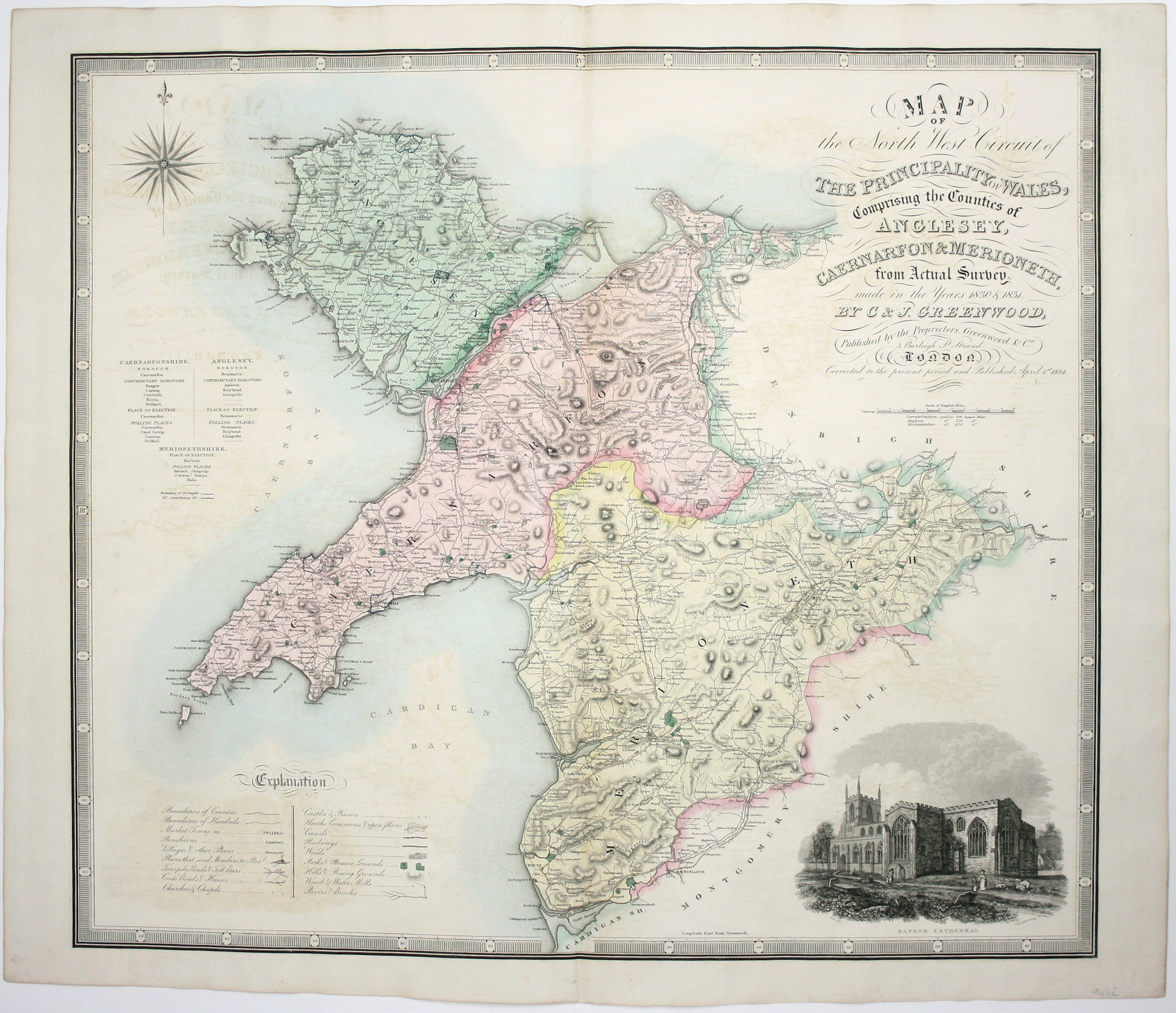
Map of the North West Circuit of the Principality of Wales, comprising the Counties of Anglesey, Caernarfon & Merioneth, from an Actual Survey…
The Greenwood brothers were land-surveyors from Yorkshire who compiled one of the last independent large-scale county atlases, in the teeth of competition from the Ordnance Survey. Read more
The maps, like this one of North Wales (with black and white vignette of Bangor Cathedral), are both decorative and detailed. Alas, as Worms reveals in ‘British Map Engravers’ the project was not a financial success: in 1834 Christopher was imprisoned for debt and the engraved plates soon passed to other hands.
Condition & Materials
Copper engraving by John and Charles Walker, 64 x 72 cm, original hand-colour, light offsetting, blank verso. Read less