Homann Heirs’ Plan of the Siege of Prague
SKU: 3324
Title:
Homann Heirs’ Plan of the Siege of Prague
Date of publication:
Printed Measurement:
Colour:
Mapmaker:
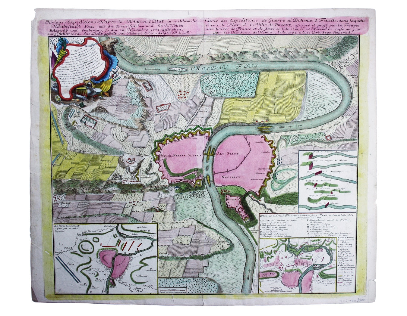
Kreigs Expeditions Karte in Bohmen I Blat, in welchern die Haubstadt Prag mit der Franzofsischen und Saechsischen Belegerug und Eroberung, so den 26 Novembere 1741 […] / Carte des Expeditions de Guerre en Boheme, I. Feuille, dans laquelle se voit le Plan de la Ville de Prague, assiegee et prise par les Troupes auxillaires de France et de Saxe […]
This town plan of Prague has insets showing sections through the fortifications, and further illustrates the disposition of the besieging forces. Read more
Prague was captured by a mixed force of French, Bavarians and Saxons on behalf of Charles, the elector of Bavaria, during the Austrian war of Succession.
In 1743, the year in which our map was published, Prague was re-taken by the armies of the empress Maria Theresa, and despite two sieges by the Prussian armies of Frederick the Great in 1744 and 1757 (the first briefly successful), Prague remained under Austrian control until the collapse of the Holy Roman Empire during the First World War.
Condition & Materials
Copper engraving, 51 x 60 cm, original hand-colour, blank verso. Read less


